

Mother's Day Forecast: Central Florida faces more storms, flooding threats to start the workweek

Orlando PM Weather Forecast: May 11, 2025
Our Mother's Day wraps up with some scattered storms across the region. Meteorologist Laurel Blanchard has the timeline and details on the heavy rain for the start of the workweek and when we dry out once again.
REST OF THE EVENING/OVERNIGHT:
ORLANDO, Fla. - Widespread rain continues to move in off the west coat. This will interact with the sea breeze coming off the east coast and spark off some thunderstorms and heavy rain showers this evening.
Today the entire region is under a MARGINAL risk level 1/5 chance for severe weather. This means there could be an isolated severe storm or multiple stronger thunderstorms for the rest of the afternoon. Main threats: gusty winds reaching 50mph, possibility for some large hail. Heavy downpours across the region could lead to limited road visibility.
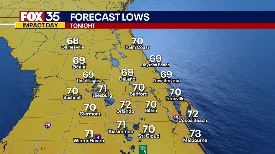
The widespread showers and storms should taper off later on tonight, but we will keep some showers through the overnight. Lows will bottom out through the upper 60s and lower 70s with muggy conditions through the overnight.
LOOKING AHEAD:
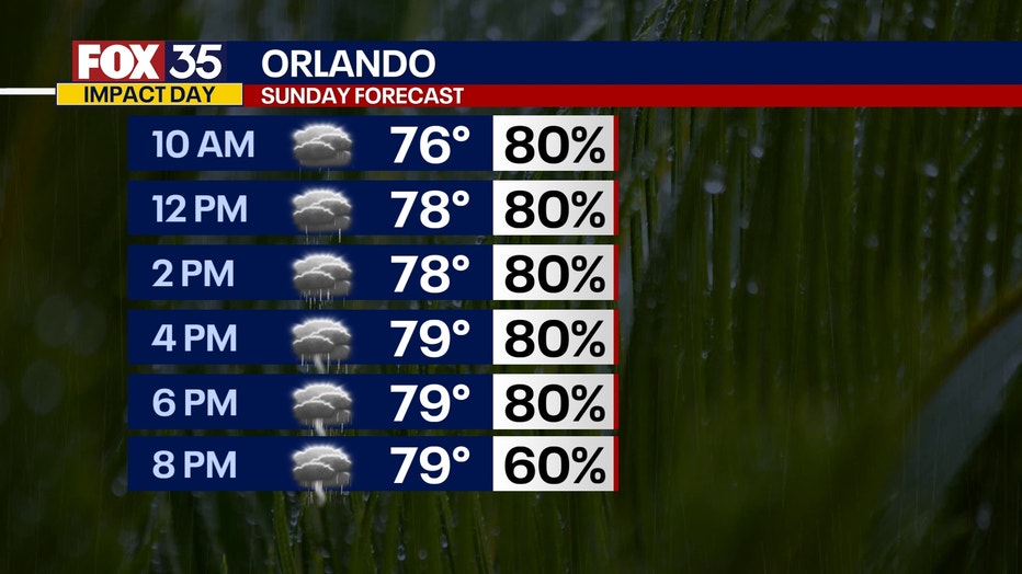
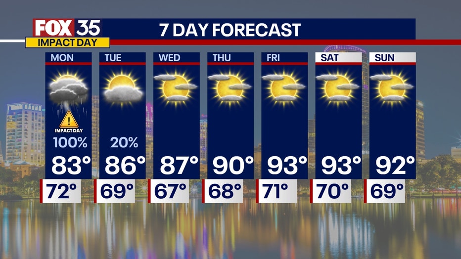
MONDAY: Get the rain gear out for Monday! We are looking at a lot of heavy rain on Monday with the possibility of embedded thunderstorms. This will be our 5TH IMPACT DAY in a row.
The entire region is under a MARGINAL risk level 1/5 chance for severe weather. This means there could be an isolated severe storm or multiple stronger thunderstorms for the rest of the afternoon.
Main threats: Flash flooding, gusty winds up to 60mph, hail with storms embedded in the rain and the low but not zero possibility of a brief tornado.
A low pressure system will sweep in rounds of moisture from the gulf creating rounds of heavy heavy rain all day for the start of the work week.
The main threat will be flooding. We are looking at a lot of rain and because some areas have already been hit with heavy rain from the past few days, the soil is already wet.
Because of the wind shear in the atmosphere, all forms of severe weather will be on the table. This includes hail and gusty wind, as well as a brief tornado or two. This will also be an all day event impacting the AM commute and evening commute limiting visibility due to the rain.
Highs closer to 80° with the rain and clouds.
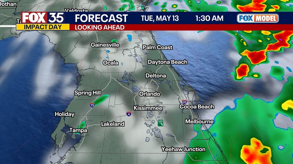
TUESDAY & ONWARD: This system starts to move out on Tuesday, but there may still be a lingering shower or two.
After this our weather gets MUCH better and calmer with sunshine and warm temperatures back in the forecast for the rest of the week and even looking ahead to next weekend. Looking at highs in the 90s and lots of sunshine!
FOX 35 Storm Tracker Radar and Live Weather Cameras
Track live when storms move across your area using the FOX 35 Storm Tracker Radar below. You can also watch as heavy rain moves across Central Florida on our Live Weather Cameras' page here.
More radar maps from FOX 35 Storm Tracker Radar
- Brevard County
- Flagler County
- Marion County
- Osceola County
- Orange County
- Polk County
- Seminole County
- Sumter County
- Volusia County
- U.S./National Radar
STAY CONNECTED WITH FOX 35 ORLANDO:
- Download the FOX Local app for breaking news alerts, the latest news headlines
- Download the FOX 35 Storm Team Weather app for weather alerts & radar
- Sign up for FOX 35's daily newsletter for the latest morning headlines
- FOX Local: Stream FOX 35 newscasts, FOX 35 News+, Central Florida Eats on your smart TV
The Source: This story was written based on information shared by the FOX 35 Storm Team on May 11, 2025.