

Massive Saharan dust cloud headed for Central Florida

Massive Saharan dust cloud headed for Central Florida
A massive Saharan dust cloud is headed for Florida. FOX 35 Storm Team Meteorologist Allison Gargaro has your forecast.
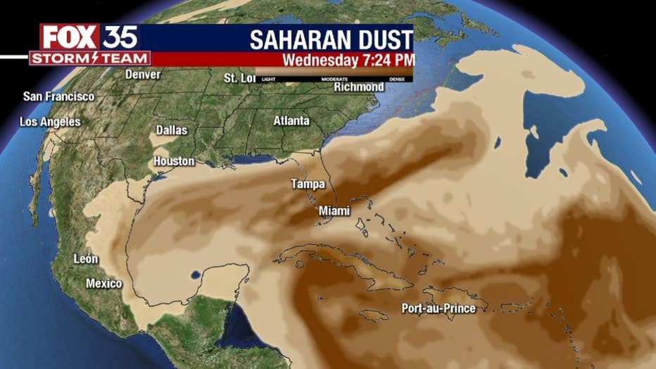
ORLANDO, Fla. - It is about that time of the season to talk about the Saharan Dust making its way from the coast of Africa to the Gulf of Mexico.
This dust is currently moving across the Atlantic and will arrive in Florida during the middle of next week.
RELATED: Chances increase for system in Gulf to become next named storm
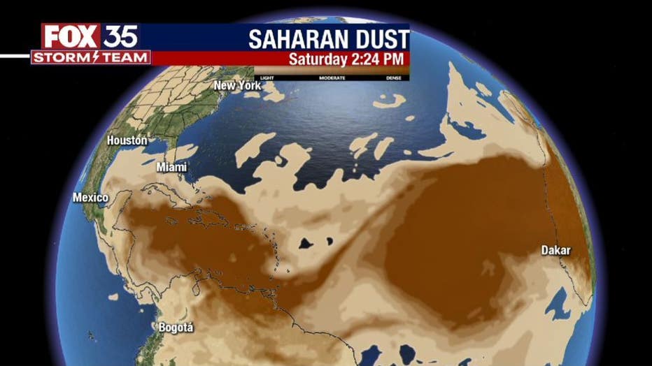
The plume of dark brown colors is where we are seeing the thickest dust.
Our models are showing the dust will be thickest over the Florida peninsula on Wednesday, but it will be sticking around through at least Saturday of next week.
When the sun is lowest on the horizon, its rays have to travel through more of Earth's atmosphere, creating more pronounced oranges, reds and pinks in the sky.
WEATHER ALERTS: Download the FOX 35 Storm Team Weather app for live radar, severe weather alerts, and daily forecast reports on your phone

If you do catch one of these beautiful sunrises, make sure to share it with us on social media. Another positive of this dust: it can help suppress any tropical development in the area.
We will continue to track these conditions in the FOX 35 Storm Center.