

Map shows risk level of COVID-19 exposure by location, size of event

Map shows risk level of COVID-19 exposure by location, size of event
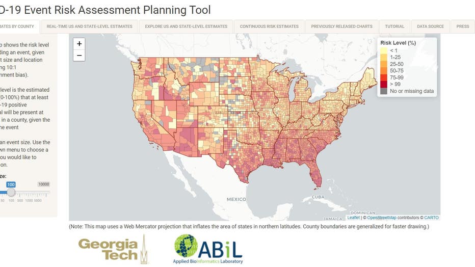
A map developed by researchers at Georgia Tech updates automatically to show how likely you are to contract COVID-19. It shows the risk level, county-by-county of attending an event.
ORLANDO, Fla. - A map developed by researchers at Georgia Tech updates automatically to show how likely you are to contract COVID-19.
It shows the risk level, county-by-county of attending an event.
The factors depend on the size and location, which you can change on the website.
The recent popularity of the site means it has a tendency to crash.
The creator, Dr. Joshua Weitz, a professor of Biological Sciences, is working with his team to expand the bandwidth to decrease crashes.
Another option to track COVID is to use your phone.
Tom Jelneck, CEO of On Target Marketing, explains how it would work.
“You walk up to a bus stop, your phone's on, let's say a gentleman close to that bus stop tested positive. [The phone] pings and lets me know, ‘Hey, this person's tested positive.’”
COVID-19 exposure logging is available for both Android and Apple phones.
On iPhones, you can find it under the "Health Tab" in Privacy.
It can only be activated with an app.
Currently, there are four states that have apps that work with this feature.
Unfortunately, Florida is not one of them.
“The downside is people freak out about privacy concerns. I think the upside, though, is people having knowledge," Jelneck said.
Dr. Weitz said he hopes individuals can use his technology to take the necessary precautions to stop the chains of transmission before they start.