

Hail, lightning possible during storms in Central Florida on Saturday
ORLANDO, Fla. - WHAT IS THE WEATHER FORECAST FOR TODAY AROUND ORLANDO?
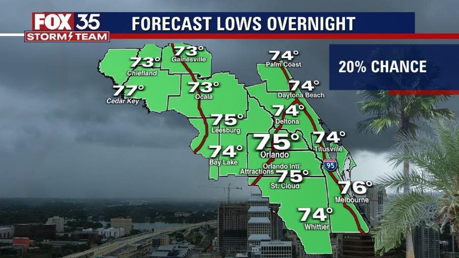
Tonight’s forecast low: 75 degrees
Tomorrow's forecast high: 89 degrees

Weather Forecast: July 16, 2022
FOX 35 meteorologist Brittany Lockley has a look at your daily forecast and the week ahead.
MAIN WEATHER CONCERNS:
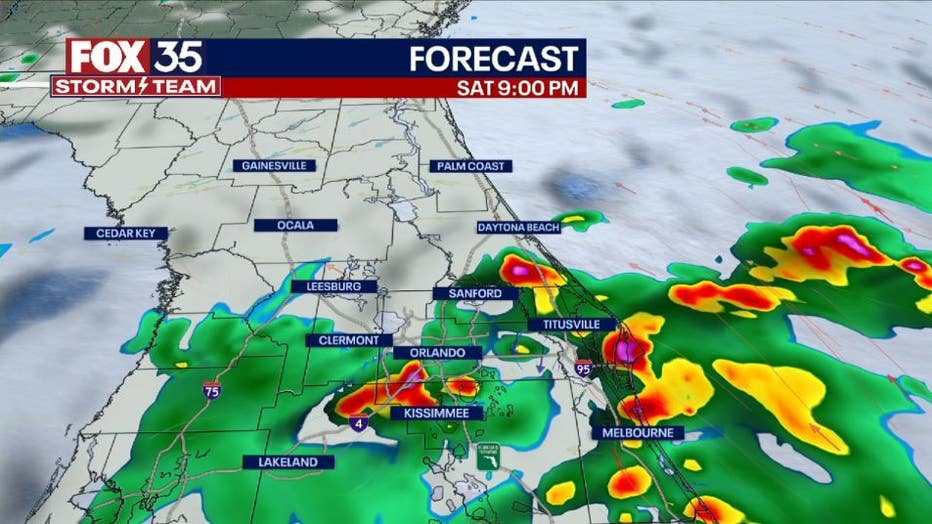
Scattered Showers continue to move towards the northwest in the early afternoon. Another round of showers and storms will move up from the south in the late afternoon. Early evening Orange and Seminole Counties will see the showers and storms. A few storms will be on the stronger side bringing heavy rainfall, frequent lightning, and small hail.
WHAT IS THE WEATHER FORECAST FOR WALT DISNEY WORLD, UNIVERSAL, AND SEAWORLD?
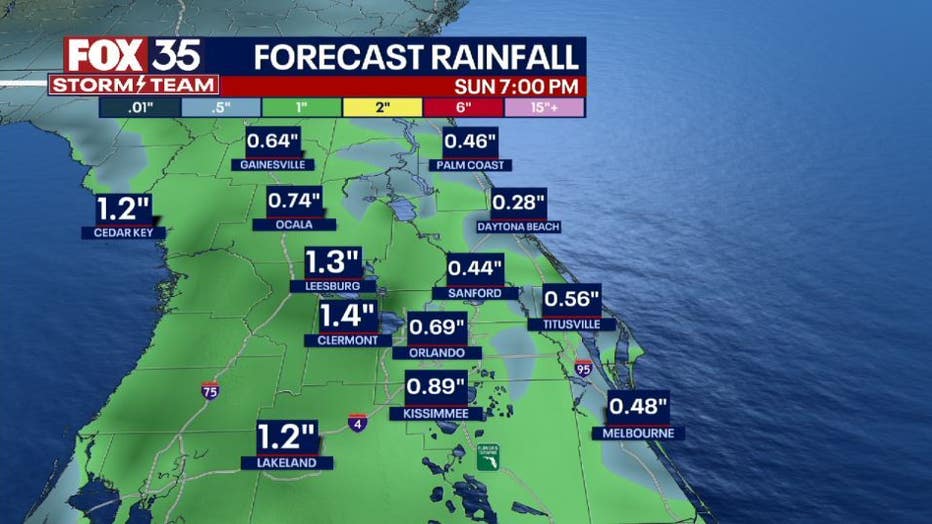
Sunday will be another rainy day for the parks. The rain will start earlier in the afternoon around 2 pm and stay consistent through the early evening. The temperature will be slightly lower because of the rainfall peaking at 89 degrees Make sure to take a poncho!

WHAT IS THE WEATHER FORECAST FOR THE BEACHES IN CENTRAL FLORIDA?
Sunday does not look to be the best beach day. Rain chances are highest between 2 pm to 8 pm tomorrow. Temperatures reach the upper 80s. The surf will be around 2-3 ft and the chances of rip currents will be moderate.
DOWNLOAD: FOX 35 NEWS APP | FOX 35 STORM TEAM WEATHER APP

LOOKING AHEAD:
Rain chances remain higher through the rest of the weekend and into Monday. Temperatures drop to the upper 80s on Sunday and gradually climb back into the mid-90s by mid-week. The tropics remain quiet with storm formation not expected for at least the next 5 days.
Make sure to stay weather aware and download the FOX 35 Storm Team app!