The Gulf is warmer than usual. Does this mean more storms?

Tropics update: July 14, 2025
FOX 35 meteorologist Brooks Garner has the latest conditions in the tropics. The 2025 Atlantic Hurricane Season runs June 1 - November 30. Download the FOX Local app for tropical alerts and notifications.
Is the Gulf of Mexico warmer than normal right now?
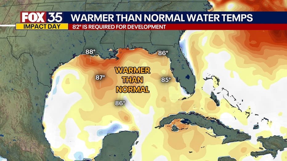
ORLANDO, Fla. - Yes, not just warm, but September-level warm. It's significant because that is a time when powerful Gulf hurricanes can form.
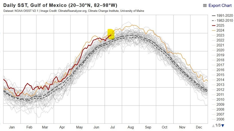
As of mid-July, sea surface temperatures (SSTs) in the Gulf are running about 1.5°F above normal, matching last year’s historic warmth (see chart: 2025 in red, 2024 in orange). While it typically takes most of the summer to really heat up like this, we're already there and on the track for what could record warmth come August.
But, wasn’t the Gulf cooler this year a few months ago?
It was. In May and June 2025, it tracked slightly cooler than 2024. But it remained well above the long-term average, running a few months ahead of schedule in its warming. And today, the warming has completely caught up to 2024 levels! So any "cooler" readings earlier-on are irrelevant today.

Aren't we talking only minor changes in temperature or a degree or two?
Yes, and it may be impossible to decipher the difference if you were to dip your feet in the water. But, as sea surface temps factually about 1.5°F warmer than normal across the Gulf, this small bump means the atmosphere can support a massive boost in evaporated atmospheric moisture.

The air above the Gulf can today hold around 10% more moisture than typically. This is the equivalent of over a million Olympic-sized pools’ worth of additional water vapor floating around in the air, allowing for a higher likelihood of flooding rains if a tropical system were to form and track onto land, tapping all of that available moisture.
What does this mean for the low pressure moving into the Gulf?
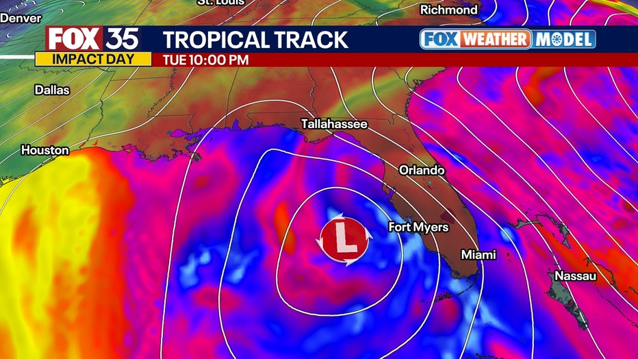
It means we'll have to watch it like a hawk. The potential for this currently non-tropical low in the Atlantic to take on tropical characteristics just went way up, as warmer waters help bring to life systems like this. It only takes 82°F water temps to support tropical cyclone development and sea surface temps range from 85-88°.

Does Florida need to worry?
With this week's potential system, all signs point to the system moving away from the peninsula portion of the state where Orlando, Tampa, Ocala and Ft. Myers and Miami reside, though some models take the low northwestward toward our western Panhandle region. The vast majority of models push the system west toward Alabama, Mississippi or Louisiana. While we'd miss direct impacts from a landfalling tropical system, we would catch scattered tropical downpours through midweek.
The Source: This story was written based on information shared by NOAA.

