

FOX 35 Storm Alert Days: Severe Thunderstorm Watch issued for most of Central Florida

Weather Forecast: March 10, 2022
FOX 35 Storm Team Meteorologist Brooks Garner has the latest on the weather in Central Florida.
ORLANDO, Fla. - The FOX 35 Storm Team has issued FOX 35 Storm Alert Days for Thursday, Friday, and Saturday. The risk of strong to severe storms will be on the rise during these three days.
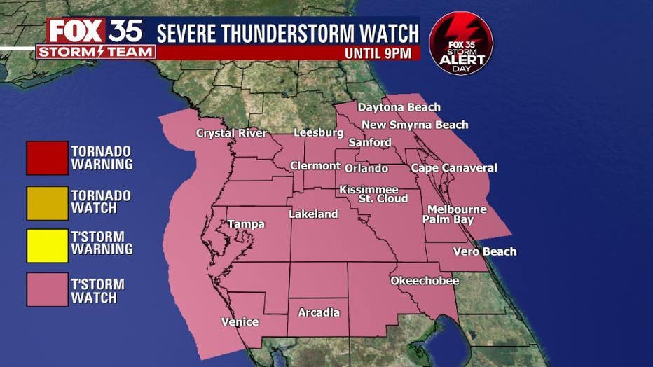
A severe thunderstorm watch is in effect until 9 p.m. for Orange, Seminole, Volusia, Lake, Osceola, Polk, and Sumter counties. Storms began forming across the area around 1 p.m. but the intensity and frequency of these storms will start to die down around 8 p.m.
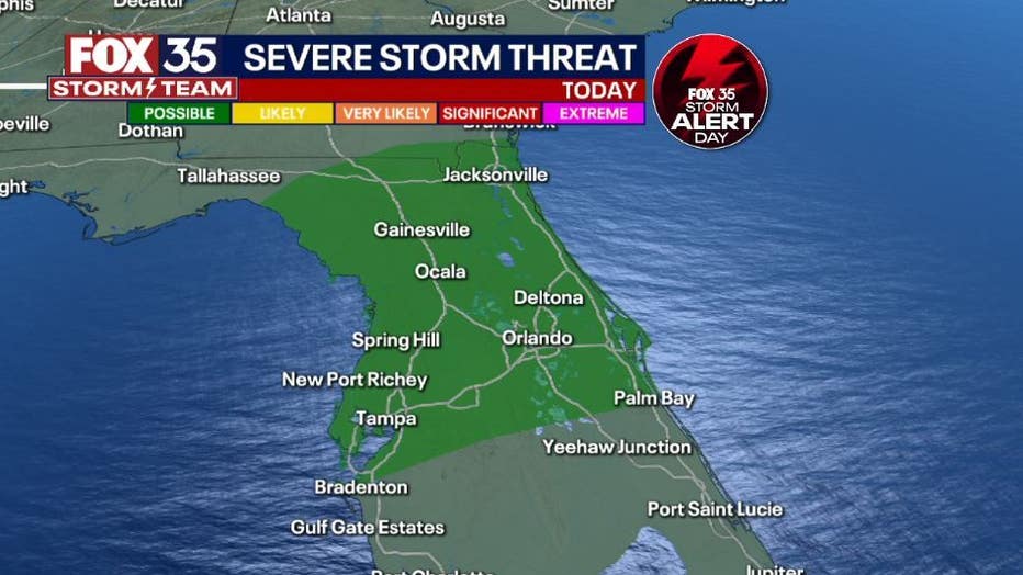
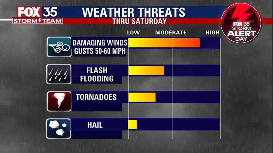
The risk of severe weather is rising. Damaging winds with gusts to 60mph, hail, heavy rainfall and cloud to ground lightning appear to be the primary threats with the developing storms.
The bulk of activity will put Central Florida at the highest risk during the evening commute and you should account for this before leaving your place of work or school.
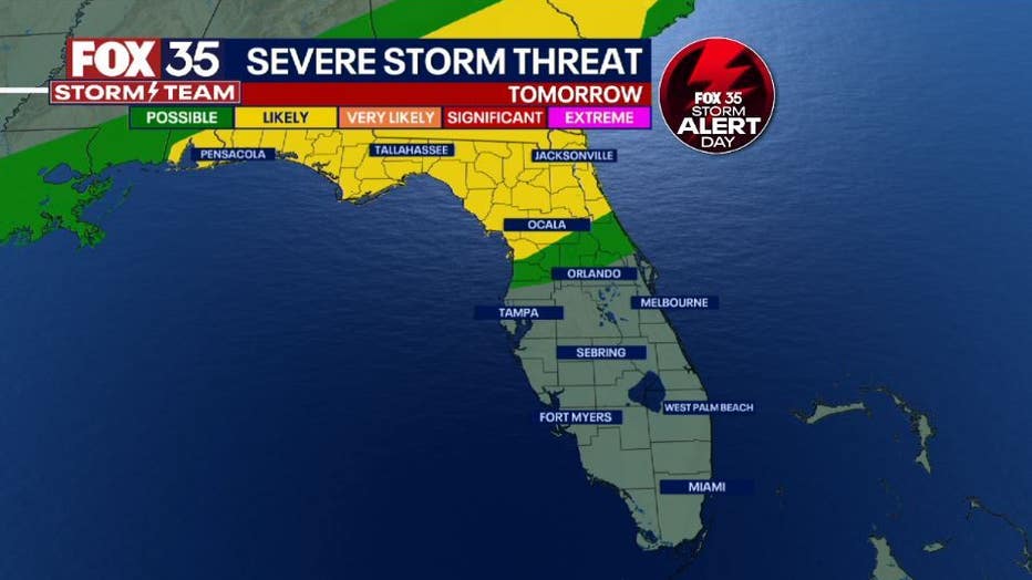
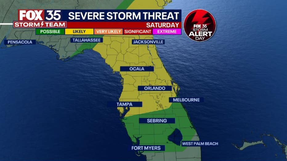
Rain and storms ease up late Thursday night, only to return on Friday as a severe weather risk "LEVEL 2-LIKELY" sinks south into the northern viewing areas.
DOWNLOAD: FOX 35 NEWS APP | FOX 35 STORM TEAM WEATHER APP
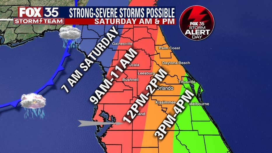
Saturday morning brings our final FOX 35 Storm Alert as a strong cold front finally barrels through the area. The line of storms should be in the Big Bend region/Gulf of Mexico around midnight Friday, then working steadily eastbound across the Florida Peninsula Saturday morning.
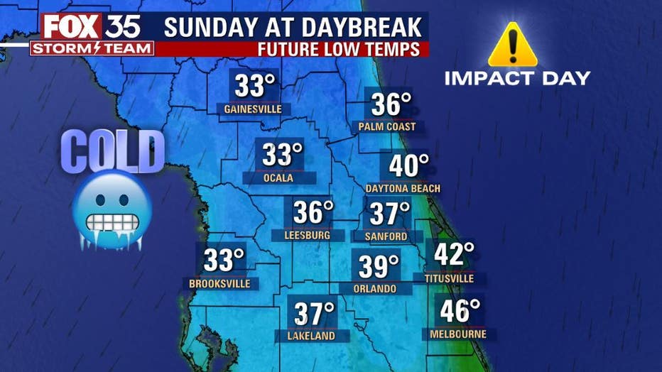
Behind the front, we've issued a FOX 35 Weather Impact Day for Sunday as we wake up in the 30s and 40s behind the front. Bottom line, we've got some big weather changes coming!
Stay prepared and with the FOX 35 Storm Team for the very latest. We're ALWAYS WATCHING, ALWAYS TRACKING our Central Florida skies!