

April showers kick off Easter weekend in Central Florida

Easter weekend forecast for Central Florida
FOX 35 Storm Team Chief Meteorologist Jayme King has the forecast.
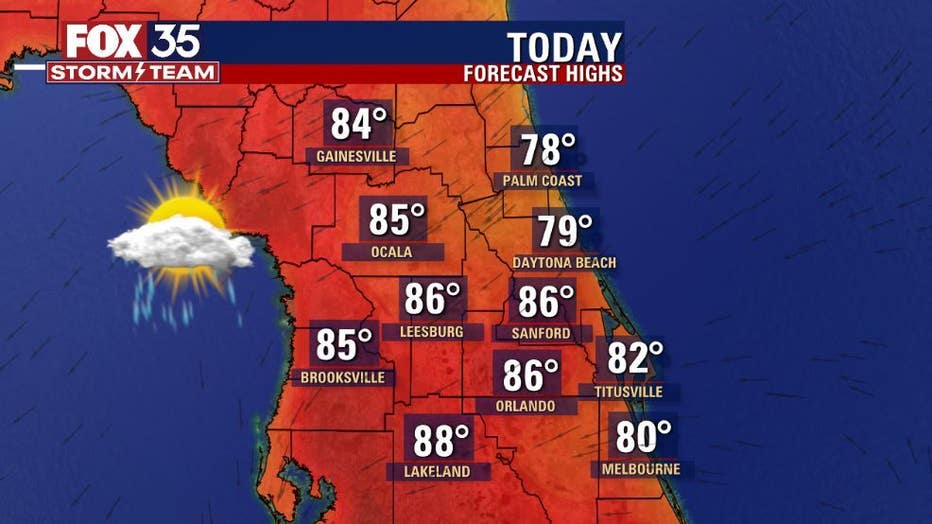
ORLANDO, Fla. - Today's forecast high: Around 86º
Tonight's forecast low: 68º
Main weather threats:
Passing showers with an isolated storm or 2 especially after 1pm. Lightning and heavy rain could result from the stronger storms South of Cape Canaveral.
WHAT IS THE WEATHER FORECAST FOR WALT DISNEY WORLD, UNIVERSAL, AND SEAWORLD?
Mixed skies early with warming PM temps in the mid 80s. Showers possible really at anytime today but emphasis will be on the 11am and beyond timeframe.
WHAT IS THE WEATHER FORECAST FOR THE BEACHES IN FLORIDA?
Beach weather looks great locally today. Just watch for a few showers for the PM hours, mainly after 12pm. Rip current risk is MODERATE. Surf remains in the 1-2' range. High tide will occur this morning, dropping out low for the PM hours
LOOKING AHEAD:
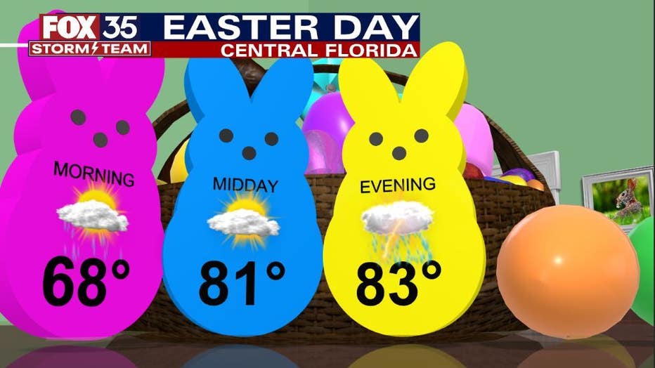
Expect warm, muggy conditions to remain in play through the weekend with highs in the 85-90º range. Skies remain in a sun-cloud mix. Rain chances fall on Saturday to 10% only to rise on Easter Day afternoon with the
approach of a cold front.
DOWNLOAD: FOX 35 NEWS APP | FOX 35 STORM TEAM WEATHER APP
Monday brings a rain chance of 50% with scattered showers and storms across the region. By Tuesday, skies begin clearing and temps fall closer to the 80º mark for highs, lows near 62°. Winds will trend breezy during this time