

Heat and storms to rule the weekend in Central Florida

Weather Forecast: July 9, 2021
FOX 35 Storm Team Meteorologist Brooks Garner has the latest on the weather in Central Florida.
Orlando, FL - Wow, is it humid out there or what? Tropical moisture is laden across Florida as we head into the weekend. This means high humidity and repeated doses of daily shower and storm chances are just about guaranteed in most Central Florida locations.
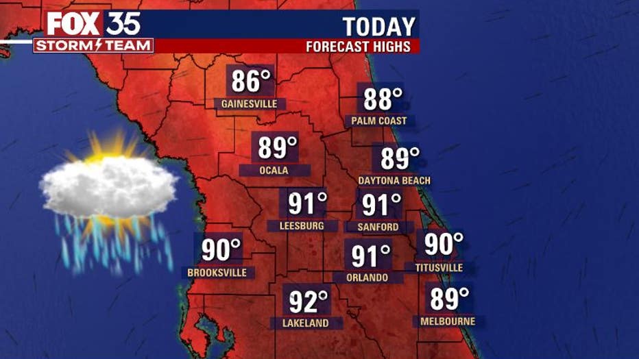
Highs today will hit around 90+ plus over the Orlando Metro areas, South into Polk County. Mid-upper 80s as you head North into Marion and Alachua counties.
TRACK THE TROPICS: Visit the FOX 35 Storm Team Hurricane Center for the latest tropical weather outlook and more
Rain chances hike up after 12pm in the far North, closer to Orlando. Things trend active after mainly 2pm or so. Cloud to ground lightning and very heavy rainfall will result in some of the more intense storms.
"If you have outdoor plans across Central Florida, stay weather aware as storms could develop quickly after 2pm. Heavy rainfall and lots of lightning look likely again today" Says FOX 35 Storm Team Chief Meteorologist Jayme King.
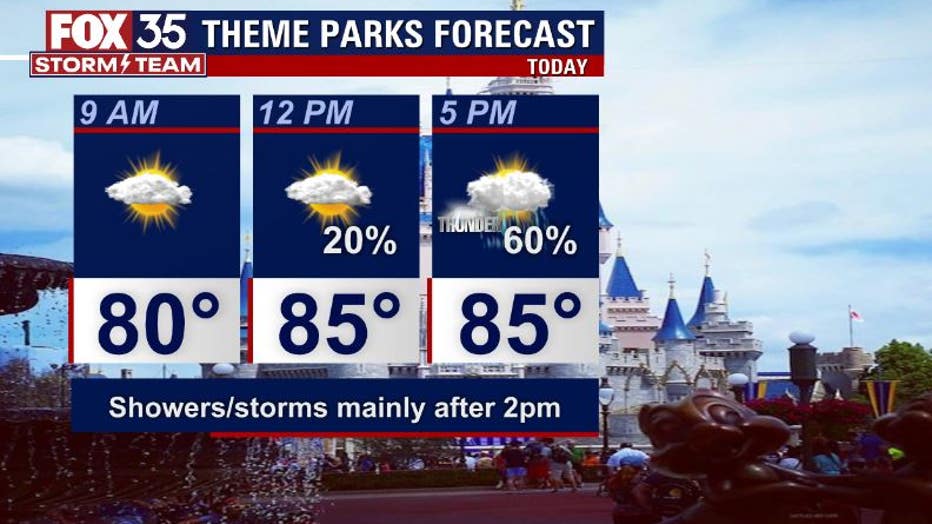
If you're headed to the theme parks today, expect hot, steamy conditions and a sharp rise in rain coverage after 2pm.
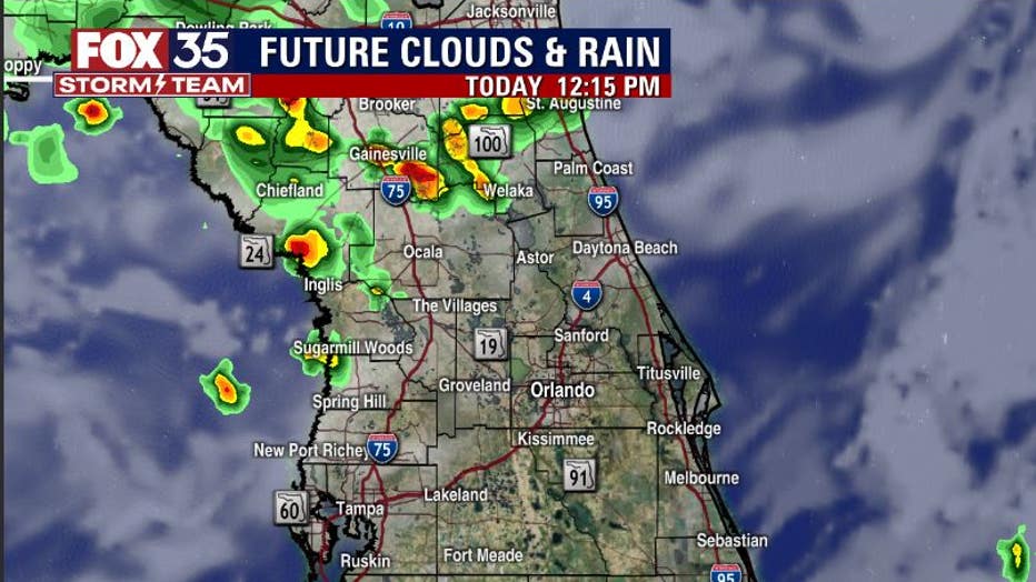
The latest forecast modeling coming into the FOX 35 STORM CENTER points to storms firing up in North Florida after 12pm. While these storms will initially be a little on the weaker side, heavy rainfall should not be ruled out entirely.
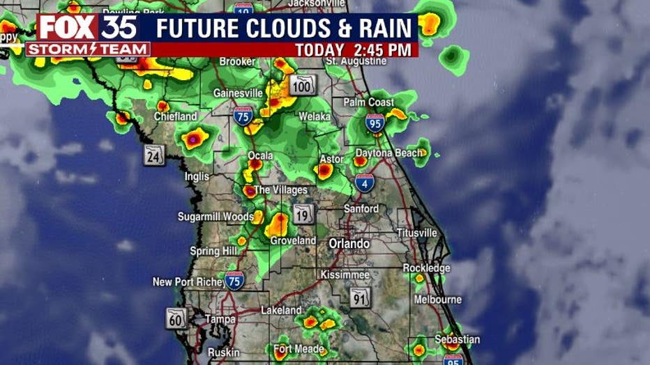
After 2pm, storms risk will advance southbound closer to the Orlando area and the Northern coastal counties. The Space Coast could see a slight uptick in coverage at this time as well. Lightning strikes and heavy downpours look a bit more likely during this time as well.
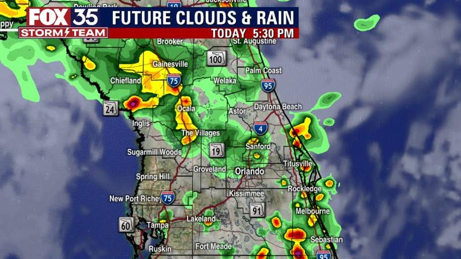
By 5pm, storms will be fairly widespread over the entire viewing from North to South.
WEATHER ALERTS: Download the FOX 35 Storm Team Weather app for live radar, severe weather alerts, and daily forecast reports on your phone
Lightning and heavy downpours will still be of concern during this time. Watch for ponding of water in lower-lying areas during the drive home from work this evening.
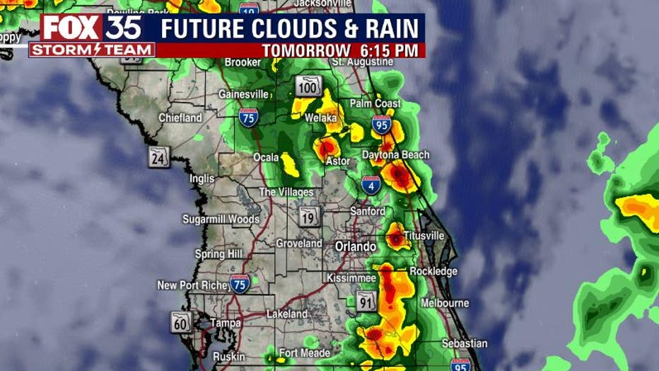
Another active day for storms looks likely for our Saturday and again on Sunday.
Storms could really stack up thick around the I-95 corridor and local beaches by Saturday afternoon – something to consider if you've got beach or boating plans in the Atlantic and intracoastal waterways.
Watch FOX 35 News for the latest weather updates.