Temperatures in the 80s will return, with a cold front expected right after

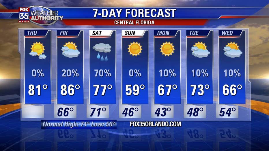
Temperatures in Central Florida will increase sharply before dropping this weekend
The high on Friday will be 86° but lows on Sunday will bounce down to 46°.
ORLANDO, Fla. - The topsy-turvy weather of Florida continues as the region will see a sharp increase and then decrease in temperatures over the next few days.
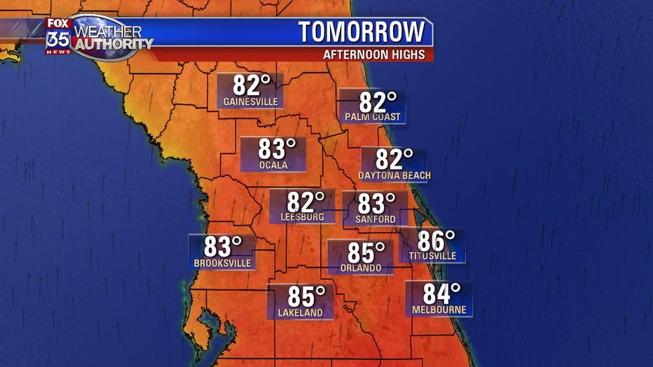
Central Florida will see a sharp rise in temperatures on Thursday into Friday. Highs that day will reach the mid-80s in several cities across the region. With this, the humidity will also rise. It will remain warm at night, with lows staying in the 70s for most of the region.
"An approaching cold front will swing our local winds to a warm, southerly direction. This will force area highs and lows to move up to very warm levels for early January," FOX 35 Meteorologist Jayme King said.
MORE NEWS: Bye bye, buoy! Officials remove giant buoy from New Smyrna Beach
A cold front will cool things back down, as it begins to move through Central Florida on Saturday. It will bring increased cloud and rain chances along with it. The rain will mostly come in the form of showers with the risk of thunderstorms remaining in the north.
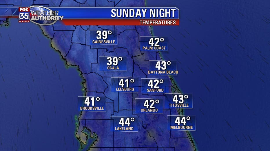
With the front departing Saturday night, winds will deliver cold air, dropping temperatures into the 30s and 40s across Central Florida by Sunday night. Skies will also clear up, as lots of sunshine is expected on Sunday.
MORE NEWS: 3 mountain lions killed after feeding on human remains
"Behind the departing front on Saturday night, gusty northerly winds will deliver some colder air, as lows tumble down into the 30s and 40s across the Fox 35 viewing area," King said. "Factor in the breezes early on Sunday morning and temperatures will feel even colder. Highs on Sunday, despite full sunshine, will struggle to hit 60 degrees."
The cooler temperatures will last well into the first full work week of 2020.