

Temperatures could rise to record highs but a cold front is approaching later this week

Weather Report: March 15
FOX 35 Storm Team Meteorologist Jayme King gives the latest in Central Florida.
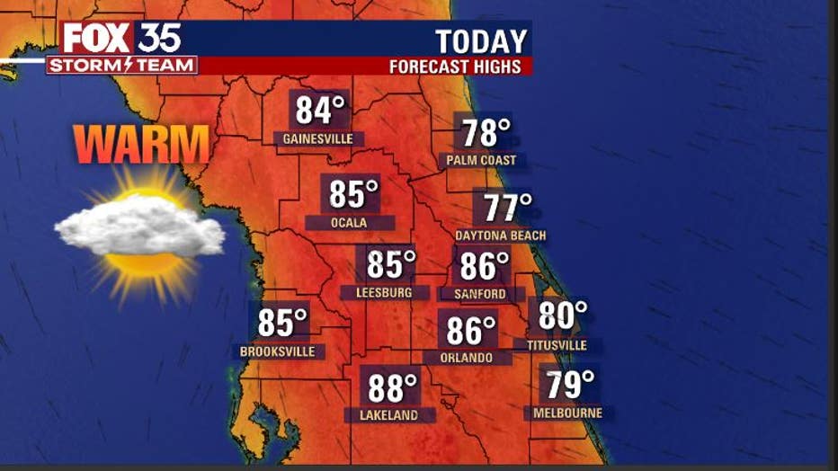
Orlando, Fl - Temperatures will be on the rise again in Central Florida on Monday afternoon.
FOX 35 Storm Meteorologist Jayme King says to expect mid to upper 80s inland and closer to 80 along the coastal areas. Skies will feature a blend of sun and clouds while breezes remain light and the trend of dry conditions continues.
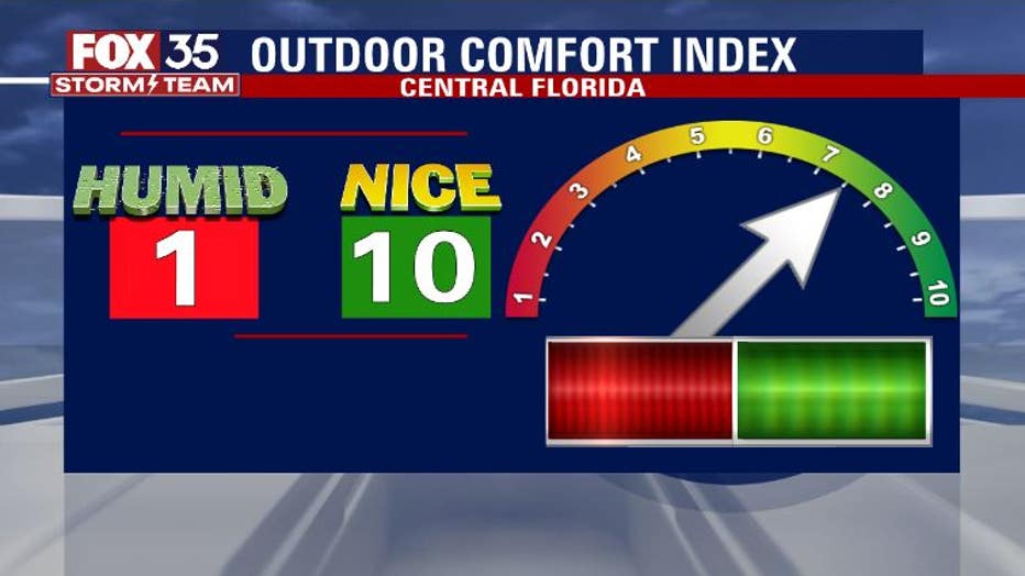
While it will be warm out, the humidity and dew point numbers are still relatively low as the air remains dry.
"Our outdoor comfort index will hit between a 7 and 8 on Monday but this won't last forever! Wednesday and Thursday will offer up highs closer to 90 degrees as winds crank up from the south. Humidity levels will rise during this time and you are bound to feel it when it does," FOX 35 Storm Meteorologist Jayme King said.
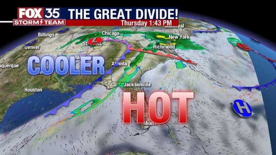
Thursday looks to be the warmest day of the week. Highs will soar into the lower 90s as a front closes in from the North.
WEATHER ALERTS: Download the FOX 35 Weather App for live radar, severe weather alerts, and daily forecast reports on your phone
Record high temperatures for Thursday, March 18th, are in the 90s for many locations. Orlando's record is 92 degrees for the date set back in 1921. Sanford may also have a decent opportunity to break or tie a record as well.

FOX 35's Storm Team is watching for the potential of a few strong, even severe storms, ahead of an approaching cold front on Thursday afternoon or evening.
"It is not currently clear how much rain or storm potential there could be but it is worth watching until the front moves through," FOX 35 Storm Meteorologist Jayme King said.
Behind the departing front will be cooler, breezy conditions. The increase in ocean breezes could spawn a few showers by the weekend time frame.
Tune in to FOX 35 Orlando for the latest weather updates.