

Rain chances increase for Central Florida before days-long cold front moves in

Weather Forecast: February 25, 2020
FOX 35 meteorologist Kristin Giannas gives you the latest on the weather in Central Florida.
Orlando, FL - Make no mistake about it, our local weather over the last few days has been down right gorgeous. Cool mornings, warm days, scattered clouds mingling with bright Central Florida sunshine and of course, rain free.
Before you get comfortable, everyone should know that we've got some fairly significant weather changes on the way beginning on Tuesday.
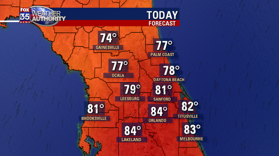
First of all, expect another warm day across the FOX 35 viewing area. Southerly breezes will pump up our temperatures this afternoon, riding into the 80s around Orlando, just a touch cooler over North Central areas due to the earlier arrival of bulked up clouds and more concentrated rain chances.
While we won't be in record territory this afternoon, you'll likely notice the warmth and extra humidity. Keep in mind, much of the Central Peninsula will remain dry before 1 p.m. with shower chances only slowly increasing by late afternoon, early evening. Highest rain coverage will trend up late tonight into Wednesday with shower chances around much of the day. Beneficial accumulations of .50-1" will be possible.

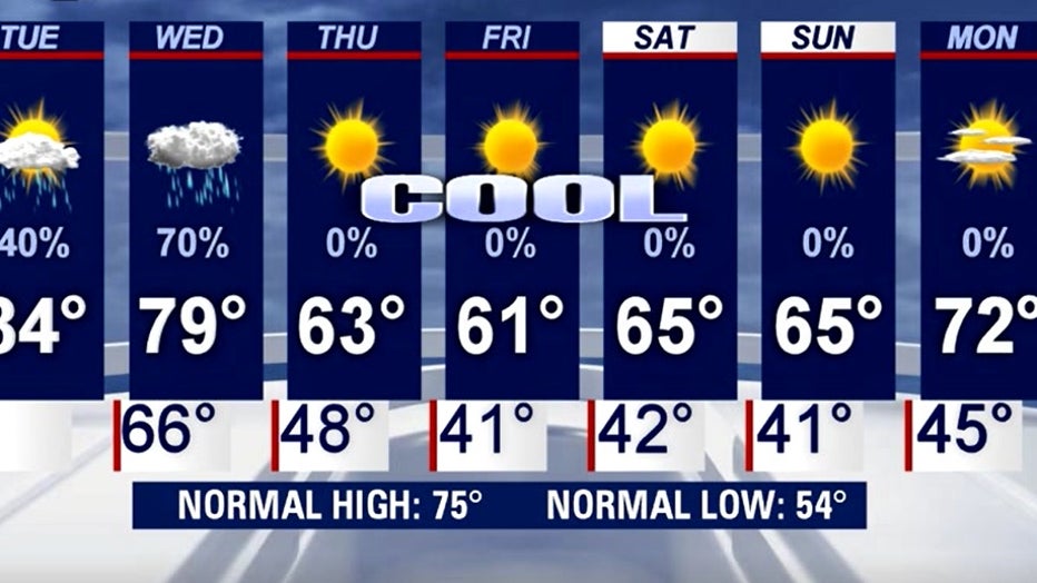
Behind the front, temperatures take a dramatic turn.
Highs in the 60s and lows in the 40s can be expected to hang around for a few days, something we don't see to often in our area. You can thank a lack of ocean breezes and a cold cap of high pressure situated North of our area through the weekend. Clear days and clear nights will be the rule.
Enjoy it if that's your thing as Summer will be here before you know it!
Be sure to have the FOX 35 Weather App downloaded and ready to be the first to know when the conditions change in your area.