

Nice weather until we get to Saturday, rainfall looking likely

Orlando, Fl - Good Thursday to you!
After a brief stint of low morning clouds and areas of mist, the day ahead on Thursday looks fabulous! Expect highs generally around 70-degrees plus with mostly sunny skies. Clouds could hang around a bit longer around the Southern Space Coast -- otherwise, we look good.
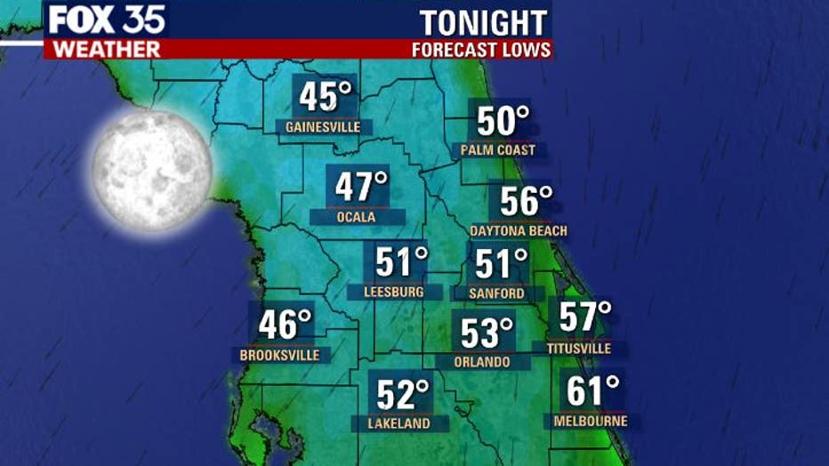
Tonight, low tumble into the 40s and 50s. Skies will be mainly clear and overall conditions comfortable. Breezes will be light from the North.
WEATHER ALERTS: Download the FOX 35 Weather App for live radar, severe weather alerts, and daily forecast reports on your phone
While our Friday looks like a great weather day as well, skies will begin changing as we go into Friday night and beyond.
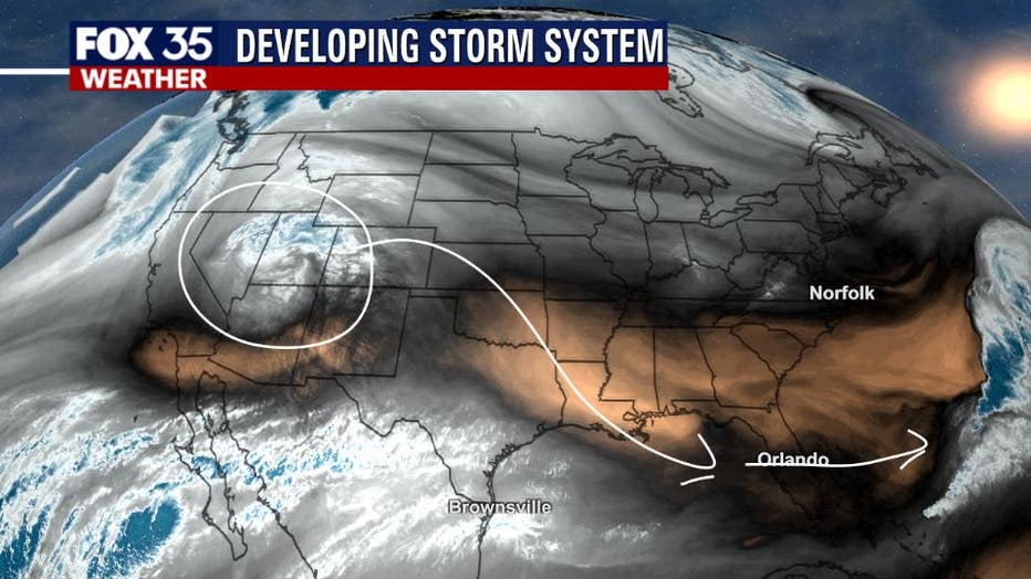
A developing storm system located out in Arizona on Thursday will move rapidly towards the Gulf of Mexico, drawing closer to the Florida Peninsula by early Saturday. This will bring increasing clouds and ultimately some rather soggy Saturday weather.
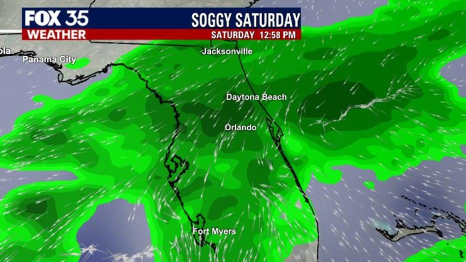
Current forecast modeling shows a large area of showers and perhaps an isolated storm for the area Saturday. The rain will likely come in an "on & off" type pattern. As of right now, shower chances will begin rising late Friday and continue into Saturday. Rain amounts could top 1" in isolated areas.
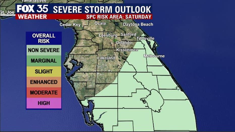
The risk of severe weather looks very low to unlikely. As of Thursday morning, the storm prediction center has parts of Florida outlined in a "NON-SEVERE" mode of isolated storms during the day on Saturday. If any storms do develop, expect some gusty winds, heavy rain, and perhaps a few lightning strikes.
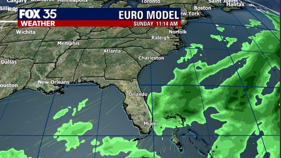
Come Sunday, the rainfall will be heading out into the Atlantic with a slow clearing trend to follow. Mostly sunny weather will return before 1 p.m. Sunday with breezy winds and high temps Sunday evening in the upper 60s.
Watch FOX 35 News for the latest weather updates.