

More thunderstorms expected Wednesday; rain chances dissipate then ramp up next week
ORLANDO, Fla. - Tropical moisture and energy continue to feed into Central Florida and that will result in the development of evening, overnight and early morning isolated to scattered downpours and thundershowers.
With the same setup in place Wednesday afternoon, any storms could produce frequent cloud-to-ground lightning and locally torrential rain, with wind gusts past 40 miles per hour.
The pattern changes late-week, as the source of that moisture gets cut off when a tropical depression forms in the western Gulf.
It's "open" now allowing the moisture to spill out into Florida, hundreds of miles away, but when it closes off into a closed low-pressure system as a tropical depression, the river of rain will turn off, leaving us high and dry. Temperatures will rise and rainfall chances will fall.
As that system tracks northward into Texas or Louisiana this weekend, we'll have a mostly dry Saturday followed by only isolated storms on Father's Day.
Beyond that the remnant low and its moisture will track through the Deep South into Georgia and be pulled into another system on the east coast, losing its tropical characteristics.
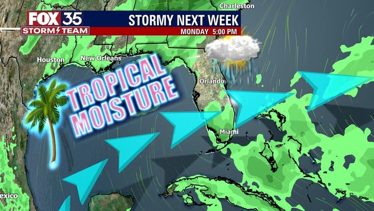
Meanwhile, Florida will be once again inundated with tropical rains for next week as the tail end of that low finally gets kicked out of our region.
As you travel around Orlando Tuesday night and Wednesday, plan for more summer-like weather with intense tropical rains followed by perfectly serene and slightly cooler weather.
The main threats from any storms over the next 36 hours include lightning, heavy rain and gust winds.