Mid-week cold front drops temperatures into the 30s and 40s in Central Florida
Orlando, FL - Looks like you might need to break out a jacket or a nice, warm wooly sweater for Wednesday!
Tuesday's storm system that brought strong storms into Central Florida is now South of the viewing area. Clouds will remain stubborn and not move out of the region around Orlando until much later today/tonight but, skies will look different up in North Central Florida as more sunshine is possible there.
"Gusty North winds and stable temps near 60 in Orlando will make things feel rather wintery for us Floridians through the day," says FOX 35 Meteorologist Jayme King.
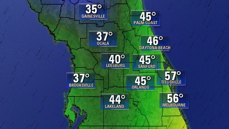
As for Wednesday night, lows tumble into the 40s around Orlando, milder along the Brevard County coastal areas, colder 30s Northwest of the I-4 corridor with perhaps some patchy frost up that way by early Thursday morning.
Temperatures areawide will rise into Friday with pleasant highs near 70 degrees. On Christmas Day, we expect temps near 73 degrees and lows for Christmas morning near 55.
Be sure to download the Fox 35 Weather App to get your daily forecast right on your cellphone.