

Florida remains cold front-free as high pressure dominates
Orlando, FL - This time of year across Central Florida, we're certainly prone to all different types of weather. It might be hot one day, then cold the very next, perhaps a run of heavy showers, followed by near desert dry conditions and a wildfire threat.
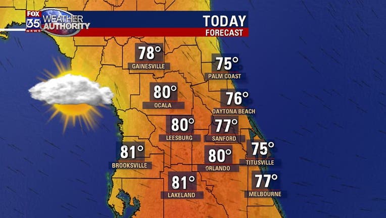
March can certainly throw us a few curve balls. One thing Central Floridians will notice over the next several days will be a general lack in weather change and that trend starts today! Highs will head for the 80 degree mark inland, 70s along the beaches, skies remain mixed with sunshine and clouds.
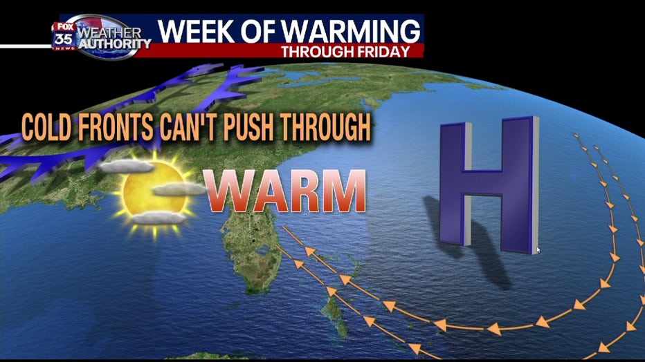
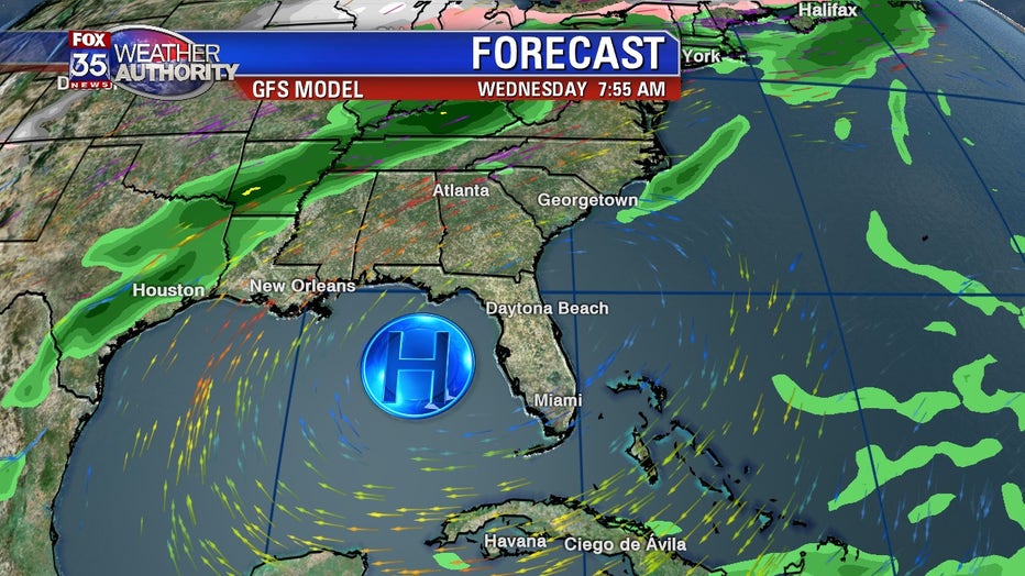
The stable nature of Central Florida weather over the next several days will be driven by a tremendous area of high pressure located East of the State. The position of the high will fluctuate day to day but, will remain in close vicinity to Florida.
Any cold fronts that try and make it into Florida will weaken upon approach and ultimately get pushed away from the Sunshine State. This means temperatures will gradually increase for both day and night as light Southeast breezes coax in a warmer weather environment.
Rain chances during this time will also be slim to none. Perhaps a few showers erupt with the warmer air, otherwise, it's mainly dry. Expect highs capping off in the mid-upper 80s as we head into the coming weekend and even beyind that.
A look at the longer range forecast modeling depicts the high remaining in play through next Wednesday, March 18th. This suggests that the warmth will remain as Florida remains cold front free.
Highs over the longer term will likely stay in the 80s with very mild overnights. Kind of has me thinking that maybe Spring has sprung...hmmm??