

Cold front coming, temperatures to drop into the 40s and 50s

Weather Report: November 16th
FOX 35 meteorologist Jayme King gives the latest on the weather in Central Florida.
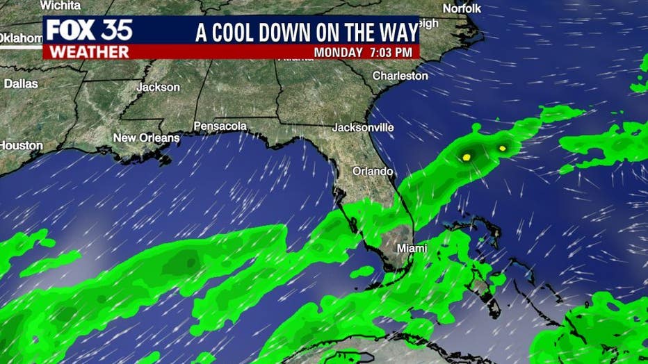
ORLANDO, Fla. - A weakening cold front will move southward across the Florida peninsula early Monday, bringing much cooler air and brief fall-like temperatures.
Isolated to scattered showers will be possible tonight ahead of the front. We are tracking the chance for isolated thunderstorms as well.
Expect dry, sunny, and cooler conditions on Tuesday, Wednesday and Thursday. It will be breezy with gusts up to 25 mph.
WEATHER ALERTS: Download the FOX 35 Weather App to track the tropics on your phone, receive severe weather alerts, and get the latest daily forecasts
Afternoon high temperatures will be near 80 degrees on Monday, falling to the mid-70s through mid-week. Overnight lows will drop to the 50s and even upper-40s in Central Florida on Tuesday night into Wednesday morning.
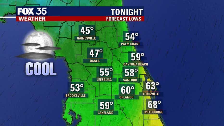
The coldest air is expected on Wednesday morning.
Download the FOX 35 Weather App to track the cold front and cool temperatures.