

Cold front to arrive in Central Florida soon: Timeline, expected temperatures

Weather Report: Nov. 21, 2021
FOX 35 Storm Team Meteorologist Allison Gargaro gives the latest on the weather in Central Florida.
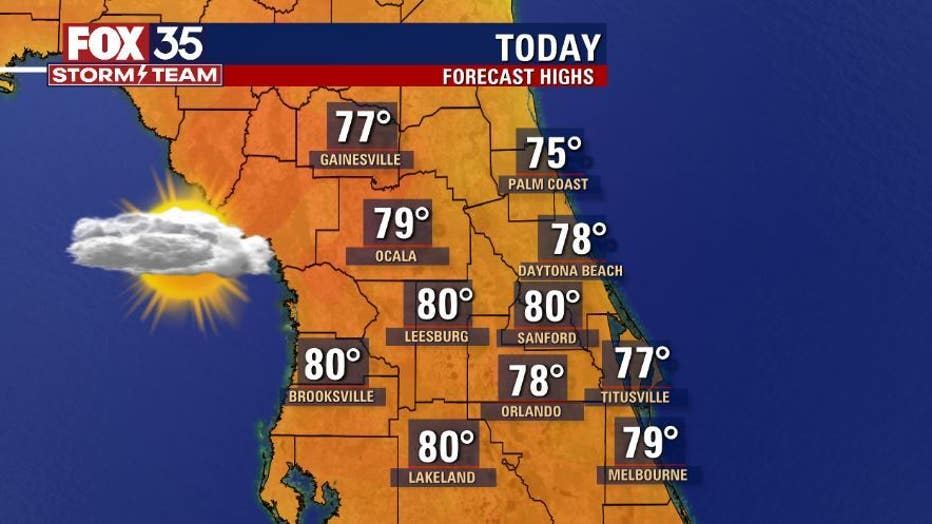
ORLANDO, Fla. - Central Florida can expect partly cloudy skies on Sunday.
Afternoon highs will be around 80 degrees across the interior and along the coast this afternoon. Breezes are likely, with gusts up to 20 mph.
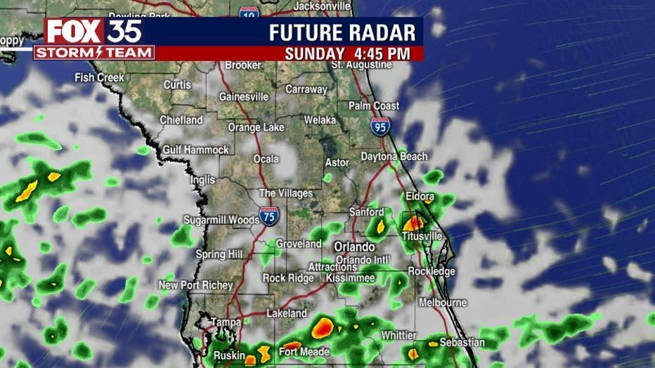
Scattered showers are also possible across East Central Florida, but most of the activity will remain in Osceola and Brevard Counties on Sunday afternoon and evening. With any shower, heavy rain and gusty winds are possible.
WEATHER ALERTS: Download the FOX 35 Storm Team Weather app for live radar, severe weather alerts, and daily forecast reports on your phone
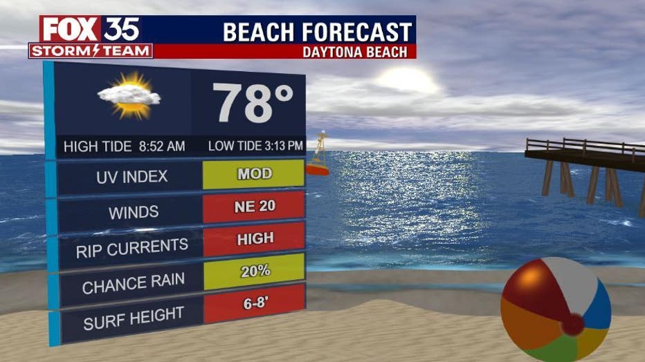
There is a high risk for rip currents at all east coast beaches with rough surf, so entering the water is not recommended.
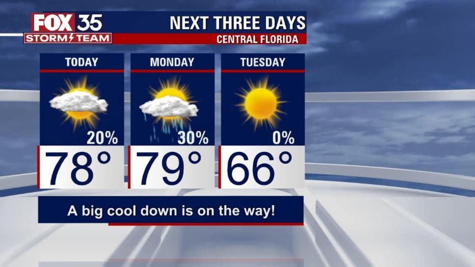
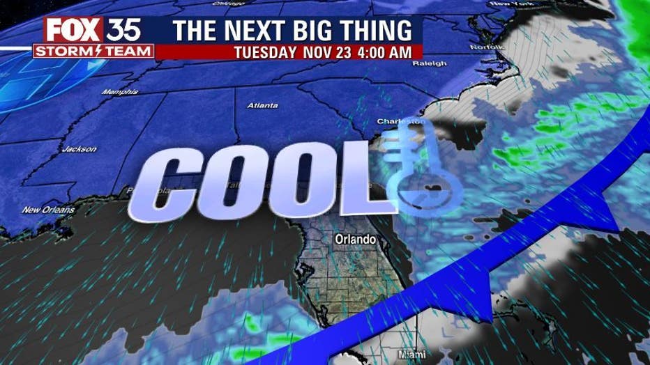
Our 'Next Big Thing' is a cold front that will sweep across the Florida peninsula on Monday. There is a chance for a few showers with this front, but the main weather impact will be much cooler air.
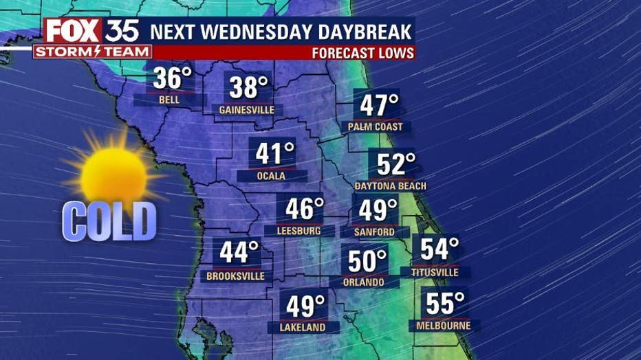
Overnight lows will dip into the 50s on Monday night, but the coldest temperatures so far this season will be felt when you wake up on Wednesday morning. Overnight lows will dip into the 30s and 40s in some cities so make sure you have your jackets ready.
MORE NEWS: Jack Kazanzas Star being installed in Downtown Orlando
Temperatures will rebound just in time for Thanksgiving. Afternoon highs on Thursday will be comfortable in the mid-70s with partly cloudy skies and dry conditions.
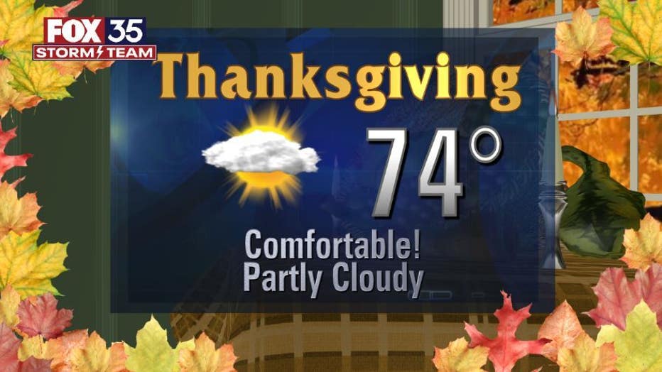
Happy early Thanksgiving from the FOX 35 Storm Team.
Watch FOX 35 Orlando for the latest Central Florida news.