

Central Florida is Cold front free this week, steadily warming temps result
Orlando, FL -
Let the warm up begin!! The week ahead will offer some substantial changes in the temperature department as high pressure builds in across Florida. This time of year, a simple change in wind direction can make all the difference and you'll likely notice the developing changes today.
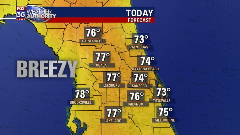
High temperatures head for the 70s areawide by this afternoon. The coolest numbers, lower-mid 70s will set up along the coastal areas with breezes off the cool Atlantic waters. As you head West of I-95, temperatures will grow a bit higher with mid-upper 70s the norm. Skies will be mixed featuring some sun and cloud mix, rain chances will hang around the 10% or less range as a few showers or sprinkles might develop in the ocean breezes.
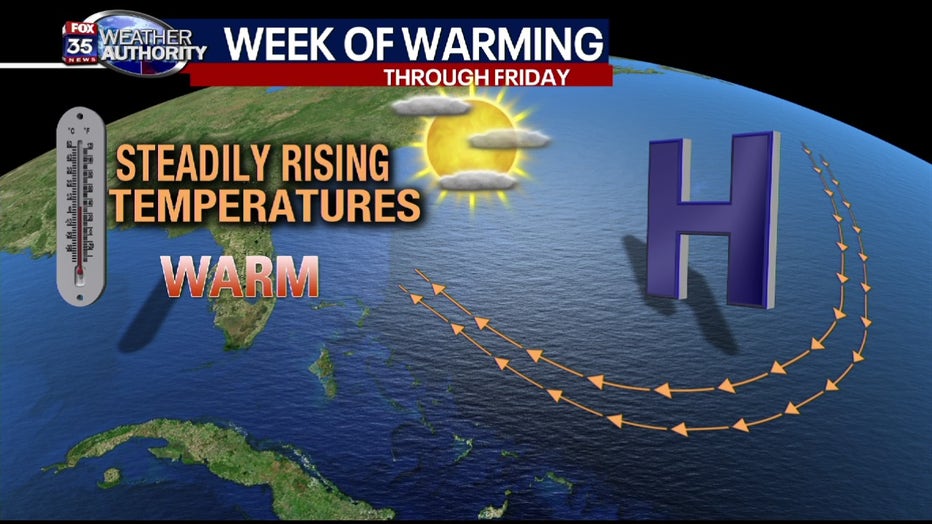
Expect high temperatures to take on a few additional degrees of warming as we head through the remainder of the week and into next weekend. High pressure will be dominate so this means no cold fronts for Florida and well above normal high temps each and everyday. Rain chances again slim to none and skies remain well balanced with times of passing clouds and times of plentiful sunshine.