

An Active Hurricane Season Ahead
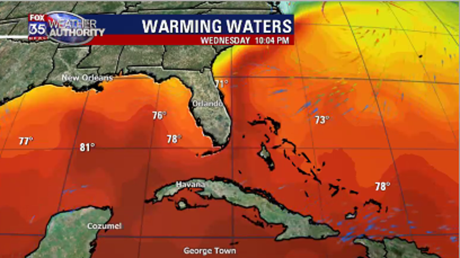
Orlando, Fl - With the waters warming across the Gulf of Mexico and the Atlantic, it is just a matter of 6-8 weeks before we find outselves surrounded by a bathtub. 80 degree water temperature usually marks the start of our tropical storm and hurricane production. That 80 degree mark is usually reached by June first.
The latest ENSO - El Nino Southern Oscillation forecast shows that El Nino has faded and we are now in a ENSO - Neutral phase. That means the waters across the equatorial Pacific are now running cooler and will shift the jetstream across North America into a patten that would favor hurricane formation.
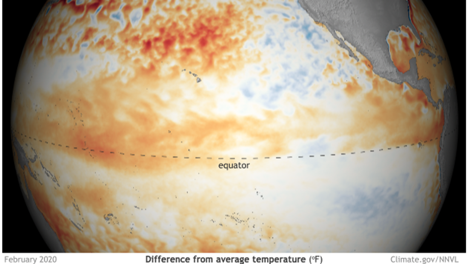
There is a 55% chance that this ENSO Neutral or La Nina pattern will be in place, and continue, through the summer season. This will allow for a light easterly wind pattern to set up across the Caribbean and the Gulf of Mexico.
Unfortunately, this pattern also sets up a steering flow that will have a tendancy to push/pull tropical sytems toward Florida and the southeastern U.S. That's the reason why the latest 2020 hurricane season outlook includes 14-18 names storms with 7-9 becoming hurricanes. That is above normal and the probability of a landfalling system across Florida is also greater than the 100 year average. Be sure to use your FOX35 Weather App to track the tropics anytime.