

After a warm Thanksgiving, strong cold front could drop temperatures into the 30s and 40s in Central Florida
Orlando, FL - Toasty temperatures will greet Central Floridians on the Thanksgiving holiday, but that changes in a big way come Sunday night into Monday in the wake of a strong cold front.
On Turkey Day, area highs will climb into the lower 80s inland with slightly cooler upper 70s along the coastal areas. Sunshine will prove to be rather plentiful and rain chances at zero.
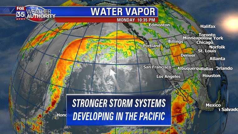
As we head into the weekend, temperatures remain elevated, but the cold front will drop temperatures way down,possibly as low as the 30s and 40s. The Pacific Ocean will serve as the birth place for a series of energetic storms, some tapping rather chilly air and driving it all the way South into Florida.
There could be a line of showers and storms along the approaching late weekend front, so rain chances might need to be increased in the longer term forecast.
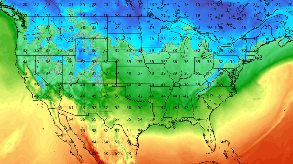
Take a look at the GFS model forecast in regard to high temps by next Monday. This shows an impressive cool down for much of the Nation, Florida included for sure. Right now, highs locally in Central Florida Monday afternoon could struggle to get out of the low-mid 60s, winds will also begin to trend a bit gusty as Northwest breezes increase.
Low temperatures Monday night into Tuesday could fall into the 30s and 40s across the area as Arctic air filters in from the North. Definitely a situation worth watching so stay tuned for more info to come!
Be sure to download the FOX 35 Weather App to get your daily weather right on your cellphone.