

Live radar: Track strong storms in Orlando, Central Florida
ORLANDO, Fla. - A weak cold front and a push of drier air are expected to limit showers and thunderstorms across much of Central Florida on Wednesday.
The greatest chance of rain will shift southwest of the Interstate 4 corridor.
Live radar: Track storms through Orlando

Storms not as widespread on Wednesday
Timeline:
A weak cold front is moving into Central Florida and will bring an earlier timeline of scattered showers and storms on Wednesday.
High temperatures will remain above normal, reaching the low 90s along the coast and the mid-90s inland.
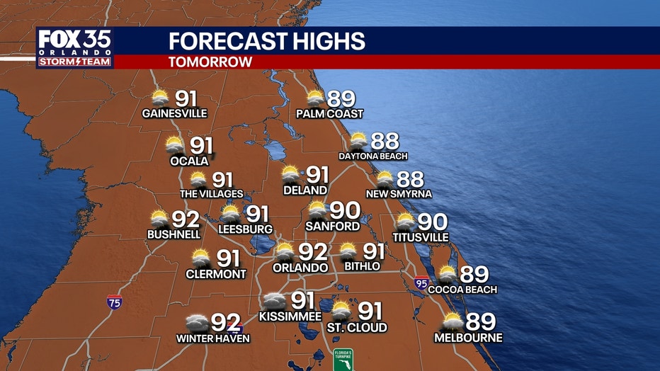
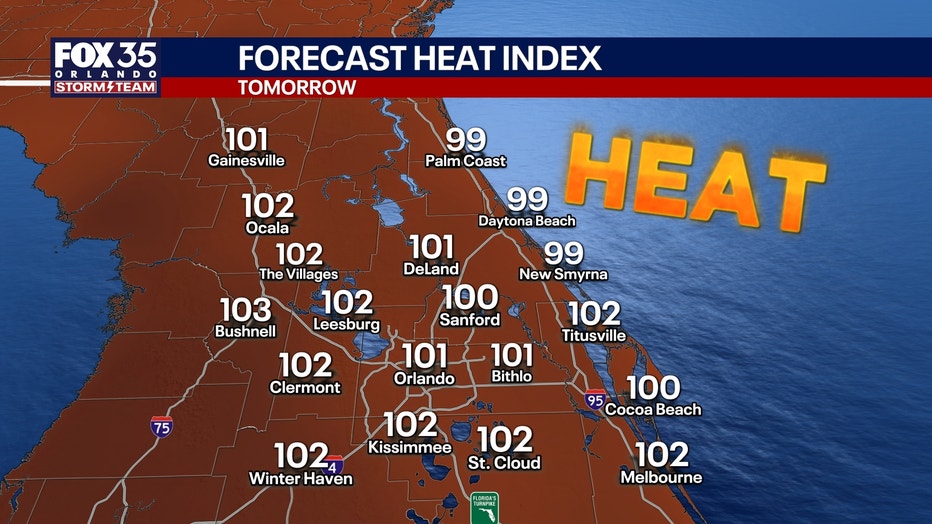
Timeline: The main round of rain will begin at around 8 a.m. to 9 a.m. and will last until around 6 p.m. to 7 p.m. Storms could produce heavy rain, gusty winds and frequent lightning, but widespread washouts are not expected.
Areas around Orlando and the theme parks could see isolated storms, while communities east and north of Orlando are expected to remain mostly dry.
Daily afternoon downpours and storms
Looking Ahead:
Rain chances will gradually increase from Thursday through Saturday, with the greatest coverage expected Saturday as widespread afternoon and evening showers and thunderstorms develop across Central Florida. While not everyone will see severe weather, one or two storms could become strong enough to produce damaging wind gusts or large hail.
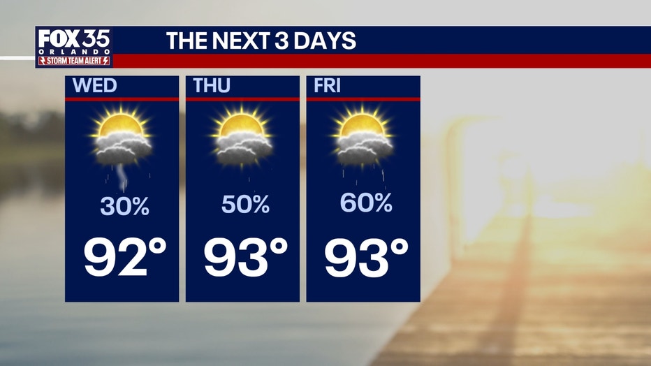
The unsettled weather could also affect Independence Day celebrations. Downpours, lightning and thunderstorms may move through during the peak fireworks hours between 7 and 10 p.m. Friday and Saturday, potentially causing delays at some outdoor events.
4th of July holiday weekend outlook
Looking ahead into the 4th of July holiday weekend, the forecast features a very Florida-like set-up.
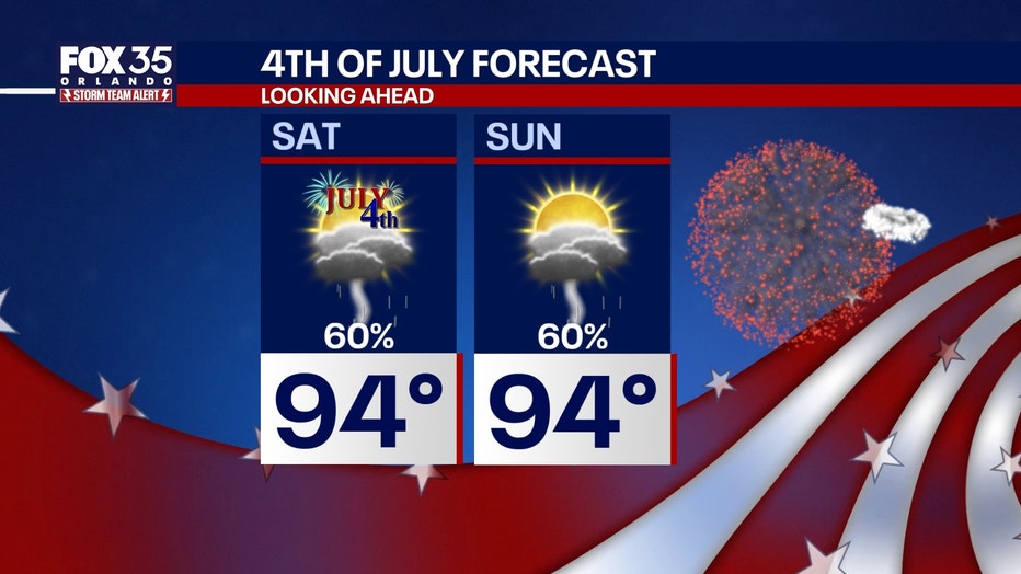
This means afternoon downpours and storms will be paired with hot and humid temperatures. A total wash-out isn't anticipated, but do plan for a 60% chance of showers and storms that will bring the potential of heavy soaking rain, gusty winds and frequent lightning.
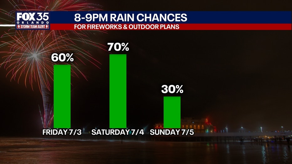
With more of a southerly wind flow Saturday, rain chances will reach the beaches and linger area-wide later into the evening, compared to Friday.
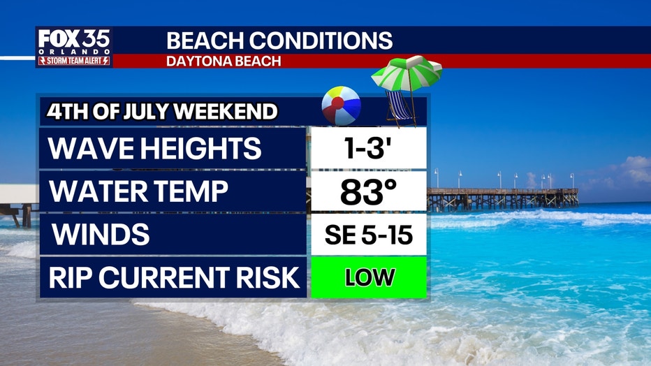
Both days, though, there is a risk of fireworks being impacted by lightning in the area around 8 p.m. to 9 p.m.
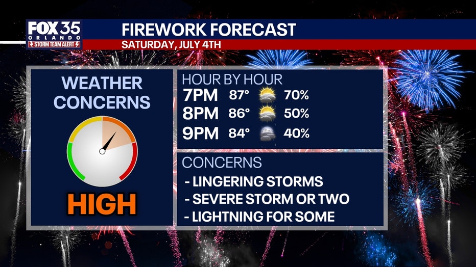
Storms should be fading away by 9 p.m. each day, but some will still be around to impact outdoor events.
If you have outdoor plans to celebrate, just keep a close eye on the skies and have a safe place to shelter from the lightning.
Remember, if you can hear the roar of thunder, you're within striking distance of lightning!
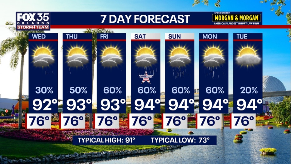
Temperature wise, it's going to be steamy. Afternoon highs will climb into the low and middle 90s as feels-like temperatures reach the low 100s.
The Source: The information used in this story was provided by the FOX 35 Storm Team.