

Orlando weather: Storms possible Friday afternoon for Central Florida
Orlando Weather Forecast: Tracking Friday Storms
FOX 35 Storm Team Senior Meteorologist Noah Bergren is tracking showers and storms for parts of central Florida Friday and a recap of the record heat.
ORLANDO, Fla. - A very warm night is in store with lows in the low-mid 70s and mostly clear skies.
Overnight lows will be way above average for this date, with the average being 64. Some places may only fall to 73 to 74 degrees. The warmest overnight low ever for this date was 76°F, set in 1978, and we will be close in a few spots.
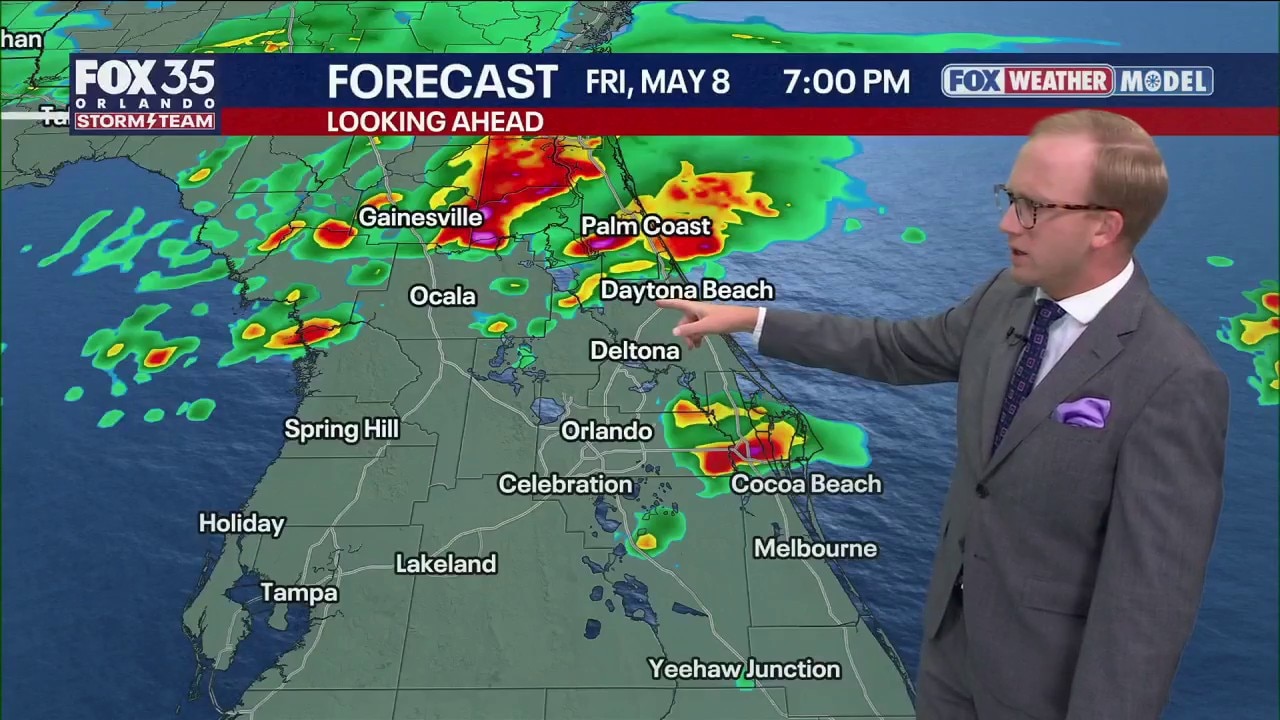
Friday forecast for Orlando
What To Expect:
It will be mostly sunny in the morning with increasing clouds in the afternoon. The remnants of a front that was up in north Florida on Thursday, will sag south into central Florida late Friday.
This remnant front will act as enough of a trigger in the hot atmosphere to trigger a handful of PM storms or showers. The best chances look to be north of Orlando on Friday afternoon and evening.

There will be enough instability and strong winds up aloft in the atmosphere that one or two of these storms could turn severe with some large hailstones.


Severe hail would be isolated in the grand scheme of things, but one or two places could see it along with a localized 50-60 MPH wind gust. Will be watching the radars close in the afternoon and evening for that potential.
Weekend forecast for Orlando
Looking Ahead:
Still hot this weekend with the low to mid 90s Saturday and Sunday. Most of Saturday should end up dry, but a handful of PM showers or thunder chances will return on Sunday and into next Monday. Nothing extreme, but a few PM pop-ups to track out there.
Wildfire risk and drought is a lingering headline that will be with us for a while to come. Burn bans are already in place for many of our Central Florida counties, so outdoor burning is strongly prohibited.

High temperatures will hold steady in the 90s through early next week. For the weekend specifically, a stalled front will meander to our north, allowing the heat and moisture to build into the region.

With the increasing moisture, this will lead to a 30% chance of isolated showers, downpours and storms starting tomorrow and lasting through Saturday and Sunday.
While it won't be a washout, pockets of heavy rain and frequent lightning are possible. Higher chances of rain will exist Monday as a weak cold front shifts into the region, bringing highs back down to the mid 90s.
The Source: Information in this story was provided by the FOX 35 Storm Team.