

Orlando weather: More rain on tap for Central Florida; temperatures reach the 90s
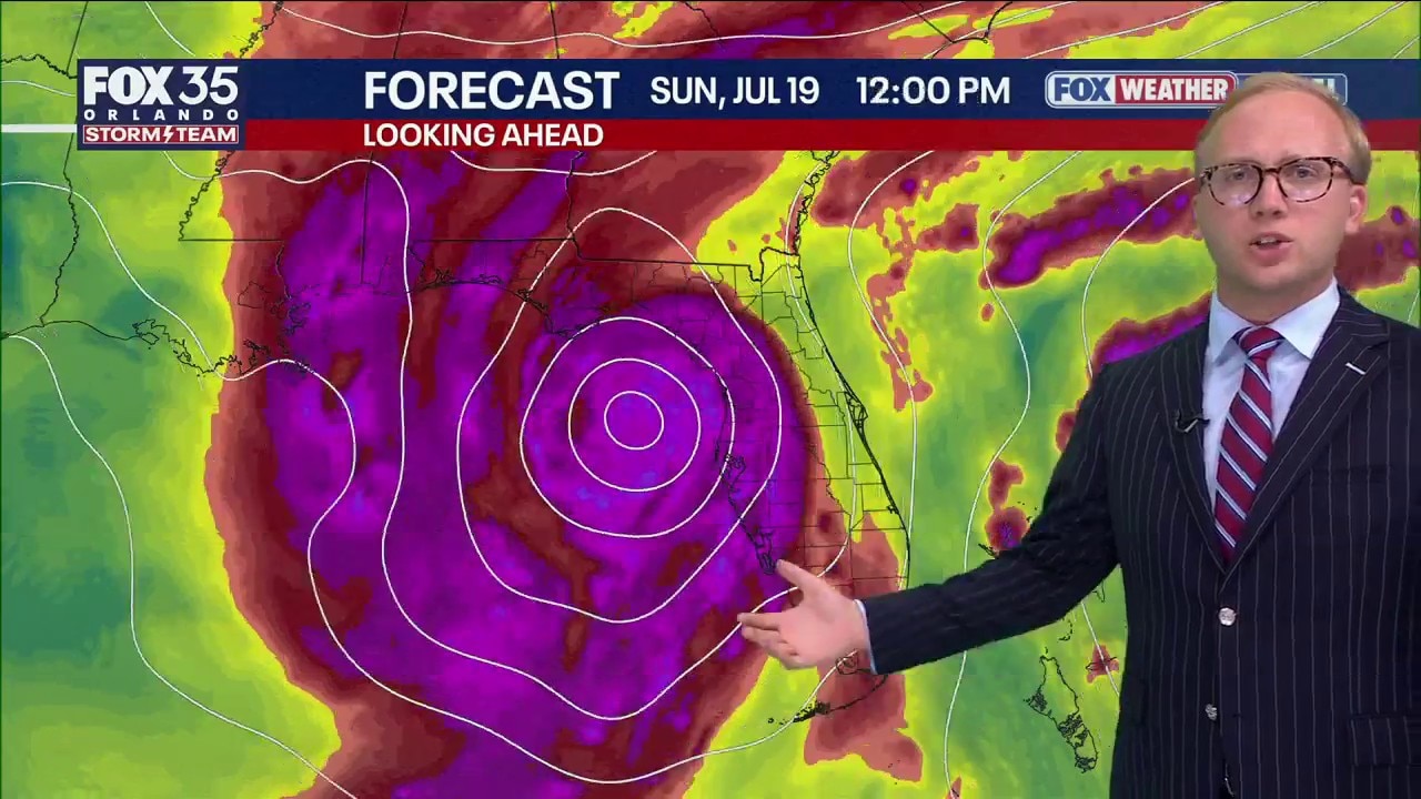
Orlando Weather Forecast: Tracking tropics and storms
FOX 35 Storm Team Senior Meteorologist Noah Bergren is tracking the chances for showers and storms to be bigger than normal for mid-summer this weekend, as low pressure develops in the Gulf.
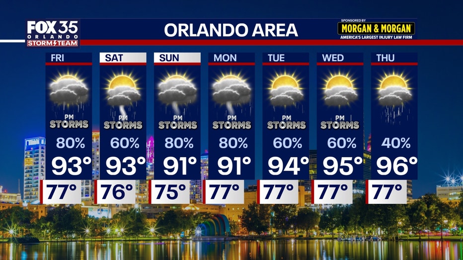
ORLANDO, Fla. - Rising chances for widespread storms and downpours return Friday, and linger into early next week.
Friday, Sunday, and Monday, in particular, look to have the highest chances of heavier than 'normal' summer storms. A couple of strong-severe storms are likely during those days as well, especially on Sunday when a few rotating storms are possible.
Widespread rain returns on Friday
When will the rain arrive?:
The data shows more moisture returning and a large area of storms in the late afternoon and evening coming up from the Tampa area.
A couple of these storms could be strong or severe.
CLICK TO DOWNLOAD THE FOX LOCAL APP
Low pressure aloft is going to form over the eastern Gulf, which means a strong push of tropical, humid, moisture-laden air from the SW into the Florida Peninsula.
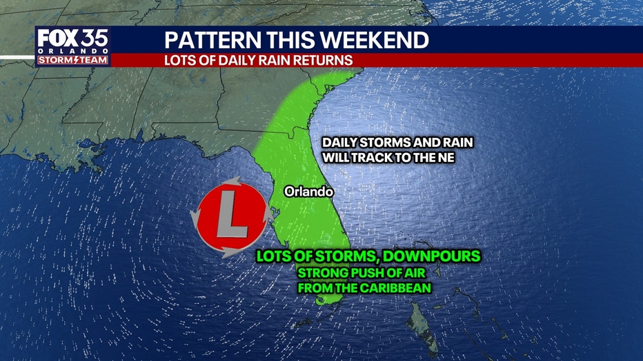
Some places could get 5 inches or more of rain locally between Friday and Monday added together.
The chance of a tropical system forming in the Gulf while not zero, is low. We will watch model trends and the satellite to see if anything changes. Some models today are hinting at more of a chance of a tropical depression forming.
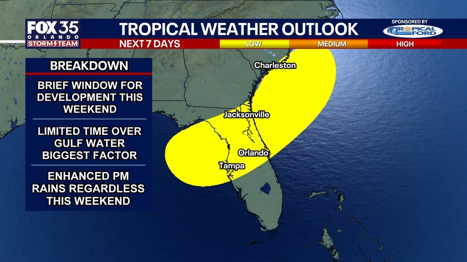
Tracking the Tropics
Timeline:
Low pressure forms starting Friday, and moves very slowly north through the Gulf heading into the weekend. It will push in lots of tropical air, downpours, and storms at times. Especially Friday, Sunday, and Monday.
SIGN-UP FOR FOX 35'S BREAKING NEWS, DAILY NEWS NEWSLETTERS
If this low pressure were to form into a tropical storm, that would likely happen Sunday or Monday. It's hypothetical track, whether turning across north-central Florida or going towards Alabama or Louisiana is not known.
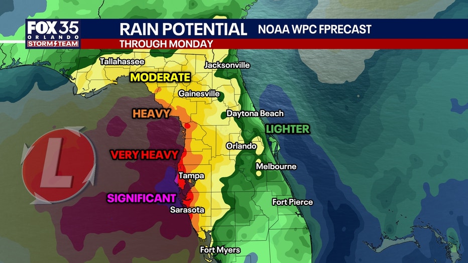
RAINFALL POTENTIAL:
There will be significant rainfall on the Gulf Coast of Florida, with some places getting 8 inches or more of rain between Friday and Monday. Flash flooding could occur at times in the Tampa and Sarasota areas. Inland closer to Orlando, more in the 2–6" range with isolated pockets of more. The lighter the totals, the further east you get towards I-95.

Florida impacts:
Regardless of how much the system is able to develop, this will be a rainmaker for Florida.
A typical summer pattern returns next week with high temperatures in the 90s and high chances for afternoon storms.
The Source: The information in the story was provided by the FOX 35 Storm Team.