

Orlando weather: Wet week ahead with temperatures climbing into the 90s
Orlando Weather Forecast: Tracking showers
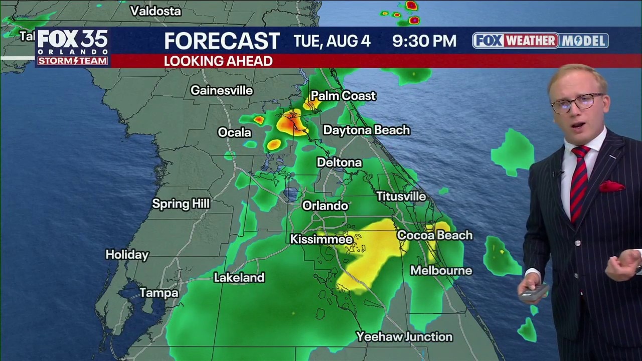
FOX 35 Storm Team Senior Meteorologist Noah Bergren is tracking lots of clouds and showers across central Florida again for Tuesday.
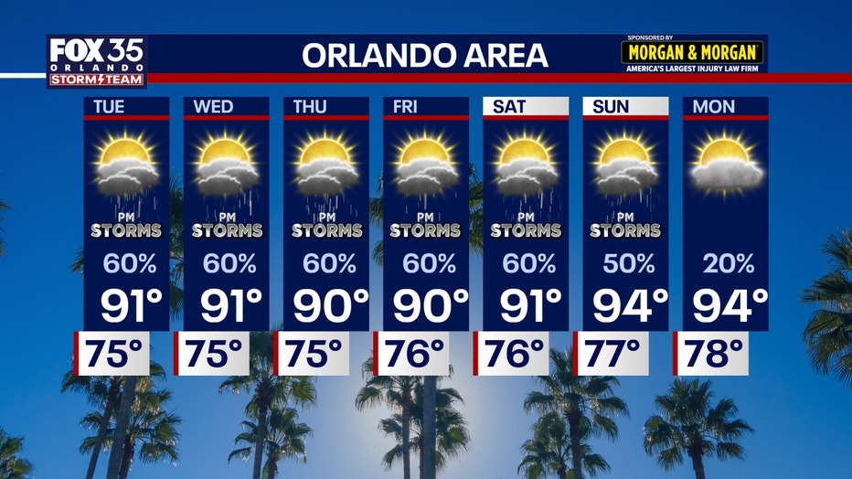
ORLANDO, Fla. - As Monday's rain winds down heading into the evening, chances for rain will persist across Central Florida throughout the remainder of the week.
By 5 p.m. Monday, light rain lingered over Brevard County while most of Central Florida began drying out.
What we know:
On Tuesday, showers and typical summer thunderstorms will move west to east across the region.
A big pattern change will come Wednesday through the early weekend with storms and showers moving the opposite direction, to the west each day.
A wet week across Central Florida
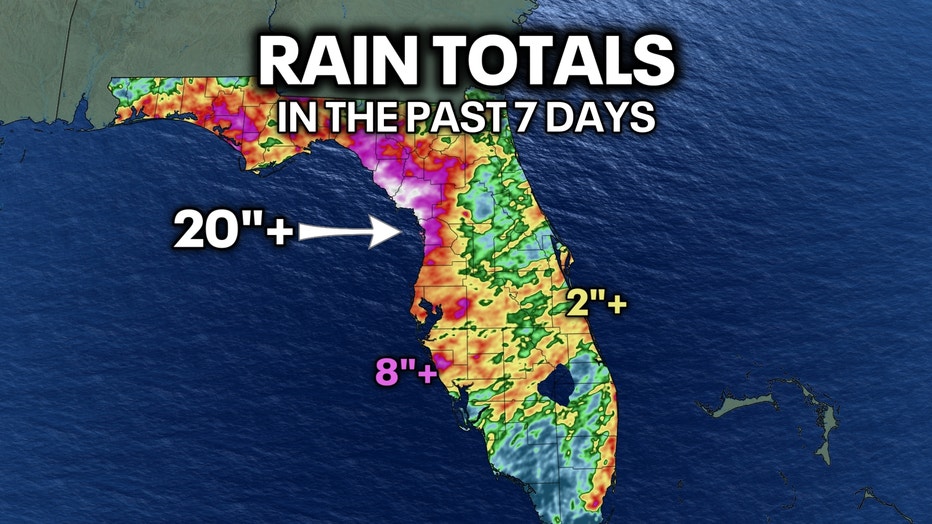
Some areas in Central Florida are set to get over 20 inches of rain.
Around the Orlando region, totals have been much more sporadic and variable, with some places not receiving a lot of rain lately.
Heading into the later week, things will pop and move west daily, reaching their peak intensity on the I-75 corridor outside our region. Westerly flow in summer means by evening, most of the area east of Orlando ends up dry and clear as all the storms and showers move west towards Tampa.
What's next:
Temperatures will stay in the low 90s for the next few days, getting back into the middle 90s by late this upcoming weekend.
The Source: Information in this story was gathered from FOX 35's Noah Bergren.