

Orlando weather: Hotter, drier Central Florida as Bertha churns in the Gulf
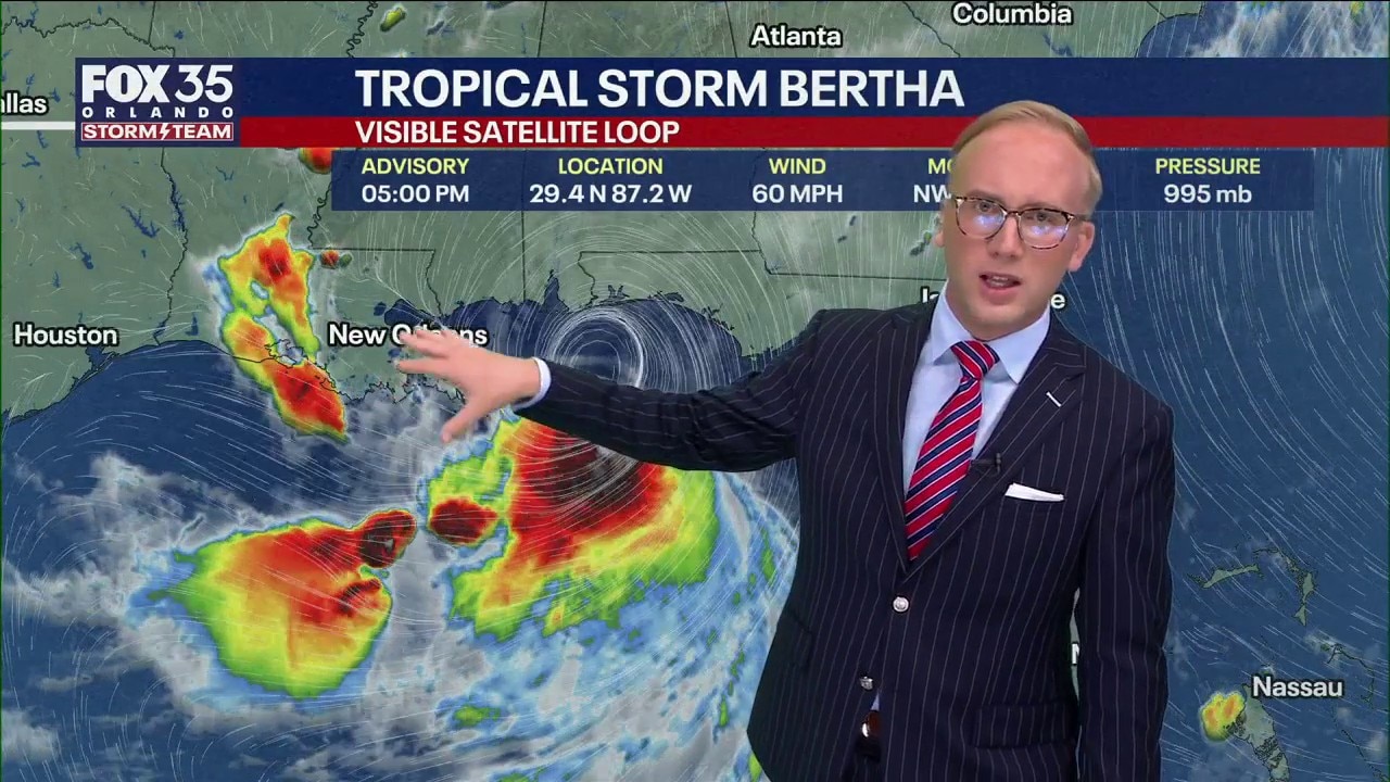
Orlando Weather Forecast: Tracking Tropical Storm Bertha
Bertha is moving away from Florida but will still impact our weather in the coming days. FOX 35 Storm Team Senior Meteorologist Noah Bergren is tracking where Bertha goes next and how much impact it will have on the Gulf coast.
ORLANDO, Fla. - Bertha is moving away from the Florida Peninsula but still impacting our weather with some gusty south winds and a few sprinkles.
We'll still see a few tropical downpours and storms Tuesday, but most of the activity will be focused off to our northwest. This trend continues through the remainder of the workweek, as heat starts to become our big story.
Tropical Storm Bertha moves toward Florida Panhandle, northern Gulf
Tropical Storm Bertha has strengthened as it moves off to the west-northwest, it encounters less shear and this should make for more intensification as it moves over the warm water.
With that shear, though, Bertha is lopsided, with the heaviest rain falling offshore, on the southern side of the storm.
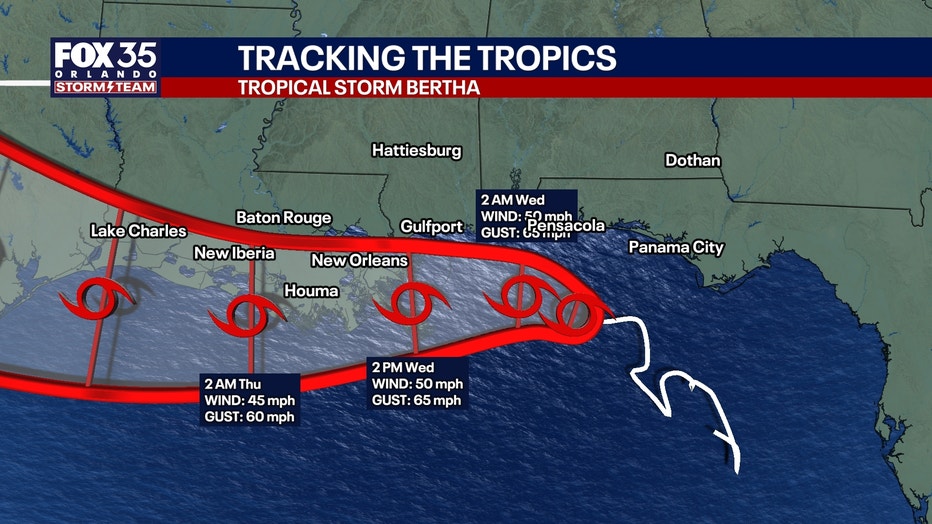
Tropical Storm watches and warnings have been issued for parts of the Gulf, including the Florida Panhandle. If you have travel plans to the Panhandle, as well as the Gulf Coast in general, you'll definitely want to monitor the latest forecast.
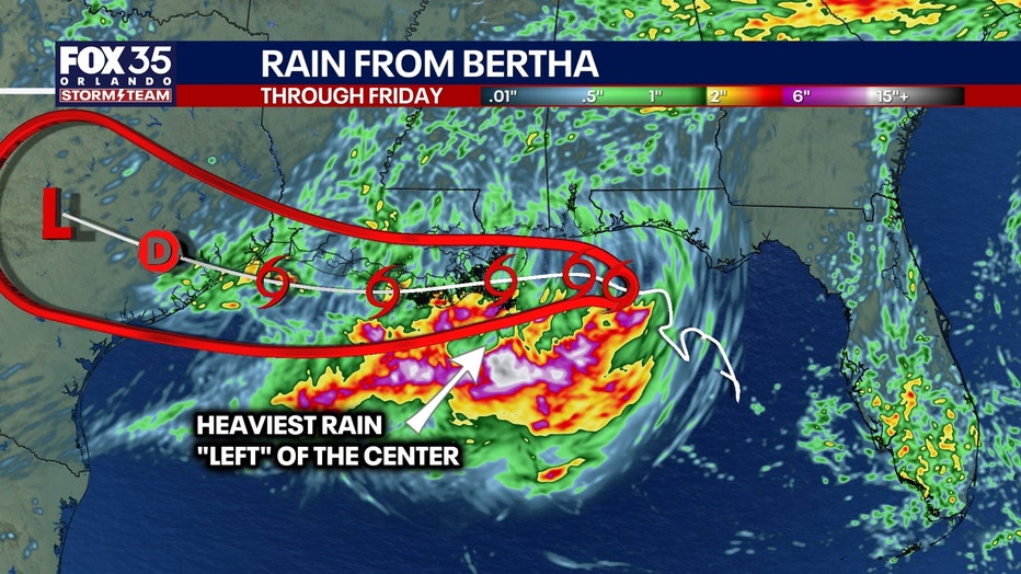
From Wednesday into Thursday, we're likely going to see a landfall in Louisiana, with gusty winds, big surf, and storm surge around 2-4'. From there, the remnants will then look to move into Coastal Texas with some lingering rain and breezy conditions.
Spotty downpours, stray storms expected
As Bertha continues to develop in the Gulf, we'll be on the outer edge of the heavier tropical moisture.
The storm will struggle to intensify much, but may briefly become a strong tropical storm before weakening again. Bertha will reach peak strength early Wednesday, with rain bands impacting the Florida Panhandle, southern Alabama, and Mississippi during those times.
There is a very small chance it could regain some intensity after landfall in Louisiana if the center of circulation can get back out over the ocean water, but not a lot of models show that.
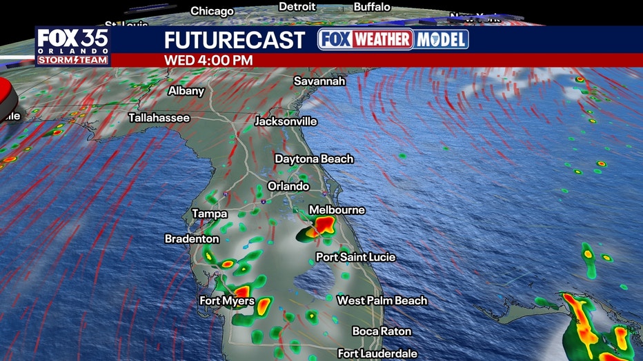
Across Central Florida, we will continue to see some spotty downpours, but drier air will continue to wrap around Bertha through the remainder of the workweek. This will start to cut down on chances of rain.
Temperatures climb for the remainder of the week
We will likely see drier than normal conditions in the middle to late week. Chances dip to around 20% Wednesday and that trend continues into Friday.
With that drier air in play, temps will be topping out in the middle 90s for the most part as we approach midweek.
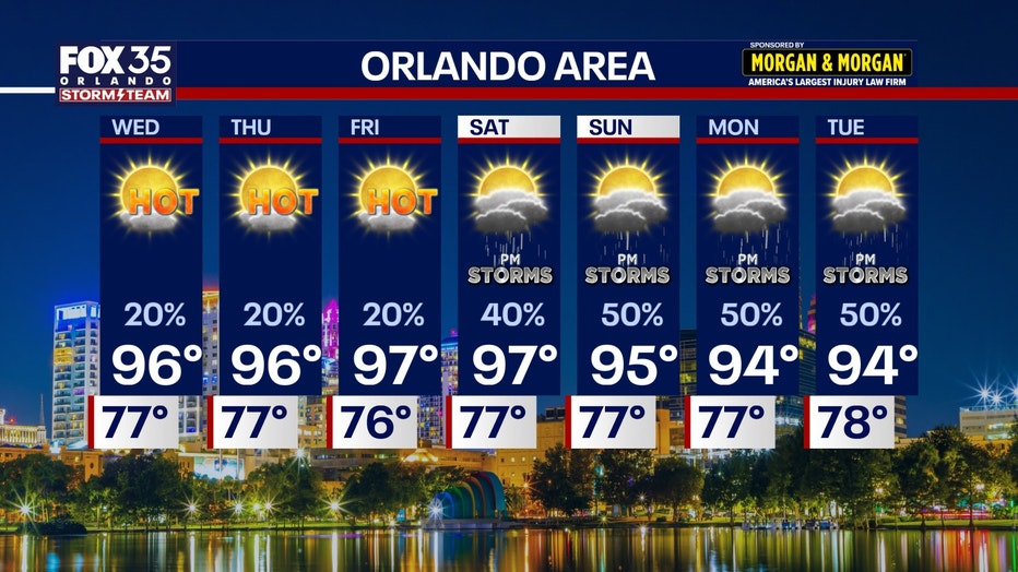
Highs by Thursday and Friday look to climb into the middle to potentially upper 90s in some isolated spots, which is above average for this time of year. Feels like temps with the humidity look to get back into the middle to upper 100s.
Rain chances do start to climb as we tap into more moisture this weekend, rising to around 50% both Saturday and Sunday.
The Source: The information in this story was provided by the FOX 35 Storm Team.