

Orlando weather: Stormy pattern settles into Central Florida as hurricane season nears
Orlando Weather Forecast: Tracking widespread storms Thursday and an update in tropics
The rainy season officially is about to get underway Thursday in central Florida with lots of PM storms and downpours, continuing into next week. FOX 35 Storm Team Senior Meteorologist Noah Bergren is also tracking an update in the tropics.
ORLANDO, Fla. - Central Florida is expected to see increasing rounds of showers and thunderstorms through the weekend and into next week.
The FOX 35 Storm Team is tracking a wetter-than-normal weather pattern ahead of hurricane season.
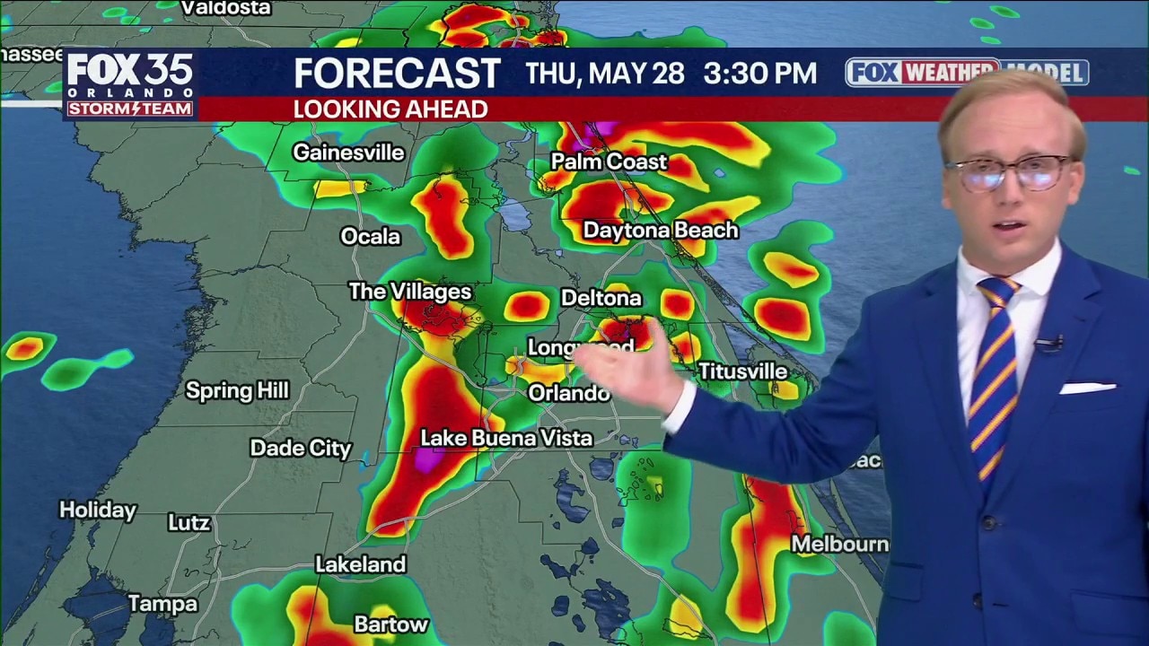
Thursday forecast for Orlando
What To Expect:
Overnight temperatures are forecast to fall into the 70s with light winds. Highs will break into the upper 80s.

Thursday will bring increasing clouds and widespread afternoon and evening storms moving east across Central Florida.
CLICK TO DOWNLOAD THE FOX LOCAL APP
Heavy downpours are expected to affect the evening commute along the Interstate 4 corridor, with the strongest storms forecast near Brevard, Volusia and Flagler counties.

A few storms could briefly become severe, producing gusty winds and hail.

Heavy rainfall on the way
Looking Ahead:
A big pattern change is developing and Thursday is when we finally start to see it take shape.
More numerous showers and storms are expected, especially around the Orlando Metro and points east. This is thanks to a southwesterly wind coming across the Peninsula. This, as well as a bit of upstairs "energy" in the atmosphere, will lead to more widespread activity.

Minor flooding is possible with the torrential rain, and we could also see some gusty wind as well as frequent lightning. It will be a Storm Team Alert Day as this shift in the storminess will favor more of the metro and our eastern locales that haven't seen the rain, bringing heavy rain potential. Be careful if you're traveling.

SIGN-UP FOR FOX 35'S BREAKING NEWS, DAILY NEWS NEWSLETTERS
Saturday is expected to bring a temporary decrease in storm coverage, though isolated showers and thunderstorms are still possible.
A more active summer pattern is expected to continue beginning Sunday and lasting into next week, with daily pop-up storms capable of producing heavy rain, frequent lightning and gusty winds. No widespread washouts are currently expected.

Moisture building over Gulf
Tracking The Tropics:
The Atlantic hurricane season officially begins Monday and runs through the end of November.

In the Gulf, some weather models indicate the possibility of weak tropical development next week as tropical moisture moves north from the Caribbean.


However, strong wind shear is expected to limit significant development.

For now, we will keep tabs on it, but the bigger story is the start of the rainy season, and more of an August pattern than an early June setup for the next 7–10 days.
The Source: The information in this story was provided by the FOX 35 Storm Team.