

Orlando weather: Hot and humid as storm chances build for Fourth of July weekend
ORLANDO, Fla. - Some lingering showers and thunderstorms are expected across Central Florida this evening.
Areas west of the Orlando metro, including Gainesville, Ocala and The Villages, are expected to have the highest likelihood of rain, while the east coast should see fewer storms.
Hot, humid and stormy Fourth of July weekend
Frequent lightning possible:
Steamy temperatures paired with afternoon and evening showers and storms are on the way for the holiday weekend.
A total all-day washout isn't anticipated, but do plan for showers and storms that will bring the potential of heavy soaking rain, gusty winds and frequent lightning.
CLICK TO DOWNLOAD THE FOX LOCAL APP
If you have outdoor plans to celebrate, just keep a close eye on the skies and have a safe place to shelter from the lightning.
Remember, if you can hear the roar of thunder, you're within striking distance of lightning!
SIGN-UP FOR FOX 35'S BREAKING NEWS, DAILY NEWS NEWSLETTERS
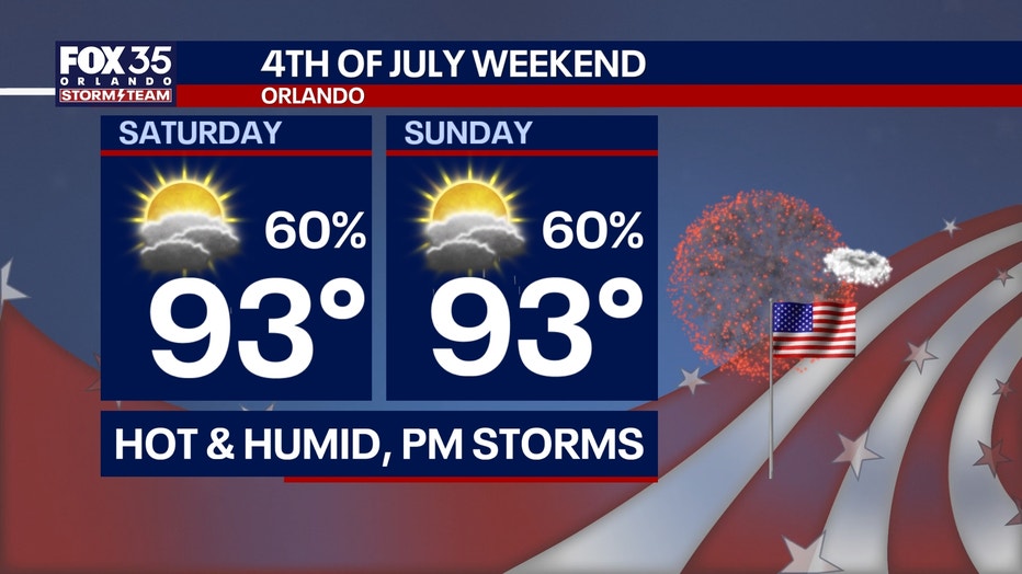
For Friday, plan for a 50% chance and for Saturday and Sunday a 60% chance.
Most of the storms will begin to form and pop up starting at around noon and will continue through roughly 8 and 9 p.m.
Impacts to your BBQ, beach and pool plans are more likely versus impacts on the fireworks shows.
A few isolated lingering showers will remain possible after sunset in a few areas.
Bottom line, keeping the rain gear handy is a safe bet. Temperature wise, it's going to be steamy.
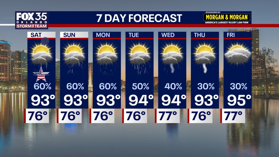
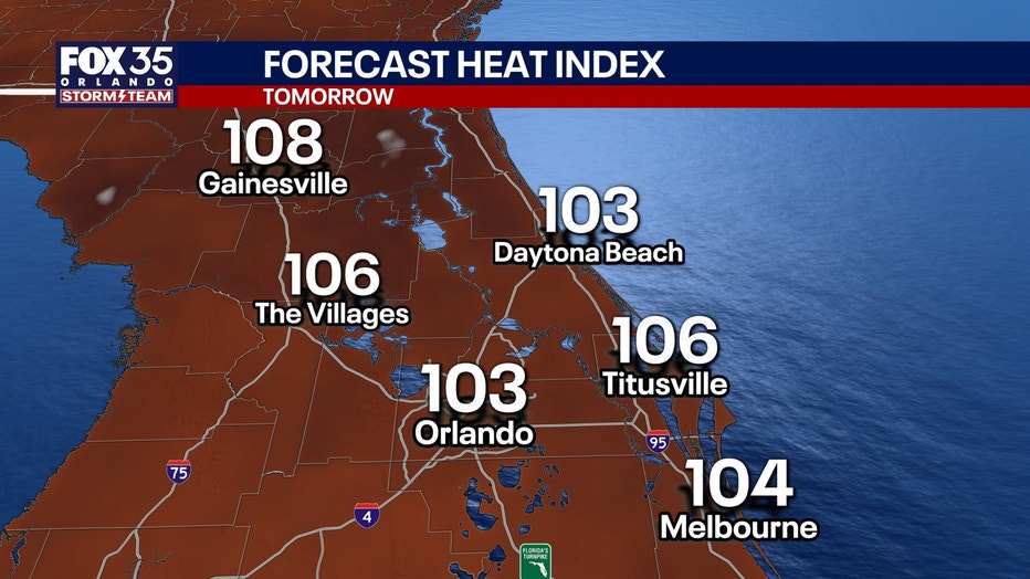
Afternoon highs will climb into the low and middle 90s as feels-like temperatures reach a range of 102-106°.
The Source: The information in this story was provided by the FOX 35 Storm Team.