

Orlando weather: Scorching days, late storms as Central Florida settles into classic July pattern

Orlando Weather Forecast PM: July 8, 2025
FOX 35 Storm Team Senior Meteorologist Noah Bergren is tracking rising rain and storm chances later this week.
ORLANDO, Fla. - Central Florida will see partly cloudy skies Tuesday night with only isolated thunderstorms expected.
What will the weather look like tomorrow?
What to expect:
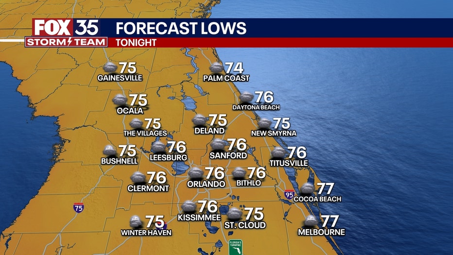
Overnight temperatures will dip into the mid-70s.
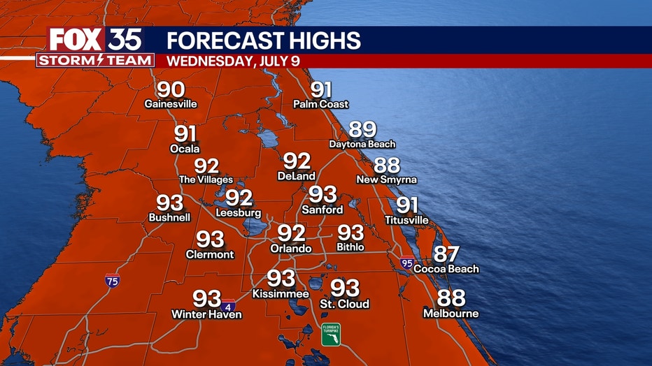
A mix of sun and clouds is in store for Wednesday, with high temperatures climbing into the mid-90s. The heat index is forecast to exceed 100 degrees during the afternoon and early evening. Thunderstorm chances increase late in the day, with scattered storms expected to continue into the evening hours.
What will the weather look like for the rest of the week?
Looking ahead:
The region will settle into a typical July weather pattern, featuring rising chances for afternoon and evening storms heading into the weekend and next week. Each day, rain and storm activity is expected to develop slightly later than the day before, becoming more widespread by midweek and beyond.
Daytime highs will remain above average, pushing into the mid-90s through the weekend. The historical average for this time of year is 92 degrees.
Tracking the Tropics
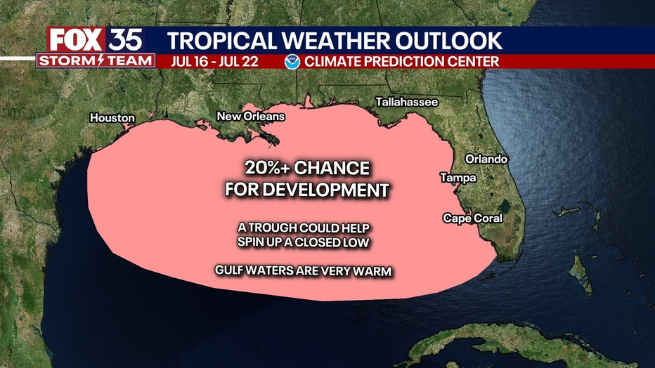
Tropical activity remains quiet for now. However, forecasters are monitoring early signals of potential development in the Gulf or southwestern Atlantic next week. While nothing has been officially noted in the National Hurricane Center’s outlook yet, a disturbance could appear in the seven-day forecast in the coming days.
Orlando 7-Day Weather Forecast

FOX 35 Storm Tracker Radar
Track live when storms move across your area using the FOX 35 Storm Tracker Radar below.

More radar maps from FOX 35 Storm Tracker Radar
- Brevard County
- Flagler County
- Lake County
- Marion County
- Osceola County
- Orange County
- Polk County
- Seminole County
- Sumter County
- Volusia County
- U.S./National Radar
STAY CONNECTED WITH FOX 35 ORLANDO:
- Download the FOX Local app for breaking news alerts, the latest news headlines
- Download the FOX 35 Storm Team Weather app for weather alerts & radar
- Sign up for FOX 35's daily newsletter for the latest morning headlines
- FOX Local: Stream FOX 35 newscasts, FOX 35 News+, Central Florida Eats on your smart TV
The Source: This story was written based on information shared by the FOX 35 Storm Team on July 8, 2025.