

Orlando weather forecast: Evening storms possible with localized flooding

Weather Forecast: Sept. 1, 2022
Orlando and Central Florida will see lingering evening showers until around midnight. Most activity will be to the western portions of our viewing area.
ORLANDO, Fla. - ORLANDO WEATHER
Tonight's low: 74 degrees | Tomorrow's high: 94 degrees | Rain: 60% chance PM Storms
Main weather concerns: Central Florida can expect a hot and humid Friday with a rise in afternoon thunderstorms. Scattered storms will be possible around 2-3 p.m. along the east coast sea breeze, then numerous will become likely through the evening across the interior. The main weather threats will be heavy rain, frequent lightning, and the chance of gusty winds. When thunder roars, go indoors. Rain chances will be lowest at the coast, around 30%, and more isolated.
BEACHES: There will be a 30% chance for afternoon showers/storms at the beaches this afternoon and evening. There is a low risk for rip currents. Surf remains in the knee-high range with a small dribble of ESE swell continuing.
THEME PARKS: Hot and humid conditions with numerous storms will continue this afternoon. Feels like temperatures will be in the triple digits, so make sure to stay hydrated and take breaks inside the a/c. Best chance for rain between 3pm-7pm. Heavy rain and lightning will be likely.
EXTENDED OUTLOOK:
Rain chances come down a bit this weekend as some drier air works into the region. The Artemis 1 mission has been rescheduled for this Saturday, the launch window opens at 2:17 p.m. Depend on the FOX 35 Storm Team and download the FOX 35 Storm Team App for the latest weather updates!
TROPICS:
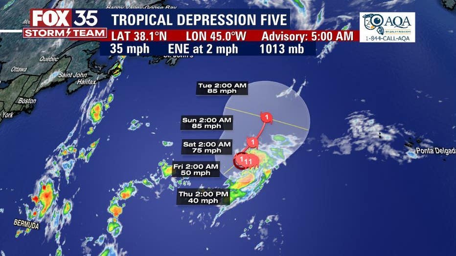
Tropical Depression FIVE has formed this morning in the distant North Atlantic. The system is forecast to acquire a name later today and will be called DANIELLE. Long term outlook brings this system to CAT 1 hurricane status as we head into the weekend. This tropical feature will be far removed from Florida and the U.S. shoreline. The FOX 35 Storm Team continues to watch long-range models.
Remember to stay alert as we approach the peak of the hurricane season On September 10th.