

Orlando weather: Toasty week before next cold front moves into Central Florida

Orlando Weather Forecast: Feb. 7, 2023
Orlando and Central Florida will see high pressure dominating the region and that means high temperatures in the 80s and lows into the 60s. There is a chance for rain this weekend that will usher in cooler temperatures.
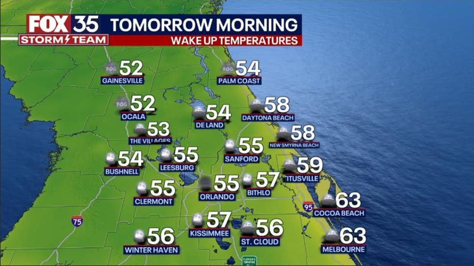
ORLANDO, Fla. - Tonight's low: 55 degrees | Today's high: 76 degrees
Main weather concerns: The next few days will be delightful across Central Florida. The skies will be dry with a mix of sun and clouds. Highs in the upper-70s across the coastal areas and near 80 inland areas. Warming temperatures continue over the next several days ahead of an advancing cold front.
BEACHES:
Skies will slowly clear by this afternoon with mild temperatures. Surf will reach 2-3 feet as some ENE swell courses into the surf zone.
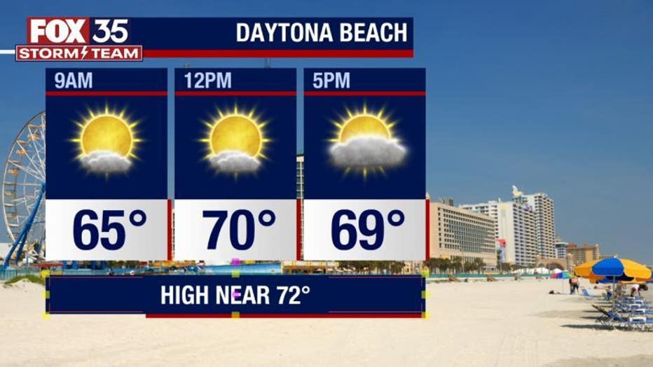
Moderate risk for rip currents. Local winds will be out of the East around 5-15mph. The UV Index remains high, so don't forget to reapply sunscreen.
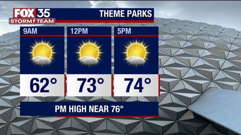
THEME PARKS:
A nice day at the theme parks! Highs warm to near 76 degrees with mixed skies, stays dry. A hat and sunglasses will be needed this afternoon.
OUTLOOK:
Fair weather returns through the middle of the week. Expect lots of sunshine with highs in the mid-upper 70s to around 80 through Wednesday.
| DOWNLOAD THE FOX 35 STORM TEAM WEATHER APP |
Our next rain chance arrives with a late week front that could bring afternoon showers and storms by Thursday and Friday.
Could be a few stronger storms in North Florida on Friday. Rain chances remain at 40% at this time. Cooler weather arrives this weekend, so make sure you keep your jackets handy.