

Orlando weather: Hotter, drier weather gives way to stormier weekend
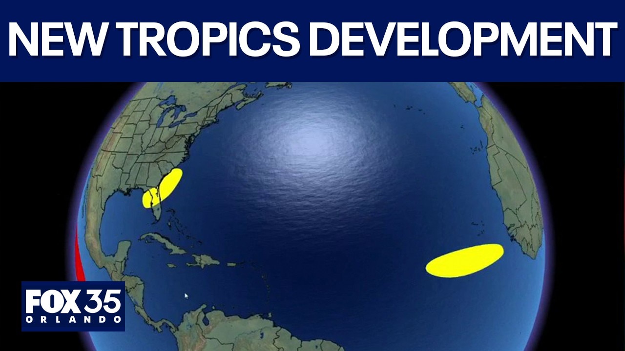
2nd Area of Potential Development Spotted by NHC
The National Hurricane Center is officially monitoring a second area of interest in the Atlantic after a fresh tropical wave rolled off the coast of Africa. FOX 35 Storm Team Meteorologist Noah Bergren sat with Garrett Wymer live to track the system's progress and break down whether Central Florida needs to worry about potential tropical development over the weekend.
ORLANDO, Fla. - Central Florida stayed mostly rain-free on Wednesday as drier air and a layer of Saharan dust limited afternoon storms, allowing temperatures to climb well above those recorded a day earlier.
Late afternoon temperatures reached the mid-90s across much of the region, including 93 degrees in Orlando and 95 degrees in Ocala. Some communities were 15 to 20 degrees warmer than at the same time Tuesday, when widespread afternoon storms cooled temperatures significantly.
Lower storm chances continue on Thursday
When will the rain return?:
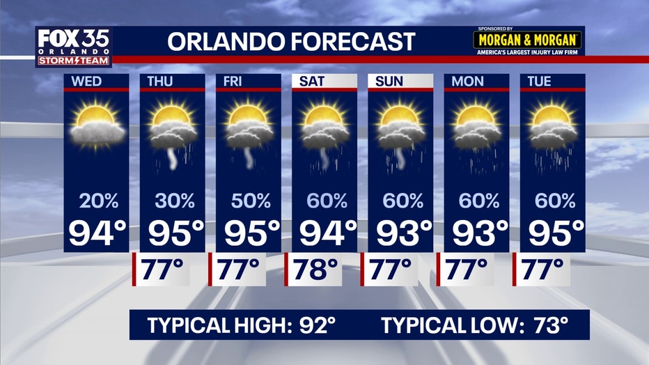
Rain chances are expected to increase slightly Thursday before a more active pattern arrives over the weekend.
CLICK TO DOWNLOAD THE FOX LOCAL APP
Scattered to numerous afternoon and evening showers and thunderstorms Friday through Sunday as an area of low pressure develops over the Gulf.
Highs in the mid-90s
Afternoon temperatures will stay a few degrees above normal, climbing into the mid 90s through the weekend.
How hot will it get?:
With lower chances of rain, the temperatures will heat up, and the hottest days will be Thursday and Friday specifically, as highs in Orlando reach 94° and 95°.
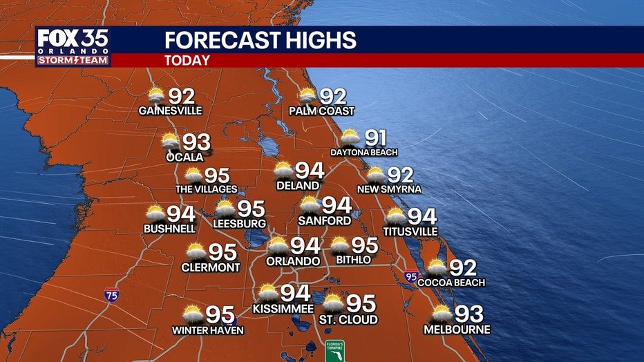
Feels-like temperatures will range from around 101°-105°.
SIGN-UP FOR FOX 35'S BREAKING NEWS, DAILY NEWS NEWSLETTERS
Temperatures are expected to ease slightly over the weekend as cloud cover and rain become more widespread before hotter conditions return early next week.
Tropical moisture returns
The National Hurricane Center is monitoring the Gulf for possible tropical development this weekend, although forecasters say the primary concern for Central Florida remains increased rainfall, frequent thunderstorms and the potential for a few stronger storms rather than a direct tropical impact.
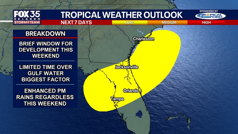
As the Saharan dust gradually thins out this weekend, tropical moisture builds back in.
An area of low pressure could form in the northern Gulf, which would help to swing additional moisture our way.
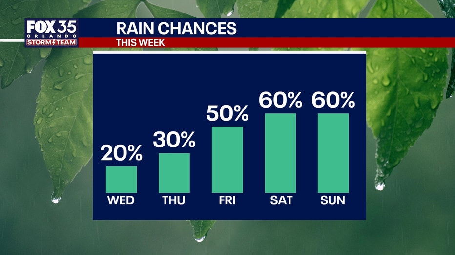
This means chances of afternoon and evening scattered showers and storms will return for the weekend and into early next week.
Plan for a 60% chance of downpours for Saturday and Sunday afternoon, lasting through next week.
The Source: The information in the story was provided by the FOX 35 Storm Team.