

Orlando weather: Comfortable and warm before weekend cool front arrives

Weather Forecast: Dec. 8, 2022
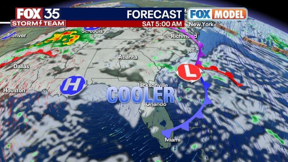
Orlando and Central Florida will see some pleasant weekend weather. High pressure will remain overhead which means more tranquil weather and plenty of sunshine. Highs will continue to be a bit above average in the upper 70s to low 80s.
ORLANDO, Fla. - Tonight's low: 62 degrees | Today's high: 82 degrees | Rain: Dry
Main weather concerns: After a cool night, we will experience a mostly sunny and pleasant Friday. Expect dry skies across the entire viewing area. Rip currents will be of issue along the beaches today as favorable tides and increasing ocean swell work in tandem increasing the risk.
BEACHES:
The high rip current risk continues today all along our coastline. Surf is in the 3-4' range as East-Northeast swell comes into the beaches. Rip current risk is high at all beaches. Temps beach side hit in the upper 70s, water temps are near 70.
Another increase in Northeast swell will occur by late week as an area of intensifying low pressure over the distant Atlantic sends wave energy into Central Florida beaches. Secondary round of swell arrives early next week, stay tuned for details on that!
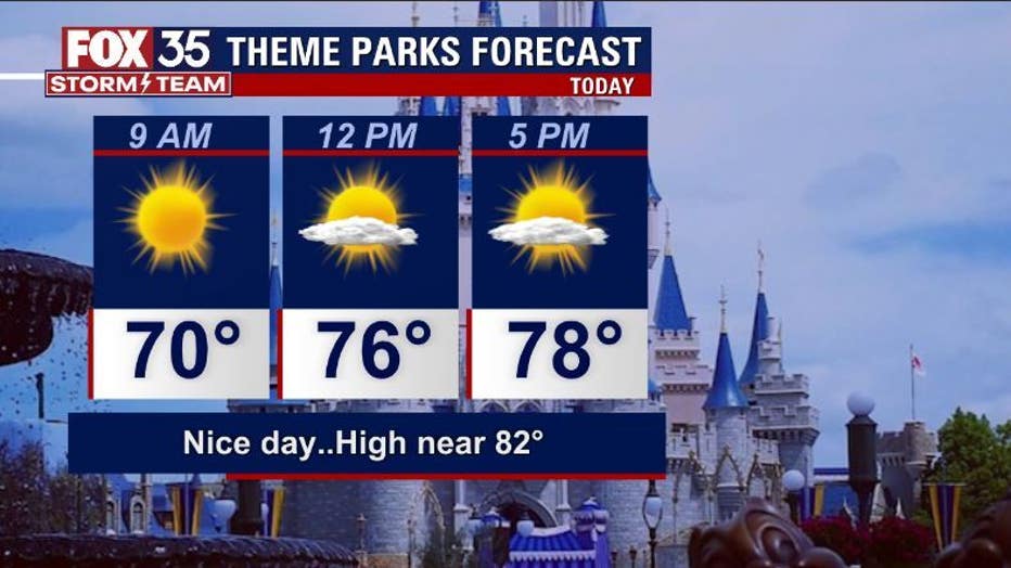
THEME PARKS:
Fantastic weather is expected at the theme parks today. Highs will be in the low-80s with mostly sunny skies. Make sure to apply a good quality sunscreen as a sunburn is possible today.
OUTLOOK:
No major changes extending through this week. High pressure will remain overhead which means more tranquil weather and plenty of sunshine. Highs will continue to be a bit above average in the upper 70s to low 80s. A weak cool front will move through the area late Friday night. This feature brings slightly cooler weekend air. Best chance for some rain appears to be next Thursday, December 15th, as front draws closer during that time.

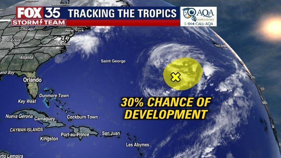
In the tropics, a non-tropical low located over the distant Atlantic stays far away from Florida. This feature stands a 30% chance of developing into a subtropical storm, if so, the name will be Owen.
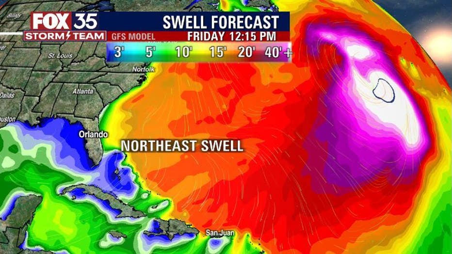
While Florida won't see wind from this low, increasing East swell will be the theme along the beaches today through the coming weekend. Beach erosion will be possible during times of high tide and rip current risk remains elevated in the "high" range.