

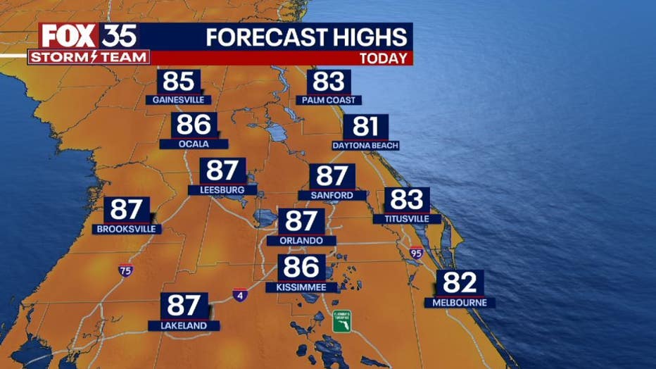
Near-record heat and rain start the week in Central Florida

ORLANDO, Fla. - The heat is on yet again for Central Florida on this Monday!
If you liked the weekend warmth, you'll love the area highs for the week ahead.
"Expect high pressure to remain in firm control of the forecast for much of the week. High temps at times will flirt with record levels before afternoon clouds increase and showers return day to day." said FOX 35 Storm Team Chief Meteorologist Jayme King.
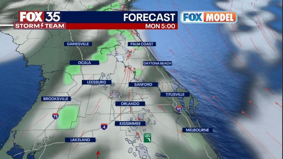
A rain chance? That's right! Our rain chances will rise this week as moisture streams into the state. Mainly showers are expected but don't rule out a few isolated storms featuring some gusty winds and perhaps a lightning strike or two.
DOWNLOAD: FOX 35 NEWS APP | FOX 35 STORM TEAM WEATHER APP
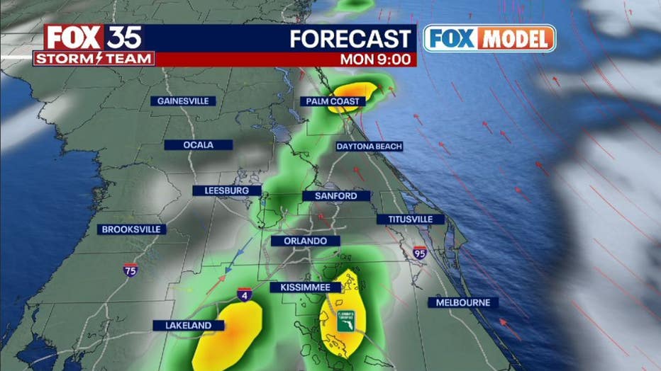
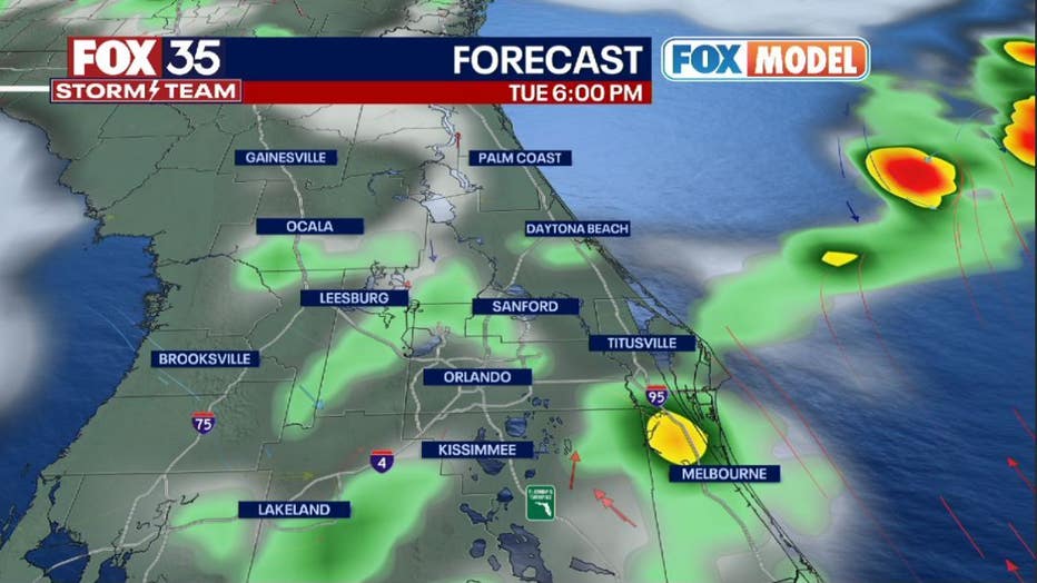
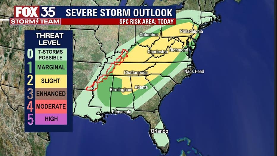
According to our FOX rainfall models, showers could persist into the overnight hours over the eastern third of the viewing area. A similar temperature and rainfall pattern should persist through midweek as a front advances through the southern states. Energy along this front will be rather robust and the threat of severe storms across the eastern U.S. will be on the rise again this afternoon.
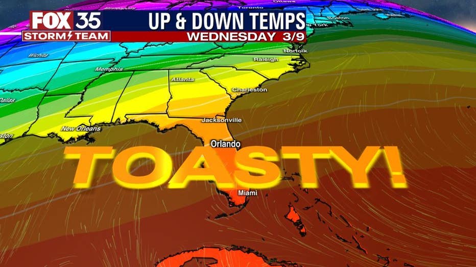
In advance of this front, temperatures will continue rising all week long. Friday will come real close to the 90-degree mark but the incoming weekend front will change all of that!
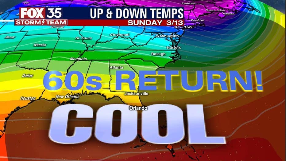
Showers and storms are looking like a good bet on Saturday with a huge cool down by Sunday. A return to the cool 60s is in the cards for Sunday with lows come Sunday morning in the 40s!