

FOX 35 Weather Alert Weekend: Hour-by-hour timeline of storms arrival in Central Florida

Weather Forecast: February 13, 2021
FOX 35 meteorologist Allison Gargaro has a look at your forecast.
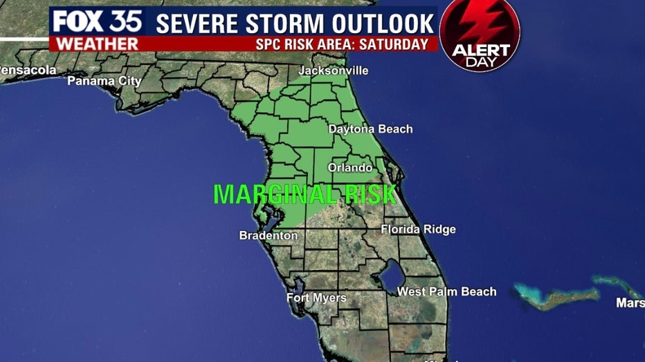
ORLANDO, Fla. - There is a marginal risk for storms and severe weather all day on Saturday and Sunday.
That is why we are declaring both days as FOX 35 Weather Alert Days.

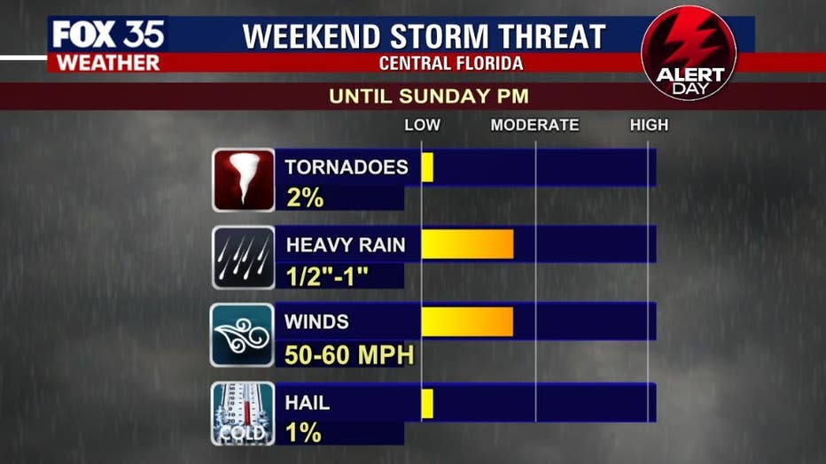
"There is a Marginal risk for severe storms to form later this afternoon," FOX 35 meteorologist Allison Gargaro said. "The biggest threat will be gusty winds, heavy rain at times and lightning.
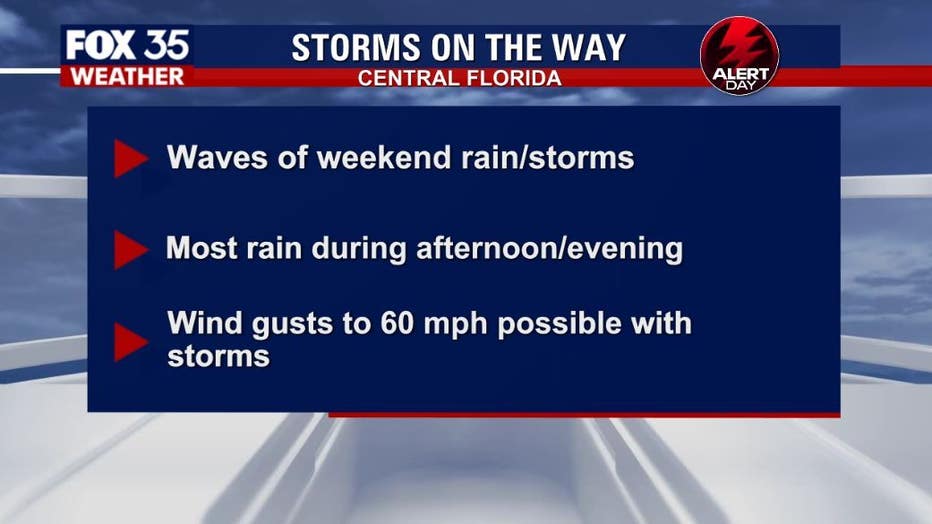
Here is the timeline of the storms through the weekend:
- The first round of showers and storms bringing gusty winds, heavy rain and lightning strikes will push offshore by 1 p.m. this afternoon.
- Another round of storms look to impact North Central Florida around dinnertime.
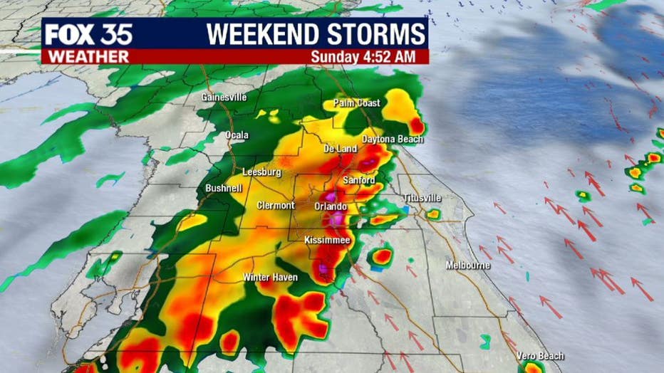
- The next big round of heavy rain arrives across the peninsula after 2 a.m. Sunday continuing through the morning hours.
- Then, scatted showers and storms begin at 1 p.m. until at least 6 p.m. Sunday.
We will be monitoring conditions closely for the big race Sunday afternoon. As of now, the main threat for severe weather will be damaging wind gusts of 50 to 60 mph.
The rain will calm down a bit, but there are several lines of storms that will move through as the day goes on.
The Storm Prediction Center has put a portion of the viewing area under a "Marginal Risk" of severe weather on Saturday that will carry over into Sunday.

WEATHER ALERTS: Download the FOX 35 Weather App to track the tropics on your phone, receive severe weather alerts, and get the latest daily forecasts
On Sunday, expect mostly cloudy skies, with a high near 76 degrees at the Daytona International Speedway.
Showers and thunderstorms will get an early start, firing up after 8 a.m. The chance for rain will remain elevated at 70% through the afternoon.
Watch FOX 35 for the latest weather updates.