

Forecasters warn of severe weather impacting southern states

ORLANDO, Fla. - Another round of severe weather is possible across the midsection of the U.S. on Wednesday.
A strong low pressure system with a trailing cold front is moving east bringing an increased threat for damaging wind gusts and tornadoes. The Storm Prediction Center has outlined a 4/5 "Significant" threat for severe storms in cities including, but not limited to Memphis, TN, Baton Rouge, LA, Montgomery, AL, Mobile, AL and Jackson, MS.
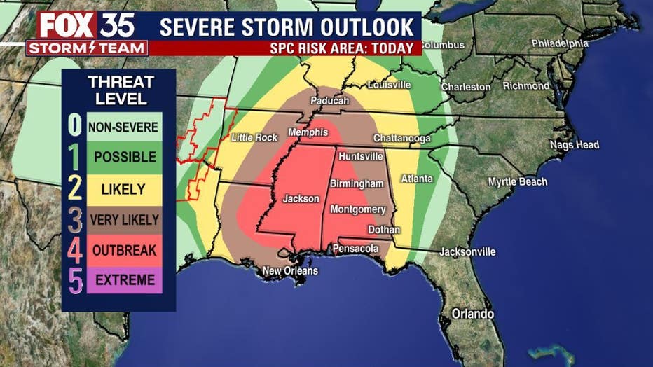
The main weather concerns for folks in this area are widespread damaging winds with gusts over 75 mph and several strong tornadoes (EF2+).
RELATED: Strong storms possible across parts of Florida this week
Severe storms are also possible in many other cities including Nashville, TN, New Orleans, LA and Birmingham, AL (3/5 "Very Likely" threat); Atlanta, GA, St. Louis, MO, Louisville, KY (2/5 "Likely" threat); Indianapolis, IN, Cincinnati, OH and Tallahassee, FL (1/5 "Possible" threat).
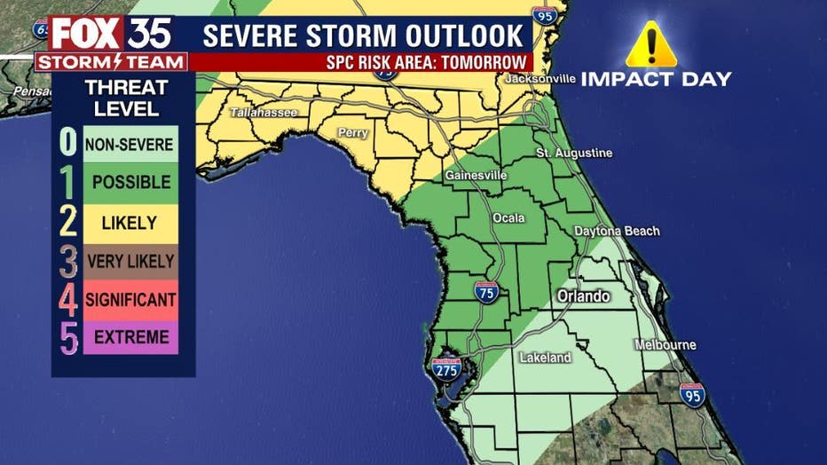
The FOX 35 Storm Team is looking ahead to Thursday, when this line of thunderstorms moves toward central Florida. Thursday is a FOX 35 Impact Day. North Central Florida has a 1/5 "Possible" threat for heavy rain, lightning and damaging wind gusts.
To track these severe weather across the U.S., download the FOX 35 Storm Team Weather app to use the interactive radar.
Orlando Weather: Storm alerts, live interactive radar, forecast, and more
Click here for the latest Central Florida news, Florida stories, and local headlines.