

Daytona 500 Weather Forecast: Could it rain on race day?
Watch FOX 35 Live
The Great American race is right around the corner here on FOX 35, and that means over 100,000 people traveling to Daytona International Speedway for the biggest event of the year in motorsports. The 66th running of the 500 is poised to be the grandest of them yet.
Unfortunately, no race in NASCAR has seen more impact from inclement weather in the past few years than Daytona. Three of the last 10 races in February got hit with bad weather, in 2014, 2020, and 2021 -- including 4 others for the summer race.
In 2009 the race was shortened due to rain. In 2014 and 2021 the race was delayed due to rain and track drying. In 2012 and 2020 the 500 was postponed due due weather.
What is the weather forecast for the Daytona 500?
We remain in an El Niño winter, which means more rain chances, storms, and significant temperature swings in the state of Florida. We have already seen that this winter. In fact, the winter of 2023-2024 to date in central Florida is the cloudiest on record since 1940.
A front will come through next Monday (Feb. 12th) overnight into Tuesday (Feb. 13th) -- but will lose most of its power before getting to central Florida. Just a few showers overnight are expected.
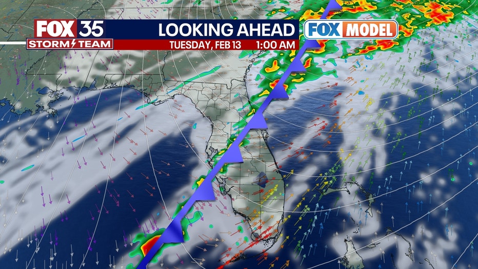
A few dry days return for race prep, qualifying, and duels Tuesday through Friday of next week. Crisp days with low humidity and mostly sunny weather.
Then all eyes turn to the Gulf. Models for weeks now have consistently hinted at low pressure developing and tracking either over or near the FL Peninsula sometime between the 17th and 19th of February. The race is Sunday the 18th.
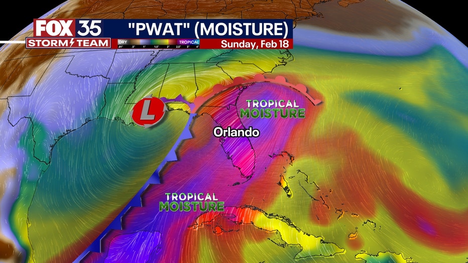
Currently, all models show rain falling within that window, potentially heavy. I think this is correct and should happen. Questions remain though at this range with the timing and placement of said rain, storms, and winds.
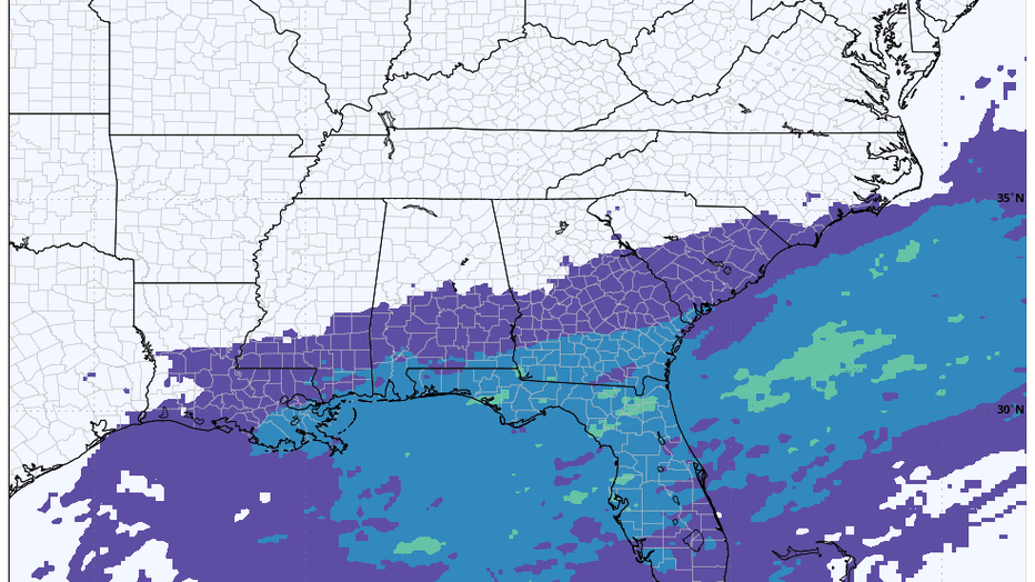
The GFS model, shown below, takes the majority of the moisture into northern Florida, Georgia, and Alabama. Still has some rain Sunday the 18th, but much more optimistic scenario clearing the rain by late morning Sunday.

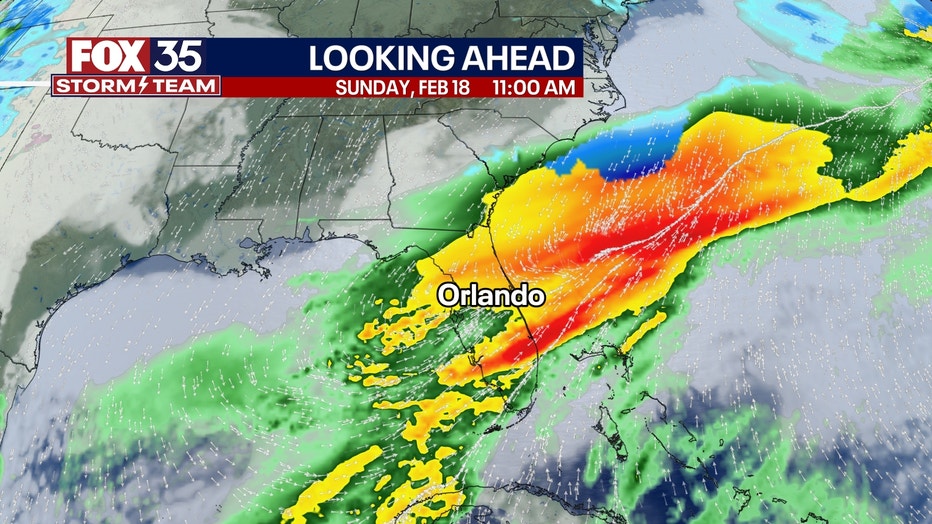
The European model, shown below, takes several waves of tropical-like showers, downpours, and storms across the state Saturday into most of Sunday.
This scenario probably brings rain most of the day on the 18th, potentially yielding the race being postponed to Monday, or starting very late in the evening, becoming a night race Sunday.
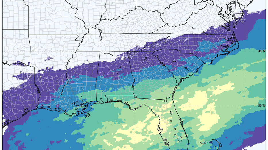
Here is a probabilistic viewpoint of the forecast. The image below is a blend of 50 different versions of the European computer model.
This is called an "ensemble" -- and the mean of them all is used when forecasting longer ranges to get a more realistic and honest view of potential weather.
This map shows the probability (as of today) for there to be 0.5" of rain or more just on February 18th (the day of the race) -- and notice the chances.
The yellow indicates a 50% chance. And the lightest green 40% chance. Both encompass all of Florida. So at this point, there is a 40-50% chance of more than 1/2" of rain that day.
The image below shows the chances, just as described above, for 1" or more of rain. Only about 20% as of now.
So what is the bottom line?
A lot of tropical moisture will likely pass across Florida at some point between Saturday, Feb. 17th, and Monday, Feb. 19th. And could have some decent, soaking rains with it. Possibly strong thunderstorms too.
Whether it all comes Saturday night, Sunday, or Monday remains uncertain. Let's hope it comes Saturday or Monday so the race can go on as planned.
However, it appears more likely than not to me that at some point that weekend, we will have to contend with a lot of rain and/or storm chances across Florida. We'll cross our fingers.