

Wet evening throughout Central Florida, hail reported in some areas

Weather Forecast: May 21, 2022
FOX 35 meteorologist Brittany Lockley has a look at your daily forecast and a look at the week/days ahead.
LAKE MARY, Fla. - WHAT IS THE WEATHER FORECAST FOR TODAY AROUND ORLANDO?
Tonight’s forecast low: 71 degrees
Tomorrow's forecast high: 91 degrees
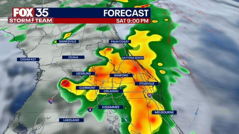
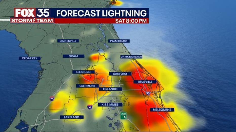
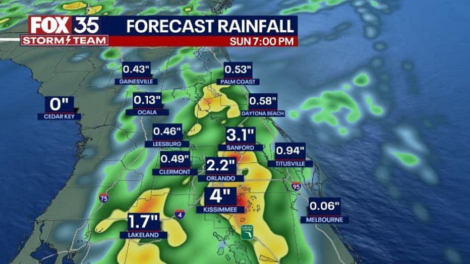
Main weather concerns: Today is a FOX 35 Weather impact day! A surge of tropical moisture has arrived in Central Florida, increasing our chances of rain once again this afternoon and evening. The strongest storms are expected between 5 pm and 10 pm. The primary threats with these storms will be gusty wind, torrential rainfall, and hail. Flash flooding is also possibility! Rainfall totals will reach 1-4" across Central Florida with isolated totals even higher.

Hail in Sanford. Credit: Jennifer Wofford & Robert Biddle

WHAT IS THE WEATHER FORECAST FOR WALT DISNEY WORLD, UNIVERSAL, AND SEAWORLD?
Sunday, rain chances dwindle down and temperatures will climb back into the low 90s. By the afternoon there is a possibility of a stray show/ thunderstorm. Make sure to stay hydrated in the parks and apply plenty of sunscreen.
WHAT IS THE WEATHER FORECAST FOR THE BEACHES IN CENTRAL FLORIDA?
Sunday will not be the best beach day. There will be mostly cloudy skies until 4pm with a possibility of a stray shower. Temperatures at the beaches will be in the mid 80s. Surf will be around 2 ft with a moderate rip current risk. Winds will be out of the southeast at 5-10 mph.


LOOKING AHEAD: Rain chances stick around for Sunday but start to ease up as we head into next week. Low rain chances around 30% and temperatures in around 90 will be the forecast almost every day. . For the latest, make sure to download the FOX 35 Storm Team App.