

Warmer weather for Florida as cold fronts take a break!
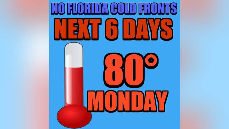
ORLANDO, Fl - Are your toes numb? Tired of lugging around a heavy jacket? Ready to get our "Florida back"? No denying it, temperatures have been a bit on the cool side here in Central Florida. Highs in the upper 50s despite full sunshine and overnight lows falling into the 30s & 40s takes a toll on Winter weary Floridians. Well, the next several days will offer up a substatial rise in area temps for both day and night, thank a temporary lack of cold fronts for that! High pressure will build in off the Atlantic through the rest of this week, altering the wind direction across the Florida Peninsula. Naturally, with breezes coming in off the ocean, temperatures will respond in upwards direction, each day gaining ground through Sunday. The weekend will serve up some upper 70s for most by Sunday and early next week brings lower 80s spreading out all the way to the beaches on Southwest breezes.
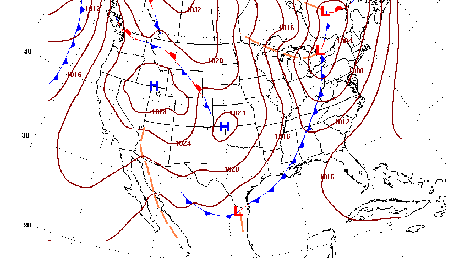
So, maybe you're asking, when will see the next cold front? Longer term forecasts like the one above, show the approach of a cooling system by Wednesday of next week. If high pressure breaks down, I would fully expect to see this approaching front to get shoved through Central Florida, showers developing ahead of it, cooling likely behind. How cool remains to be seen, so until then, enjoy the extra warmth on the way in the coming days!