

Tracking the Tropics: FOX 35 meteorologists monitor 2 'areas to watch'

Tracking the Tropics: July 20, 2020
FOX 35 Chief Meteorologist Glenn Richards has the latest tropical activity in the Atlantic Ocean and the Gulf of Mexico.
LAKE MARY, Fla. - We continue tracking the tropics for you here at FOX 35!
It's been very quiet in the tropics lately, but we now have a couple of features to keep our eyes on.
The first area is pretty close to home and over the Central Bahamas.
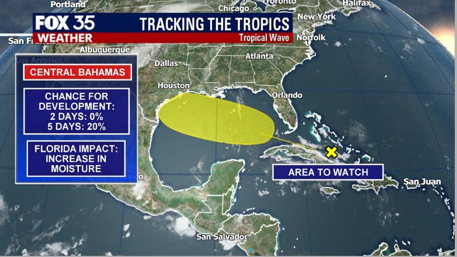
This week, an easterly wave will continue moving in a northwest direction, passing south of Florida through midweek.
It will be close enough to enhance Florida's rain chances by Tuesday across the state, especially down in South Florida.
The five-day developmental outlook on this feature from The National Hurricane Center (NHC) stands at 20 percent and by that time, the wave will be well west of Florida and closer to Texas.
A second easterly wave is located way out in the tropical Atlantic.
This system has a lot to contend with and these factors will hinder development in the long run.
The five-day outlook from the NHC is 20 percent at five days and after that, the wave will struggle to get its act together.
On the current path, this wave is expected to bring rain and breezy winds to the Windward Islands as it draws closer to the eastern Caribbean.
The Saharan air layer is still firmly in place across the tropical Atlantic.
Another large area of dust will move off west Africa through early this week.
A general track to the west is expected with this next surge as we head into later this week.
Longer-range models bring this area of dust closer to the U.S. by next weekend.