

Slight tornado threat, hail, thunderstorms possible for North Central Florida

Weather Forecast: April 14, 2020
FOX 35 meteorologist Kristin Giannas has your Central Florida forecast.
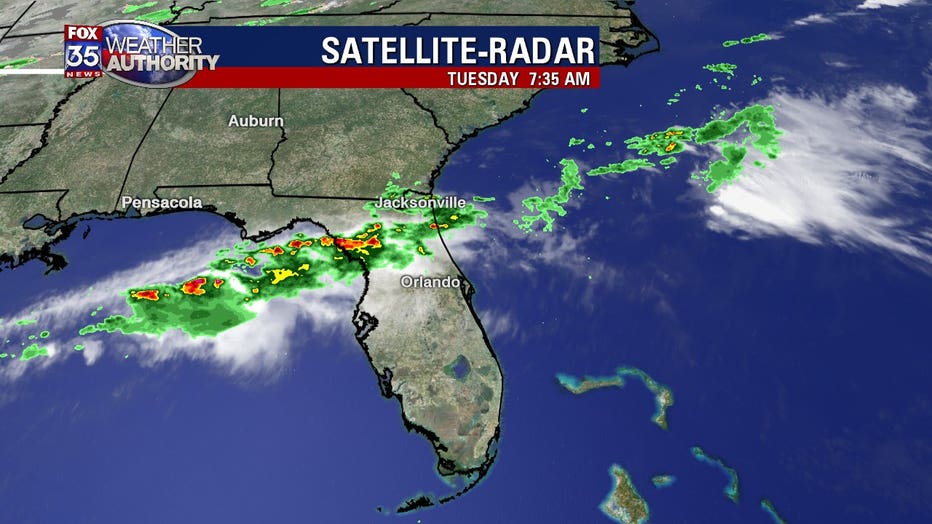
ORLANDO, Fla. - A line of strong thunderstorms will continue to push into North Central Florida from the Gulf of Mexico on Tuesday.
The main hazards will be locally heavy rainfall, gusty winds in excess of 40 mph, and small hail.
With that said, Tuesday is declared a FOX 51 Severe Weather Alert Day.
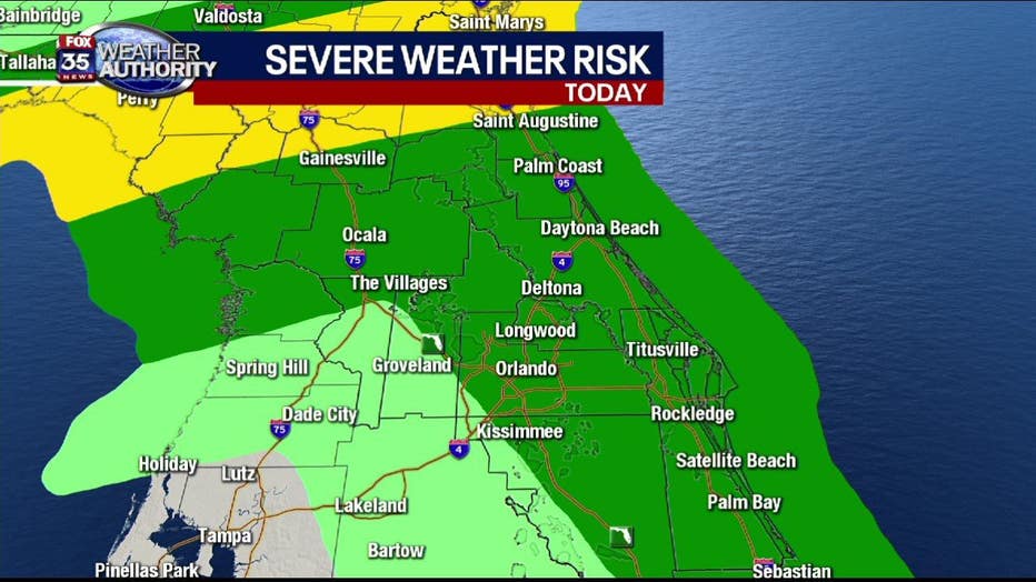
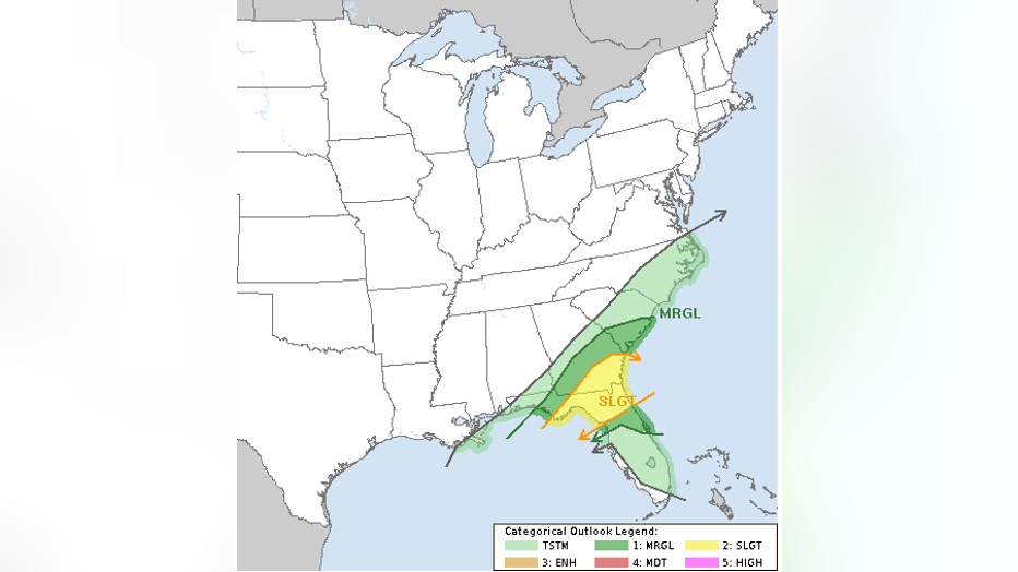
SPC has moved the “slight” line further north. Marginal risk for severe weather for most of the viewing area. NORTHERN Alachua county (still in the yellow or “slight” category... there’s a (15%) chance of damaging winds (wind gusts of 50mph or higher) and (15%) chance of hail (one inch diameter or larger).
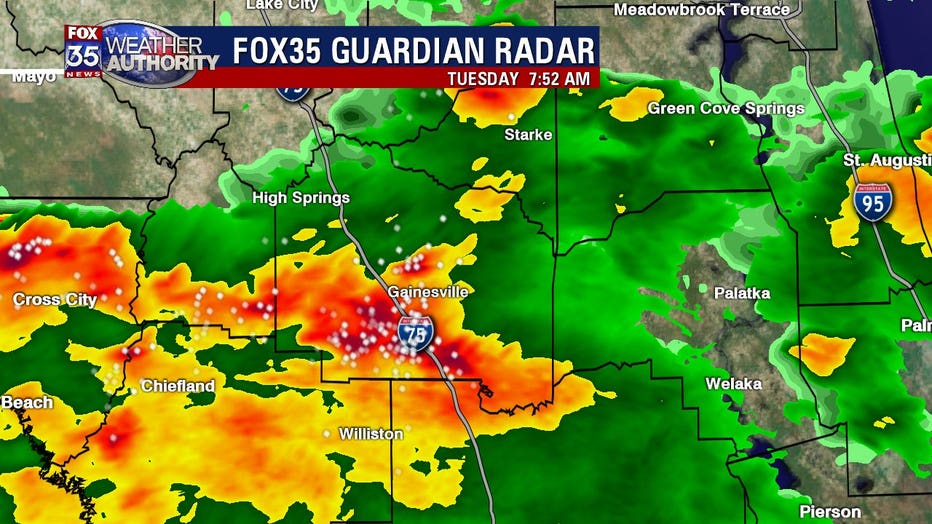
Isolated severe storms are possible throughout the day, as a frontal boundary remains stalled over the state.
The Storm Prediction Center has Alachua county and northern Marion county under a "slight" risk of severe weather.
The tornado threat is low (2%) but there's a better probability of damaging wind gusts (15%) and hail (15%).
For Central Florida, it's a hazy and rain-free start, with wake-up temperatures in the 70s.
Afternooon highs will top off in the upper-80s, low 90s, with winds out of the south-southwest at 5-15 mph.
There's a 30% chance of showers and thunderstorms in Orlando, mainly after 5:00 PM.
Be sure to download the FOX 35 Weather App to receive these updates on your phone.