

Orlando weather: Back-to-school forecast brings high heat and lower rain chances
ORLANDO, Fla. - Scattered storms are spreading across Central Florida on Sunday, as an area of tropical moisture moves away.
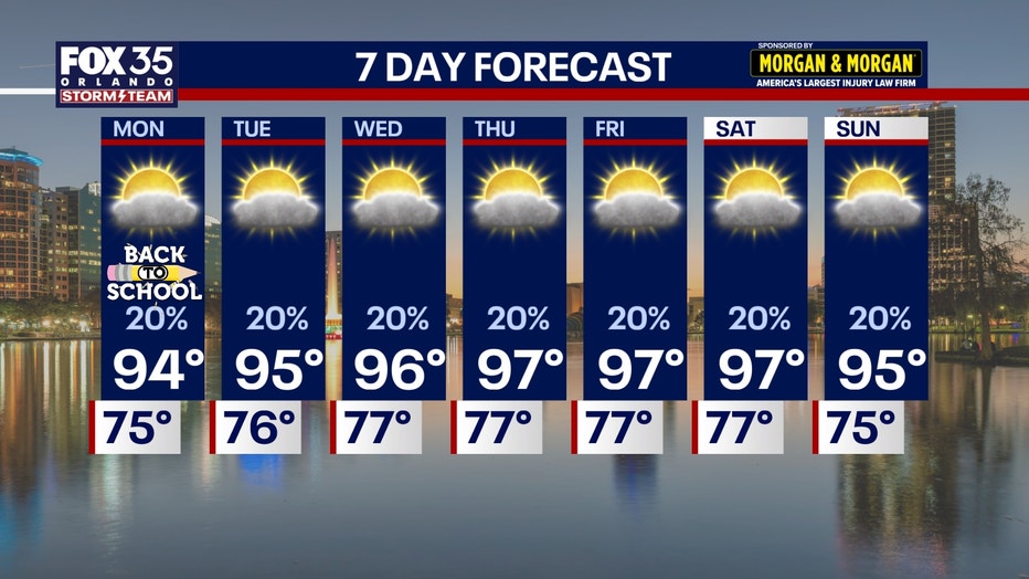
Temperatures climbing into the mid-90s are expected as students head back-to-school.
What we know:
Scattered storms will continue to pop up and work westward through the remainder of the afternoon. Some storms could be on the stronger side, but should be calm by sunset.
The main threats are: heavy rain, gusty winds and frequent lightning.
Back-to-School forecast
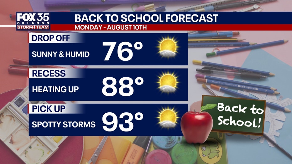
As students head back to school, morning drop off and afternoon pick-up should be pretty smooth weather wise!
Our chances of rain will be very spotty for the first week, though the rain jacket won't be necessary.
Meteorologist Tip: Bring a water bottle to school and drink plenty of water to stay cool
Rain chances going down
After this wave of tropical moisture moves out, our chances of rain will become much more scattered as we start off the week.
We'll still experience hit-or-miss showers and storms during the afternoon and evenings with the help of the sea breezes, but overall, we'll see less coverage.
By Tuesday, high pressure will take hold and that will lower our rain chances even more with that pattern holding into next weekend.
High temperatures return next week
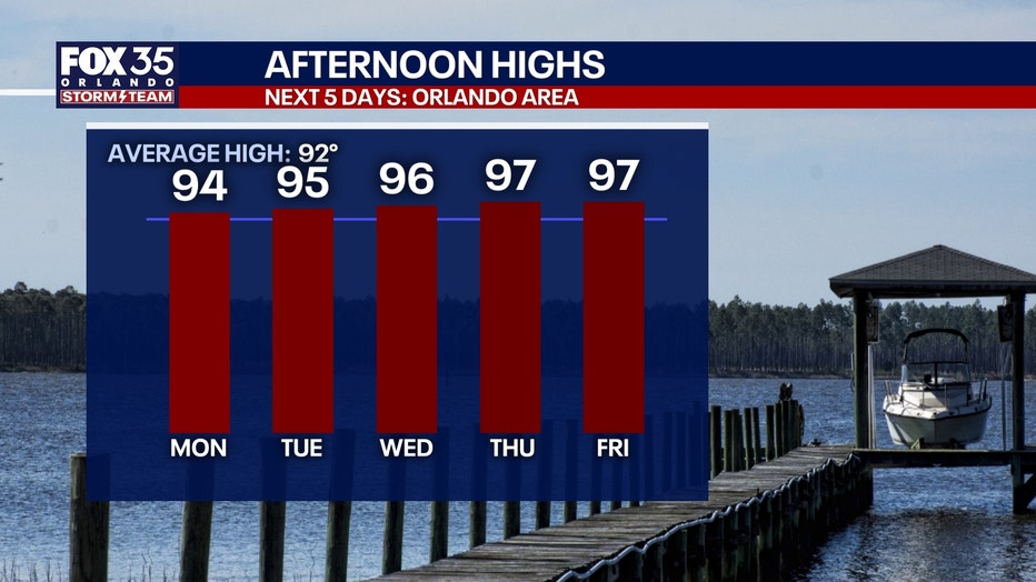
With this ridge of high pressure building, temperatures will once again be in the mid and upper 90s.
Our average for this time of year is 92 degrees, and we'll likely be a few degrees above that.
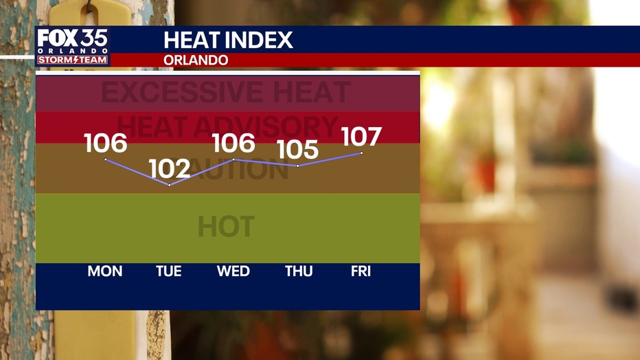
Highs jump from the lower 90s this weekend and early next week to the mid-90s Tuesday. By late week, it's looking like we'll be able to rise into the upper 90s, but either way, the humidity will make it feel like the lower to mid-100s.
Meteorologist Tip: Make sure you are drinking plenty of water, especially now that sports are back in season. Listen to your body and take it easy with the brutal heat.
Tracking the tropics
The chances for development have grown since Saturday night. This is the part of the season where we see the Saharan dust in the atmosphere go down and waves of tropical moisture off the west coast of Africa due to their monsoon season start to work their way into the Atlantic.
Right now, FOX 35 is monitoring two waves:
- Wave 1: Eastern Atlantic - 20% chance of development
- Wave 2: Eastern Atlantic - 50% chance of development
We will have to watch for developments, especially mid to late in the week. Models suggest that there is a chance of a depression or Tropical Cristobal with either wave, but current steering should keep it away from the U.S.
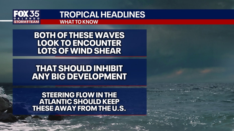
Both waves will encounter a lot of shear that will limit development. Something that we will have to watch closely.
Impacts to Florida
Both systems don't look to impact Florida. The strong ridge of high pressure in the Atlantic should help steer this system out into the open Atlantic and keep it away from any major landmass.
The Source: Information in this story was gathered from FOX 35's Laurel Blanchard.