

Orlando weather: Hot Saturday with spotty storms possible this afternoon
Orlando PM Weather: Humidity and PM Storms are Back
The afternoon and evening storms are back. Temperatures will still stay warm but the humidity will make it feel even warmer! We will see more widespread storms to round out the weekend.
ORLANDO, Fla. - Hot temperatures and spotty shower and storm chances are on the way for our Saturday across Central Florida. Highs today will be just a degree or two above normal, climbing into the mid 80s along the coast and into the low 90s inland.
A 30% chance of isolated showers and storms are expected, mainly this afternoon. A few isolated downpours can't be ruled out this morning, especially near the coast.
Higher chances will begin at around 1:00 p.m. - 2:00 p.m. , with chances peaking between 4:00 p.m. and 8:00 p.m.
Areas near the I-75 corridor will have the best chances of seeing rain and storms. However, a few quick downpours can't be ruled out closer to the I-4 corridor. Any lingering showers will fade after sunset this evening.
What will the weather look like tonight?
What to Expect:
Mild, mostly dry, and slightly more humid tonight. Sunday morning lows will fall into the upper 60s and low 70s.
Looking ahead
What to Expect:
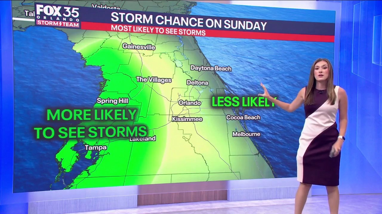
Higher chances of showers and storms will develop Sunday across Central Florida. A 60% chance of afternoon and evening scattered rain and thunderstorms will be possible tomorrow, but don't plan for a washout.
Heavy rain, downpours, and lightning will be possible starting at around 1-2pm and will last through around 8pm, before eventually fading into the late evening hours.
Temperatures will hold steady next week a degree or two either side of 90. It appears that next week could begin what looks to be a start to the rainy season and a more summer-like pattern.
Sea-breeze driven daily downpours and storms will be possible just about every afternoon next week.
The Source: This story was written based on information provided by FOX 35 storm team meteorologist Jessica Dobson on May 16, 2026.