Orlando weather: Front over Central Florida brings stormy weekend

Orlando Weather Forecast: September 16, 2023
FOX 35 Meteorologist Ian Cassette has a look at the weekend forecast in Orlando and Central Florida.
Today's high: 88 degrees
Tonight's low: 75 degrees
Main weather concerns:
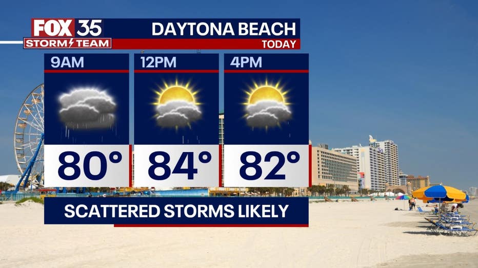
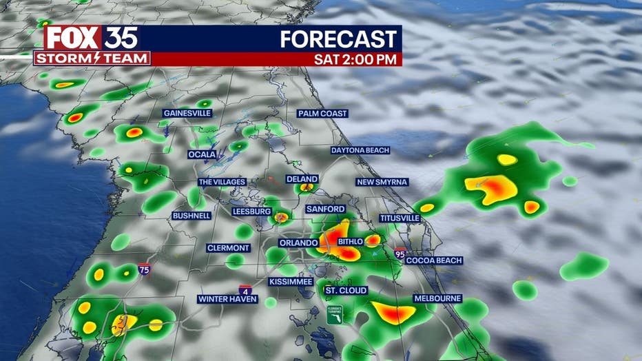
It looks to be a stormy weekend with numerous showers and storms expected both Saturday and Sunday. A front has stalled out over Central Florida and will lead to good chances of rain along the coast and inland into the afternoon. While severe weather is unlikely, heavy downpours, frequent lightning and localized flooding is possible. The most likely area to see flooding issues will be in coastal areas of Volusia and Brevard County. Thanks to clouds and rain, highs will mostly only warm into the mid 80s this weekend.
BEACHES:
Despite surf lowering some to 4–6 feet this weekend, a high rip current risk will continue. Swimming is discouraged, even for the most capable swimmers. In addition to the rip current risk, storms will be likely along the coast today beginning in the morning and continuing into the afternoon. The strongest storms may put down 1-2" of storm, bring gusty winds, and frequent lightning.
THEME PARKS:
A humid day at the parks with highs warming to near 88. Scattered showers and storms will be possible by the early afternoon (by 12 pm). When thunder roars, go indoors!

OUTLOOK:
Likely storm chances will continue Sunday with the stalled front still nearby. A system in the Southeast will push this front north on Sunday and increase our rain chances again with higher levels of humidity. A front will push through Florida by Monday and will briefly lower rain chances to begin the week. Looking ahead, an upper level low could bring more unsettled weather to end the week (along with cooler temperatures). Rain chances will increase to end the week and last into next weekend. Highs will go from the upper 80s to mid 80s.
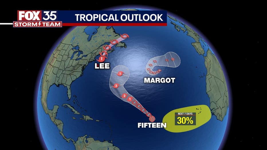
TRACKING THE TROPICS:
The tropics remain busy here in mid-September. Lee is now a Post-Tropical Cyclone and is forecast to made landfall in Nova Scotia Saturday. Dangerous surf will continue along the Atlantic coastline through this weekend thanks to Lee. Tropical Storm Margot remains out to sea and will not impact any landmass. Tropical Depression Fifteen developed Friday and is forecast to become our next named storm before the end of the weekend. Its name will be Nigel (Ny-gel). Elsewhere, another tropical wave off the west coast of Africa has a 30% of development over the next 7 days.