

Orlando weather: Afternoon heat, humidity and storms
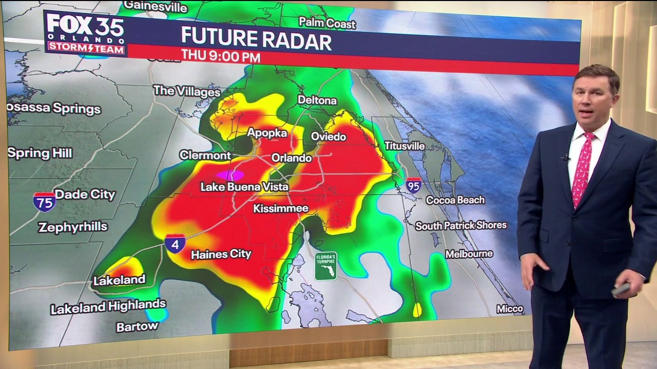
Orlando Thursday AM Weather Forecast: Hot and Stormy Afternoon
An upper level low will help enhance our afternoon and evening storm chances and intensity, after another day of unusually high heat and humidity
Central Florida could see some strong and severe widespread storms in addition to afternoon heat.
As of Thursday, Central Florida has had 11 days in a row with heat advisories – making this the most consecutive days that the National Weather Service Melbourne office has issued heat advisories on record. This record beats 10 consecutive days, set back in 2023.
What we know:
Be prepared for another hot day with feels like temperatures between 108 and 112 across Central Florida.
But with all this heat humidity and a very weak upper level low moving over Central Florida, it will amp up the storm energy for this afternoon.
Hot and stormy afternoon
A 70% chance of scattered downpours and storms. Storms will begin to develop and pop up on the radar at around noon, with the highest chances of downpours and storms taking place from 2 p.m. to 8 p.m.
As per severe threats, Northern Alachua County, Flagler, Levy, Dixie and Gilcrest counties are in a level one out of five chance for severe weather today, but as we saw yesterday, severe thunderstorms can happen anywhere, especially in the weather pattern that we’re in.
The main threats region wide today are torrential rain, vivid lightning, damaging winds, and the potential for hail with the stronger storms.
Downpours bring a small dip in temperatures
What's next:
There is relief from the heat coming soon as temperatures go from the upper 90s back down to average temperatures in the low 90s, but the sea breeze storms will be back for the weekend.
As opposed to feels-like temperatures feeling like 108 and above, temperatures will feel right around 100° heading into the weekend and into the start of next week.
As we round out the work week on Friday and head into the weekend, there will be a 50–60% chance of storms. While it won't be a washout, plan for afternoon downpours with storms bringing frequent lightning and isolated gusty winds.
Tracking the tropics
There is no tropical activity expected over the next seven days.
However, looking ahead towards the next two and three weeks, it does seem like the tropics could be waking up. The Saharan dust was slowly start to fade, but the shear will stay around for the rest of the season.
Sixty-six percent of all tropical activity happens between now through the end of September. And September 10 is the peak of hurricane season.
It's important to never let your guard down just because the Atlantic is quiet for now.
Don't wait until there's a storm brewing. Take this opportunity to check your hurricane plans and supply kit are ready to go.
The Source: Information in this story was gathered by FOX 35's Laurel Blanchard.