

TIMELINE: When to expect storms in your area on Saturday
ORLANDO, Fla. - Happy Saturday East Central Florida.
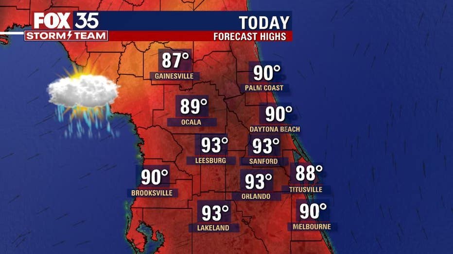
We have another hot and humid weekend ahead. Afternoon highs today and tomorrow will reach the low-90s across the interior, and the upper-80s along the coast.

Heat index values up to 104 degrees are expected, as well. If you are planning on heading out to the beach or the theme parks, don't forget to pack plenty of water and reapply sunscreen.
RELATED: NHC: Tropical depression may form in coming days as 3 waves move across Atlantic
The chance for storms increases after 3 p.m. today. The west coast sea breeze will dominate, meaning the sea breeze collision will be over our region, just like Friday night.
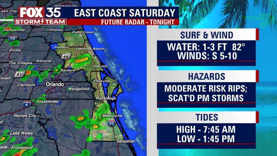
You can expect brief heavy rain, 1-3" in a short amount of time, frequent lightning and wind gusts up to 50 mph tonight. Evening storm chances remain high on Sunday as well.
WEATHER ALERTS: Download the FOX 35 Storm Team Weather app for live radar, severe weather alerts, and daily forecast reports on your phone
Stay weather aware and download the FOX 35 Storm Team weather app to use the interactive radar feature to track storms in your area.
Watch FOX 35 News for the latest weather updates.