

Storms chances thin out as dry air settles over Central Florida this weekend

Orlando Weather Forecast: Sept. 21, 2023
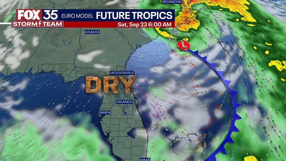
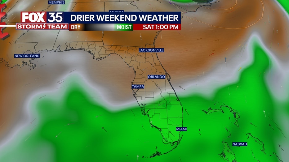
Rain chances continue into Friday, but some drying will occur over the weekend as Potential Tropical Cyclone 16 develops off Florida's Atlantic Coast.
ORLANDO, Fla. - Tonight's low: 72 degrees | Tomorrow's high: 88 degrees
Main weather concerns:
Rain chances continue into Friday, but some drying will occur over the weekend as Potential Tropical Cyclone 16 develops off Florida's Atlantic Coast. Rain eases this evening, and quiet skies overnight. Highs head for the mid-upper 80s across the region today, and lows tonight will settle in the 70s. Partly cloudy skies late.
BEACHES:
Sun and clouds will dominate coastal skies for much of the day. Rain chances will be possible before 12 pm with increasing coverage after 3pm at 60%. There's also a moderate risk of rip currents. Surf is in the 2-3' range as a disorganized NE wind swell pulses through the local surf zones.
THEME PARKS:
Expect mixed skies and warm 80s at the attractions today. Rain chances will be possible before 12pm, looking rather slight. The afternoon brings higher coverage, up to 60%. Heavy rain and lightning will be the primary threats.
OUTLOOK:
A low pressure develops East of Florida through Friday. Florida remains on the West side of the low and this means impacts primarily in the coastal areas. Gusty Northerly winds (around 30 mph) and perhaps some rain could be in play there. The window for these impacts appears to be somewhat limited on Friday.
Winds will ease on Saturday as the low moves North-Northeast and closer to the Carolinas. Both rising seas and surf locally looks likely. Coastal flooding could also materialize North of Cape Canaveral if breezes angle a bit Northeast.
TRACKING THE TROPICS:
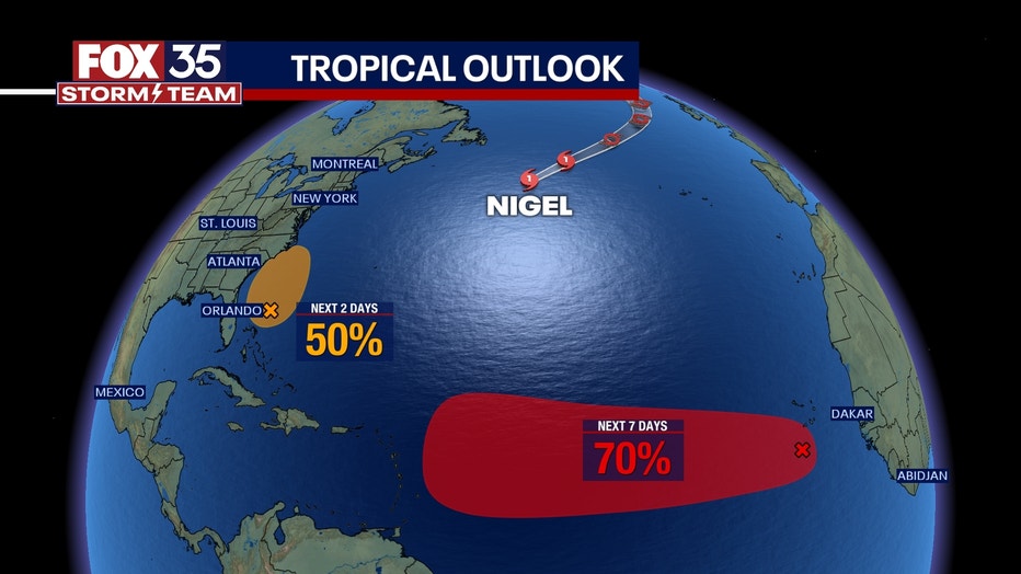
Hurricane Nigel remains a Category 1 hurricane. Nigel will likely remain out at sea with no impact on land. Elsewhere, another tropical wave off the west coast of Africa has a 70% of development over the next 7 days. If this becomes a named storm, it will be Ophelia.
An area of non-tropical low pressure is forecast to form off the east coast of Florida/ SE U.S. later this week. This system could acquire some subtropical characteristics this weekend if it remains offshore and draws closer to the Carolinas over the weekend. Coastal impacts will be brief across the Central Florida coastal waters. Gusty North winds are expected during the day Friday with rough seas and increasing wave energy in the local surf zones.