

Storms to roll through Central Florida: Timeline and potential impact

Cold front possibly coming to Florida
FOX 35 Storm Team Meteorologist Allison Gargaro has the forecast
ORLANDO, Fla. - Happy weekend Central Florida!
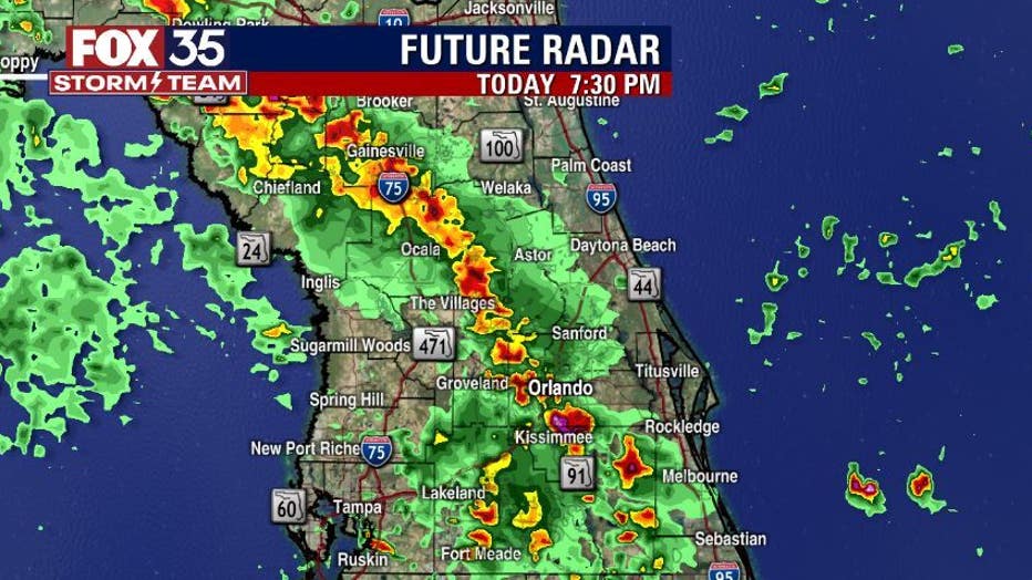
We start the last weekend of summer on a cloudy note. We will see a mix of sun and clouds through the mid-morning hours before showers and storms arrive after 2 p.m.
The east coast and west coast sea breeze will collide across the center of the peninsula, bringing heavy downpours, up to 2"-4", frequent lighting and gusty winds.
WEATHER ALERTS: Download the FOX 35 Storm Team Weather app for live radar, severe weather alerts, and daily forecast reports on your phone
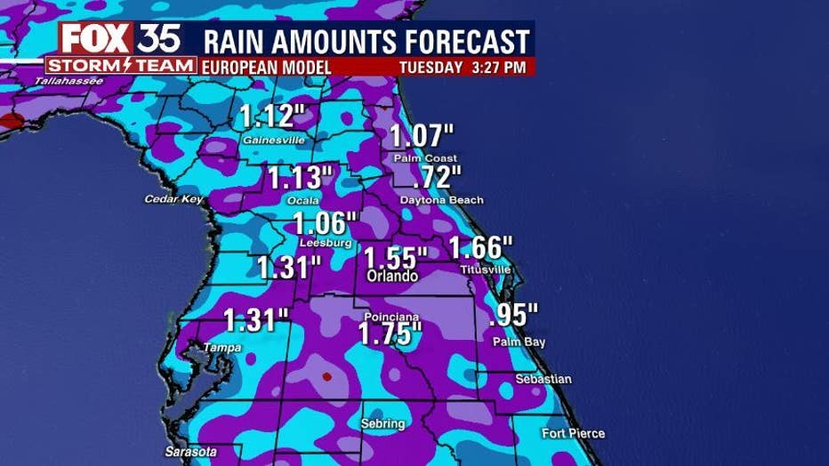
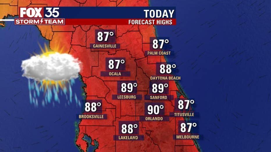
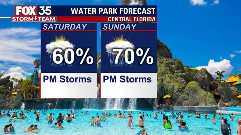
There is a tropical influence across the region, which will keep rain chances high through the remainder of the weekend. Due to the clouds and storms, afternoon highs will stay in the upper-80s across most of the region. It will be a humid weekend, feels-like temperatures as high as 102 degrees.
Stay hydrated and reapply sunscreen because the UV Index is very high.
Watch FOX 35 News for the latest weather updates.