

Storms target northern Gulf as Dolly’s remnants approach Puerto Rico, Virgin Islands: Impacts to Florida?
Orlando Weather Forecast: Tracking storms
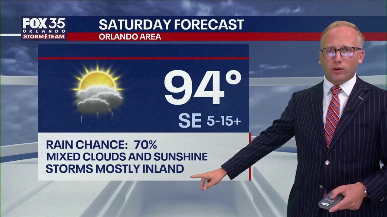
More storms are expected to move across Orlando and Central Florida this weekend. FOX 35's Noah Bergren takes a look at the forecast.
ORLANDO, Fla. - Two areas are drawing attention heading into the weekend: a stormy system over the northern Gulf and the remnants of Tropical Storm Dolly moving toward the northeastern Caribbean.
Forecasters are watching the remnants of Tropical Storm Dolly for possible redevelopment next week.
Tracking the Tropics
What To Expect:
In the Gulf, widespread showers and thunderstorms were developing Friday around an area of unsettled weather along the Gulf Coast. Meanwhile, Dolly’s remnants are expected to bring strong winds, thunderstorms and dangerous seas to the Leeward Islands, Virgin Islands and Puerto Rico.
Dolly’s remnants approach northeastern Caribbean
Farther east, the remnants of Tropical Storm Dolly continue moving west across the Atlantic toward the Caribbean.
Dolly is no longer a tropical storm, but its remnants are expected to produce strong winds, thunderstorms and very rough seas as they approach the Leeward Islands on Saturday.
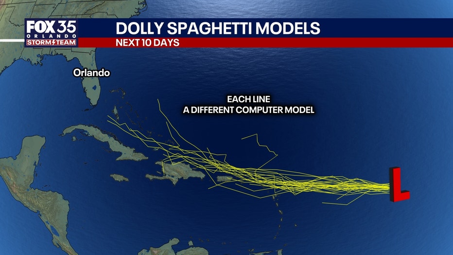
Those conditions are forecast to spread into the northeastern Caribbean, including the Virgin Islands and Puerto Rico, late this weekend into early next week.
The system is then expected to continue west toward Hispaniola early next week.
"We're going to need to keep tabs on the remnants of once-Tropical Storm Dolly next week," said FOX 35 Storm Team Meteorologist Noah Bergren.
Residents and visitors in Puerto Rico, the Virgin Islands and surrounding islands should continue monitoring forecasts as the system approaches.
Another system to bring storms to northern Gulf
Numerous showers and thunderstorms were affecting the northern Gulf on Friday, particularly areas north of the central Gulf.
The storms were associated with an area of unsettled weather extending across the region.
The National Hurricane Center expects the system to linger near the northern Gulf during the next several days, bringing periods of thunderstorms through the weekend and potentially into early next week.
While the system is not described as a tropical cyclone, individual thunderstorms could produce gusty winds and locally rough seas.
Outside of the thunderstorms, conditions across much of the Gulf are expected to remain relatively calm.
Will either impact Florida?
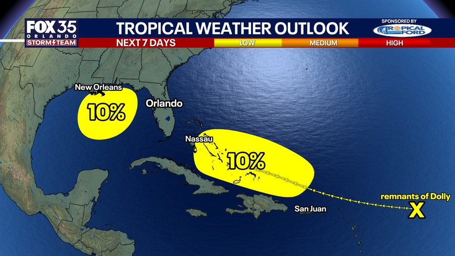
Which route the remnants of Dolly take will determine what impact it could have on Florida. If it heads north of Hispaniola, it could reorganize over the Bahamas.
"There is now a 10% chance of re-formation in the Bahamas mid-next week. Wind shear will be light and the water extremely warm, if the remnants can survive to that point," said Bergren.
The zone over the Gulf will most likely produce storms across coastal areas of Florida into the Big Bend area.
"I don't think is going to do anything at this point," Bergren added.
Other disturbances cross Atlantic, Caribbean
Forecasters are also tracking two other tropical disturbances.
One is moving west across the eastern Atlantic but is producing only limited shower activity.
Another is moving quickly west through the central Caribbean and is contributing to showers and thunderstorms around eastern Cuba and Jamaica.
Scattered showers and thunderstorms were also occurring over parts of the western Atlantic between Bermuda and the Bahamas.
For the weekend, however, the northern Gulf thunderstorms and Dolly’s remnants approaching the northeastern Caribbean are the two areas likely to have the most immediate impacts.
The Source: This story was written based on information shared by the National Hurricane Center and the FOX 35 Storm Team.