

TIMELINE: Saharan dust approaching Florida, bringing hazy skies and reduced air quality

Saharan dust coming to Florida
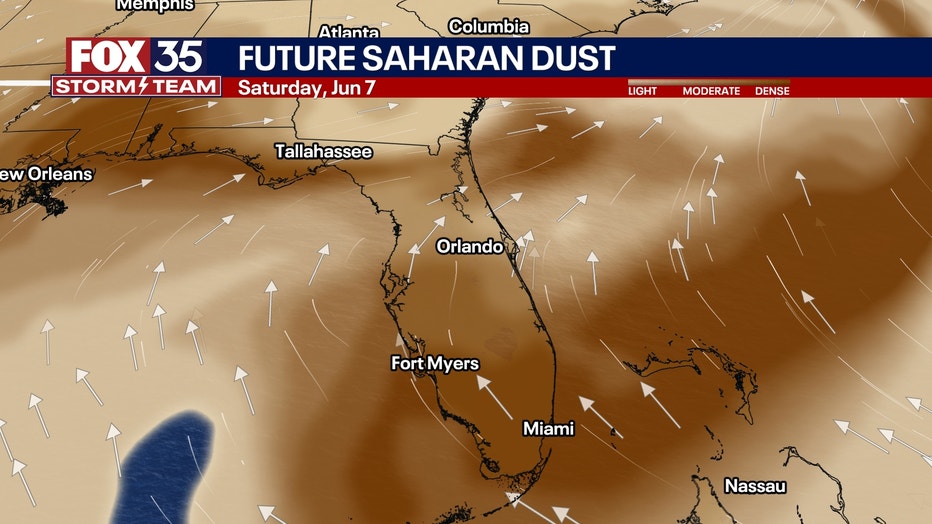
Saharan dust is sweeping off the coast of Africa and will be working into Central Florida this week.
Saharan dust is sweeping off the coast of Africa and is trekking toward Central Florida this week.
A thicker plume of dust will arrive by the end of the week – around Thursday and Friday, according to FOX 35 Storm Team Meteorologist Brooks Garner.
What is Saharan Dust?
What we know:
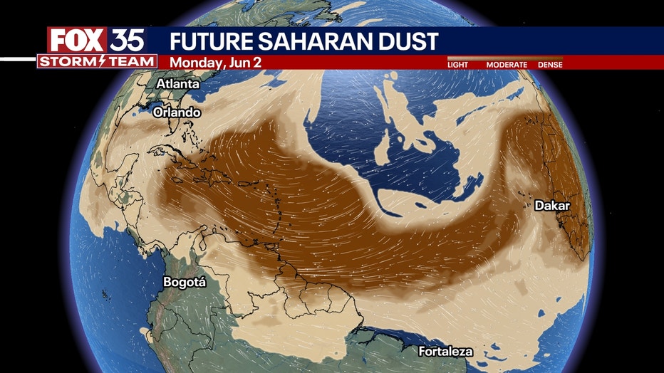
Every summer, strong winds blow massive clouds of dust off the Sahara Desert in Africa. This is called the Saharan Air Layer, or SAL. These dust clouds ride the wind across the Atlantic Ocean, sometimes traveling more than 5,000 miles all the way to Florida.
Local perspective:
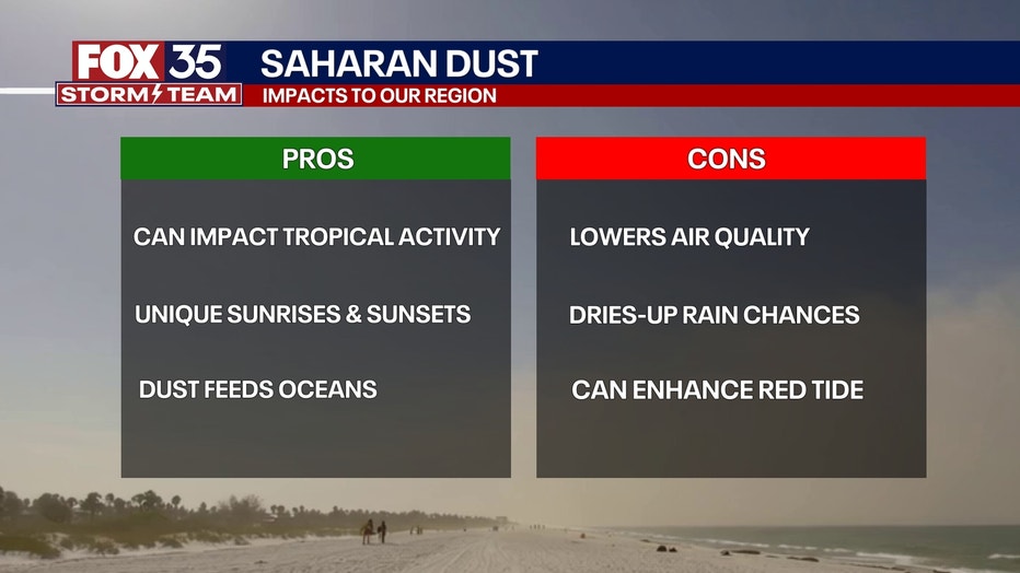
When the dust arrives, it can:
- Create hazy skies and reduce visibility
- Produce beautiful orange and pink sunrises/sunsets
- Lower air quality (especially tough for people with asthma or breathing issues)
How does it travel so far?
Dig deeper:
Powerful winds over the Sahara lift the dust high into the atmosphere—up to 15,000 feet or more! Then, strong trade winds carry it westward across the Atlantic like a sky-high highway. That’s how it ends up in the Caribbean and the southeastern U.S., including Florida.
Why does the dust die down?
Timeline:
By August and September, Saharan dust storms usually slow down.
More Rain: As the Atlantic Ocean gets warmer, it creates more humid air and tropical rain. These rains help wash the dust out of the sky.
Weaker Wind Systems: The pressure systems that help lift and move dust from Africa weaken later in the season.
Changing Atmosphere: The air becomes more tropical—warm and wet, which is not friendly for dry, dusty SAL air.
STAY CONNECTED WITH FOX 35 ORLANDO:
- Download the FOX Local app for breaking news alerts, the latest news headlines
- Download the FOX 35 Storm Team Weather app for weather alerts & radar
- Sign up for FOX 35's daily newsletter for the latest morning headlines
- FOX Local: Stream FOX 35 newscasts, FOX 35 News+, Central Florida Eats on your smart TV
The Source: This story was written based on information shared by the FOX 35 Storm Team on June 2, 2025.