

Orlando weather: Warmer days ahead, showers possible Thursday
Orlando Weather Forecast: Will it rain for the Daytona 500?
FOX 35 Storm Team Meteorologist Noah Bergren is tracking the chances for rain for the race weekend in Daytona.
ORLANDO, Fla. - Skies will remain mostly cloudy Wednesday evening, with temperatures falling into the 50s overnight.
A brief sprinkle is possible in isolated areas.
Heading to the weekend
What To Expect:
After overnight lows dip into the upper 50s across most of the region, temperatures will begin to warm up after sunrise.

The warming trend continues with highs that will run in the low to mid 70s, with some high 60s along the coasts of Flagler and Volusia counties.

Cloud cover continues Thursday, with scattered showers developing during the afternoon and evening.

Sunshine returns Friday and Saturday, bringing a warming trend. Highs will approach 80 degrees Friday and rise into the low 80s Saturday. Both days are expected to remain largely dry.
Ahead of an approaching cold front, winds will increase Sunday, with gusts developing across Central Florida. Afternoon temperatures will climb into the low to mid-80s.
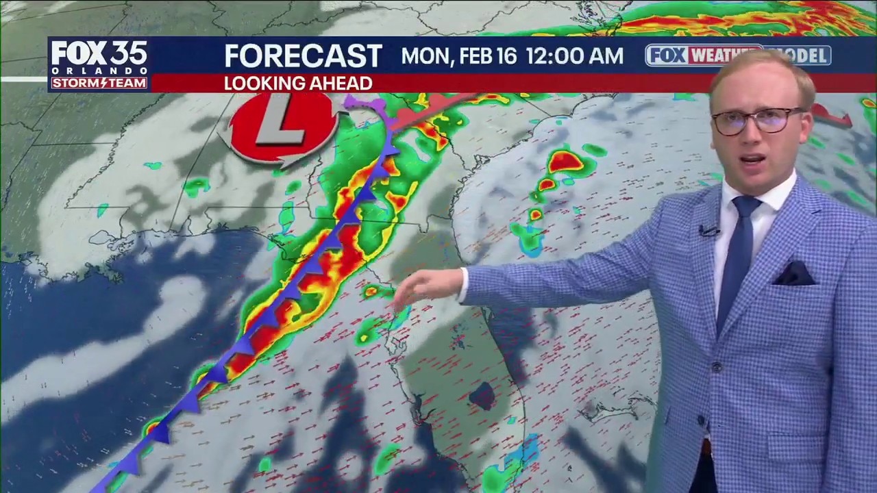
Daytona 500 forecast
Looking Ahead:
A cold front is expected to move across Florida late Sunday or early Monday, bringing scattered showers to Central Florida and the potential for thunderstorms in parts of Georgia and the Florida Panhandle.
Rain has fallen on race day in Daytona for the past two years. Historical records show the event has not been significantly affected by rain three consecutive years.

A brief, light shower cannot be ruled out during the day Sunday, though widespread or heavy rain appears unlikely at this time.
Forecast models differ slightly on timing, but most suggest the main line of showers and possible thunderstorms will arrive late Sunday night, potentially after midnight Monday.

Occasional lightning and wind gusts of 45-55 mph could accompany the showers.

Stay tuned over the coming days as we're able to analyze more and better data to fine-tune the forecast details.
The Source: This story was written with information from the FOX 35 Storm Team.